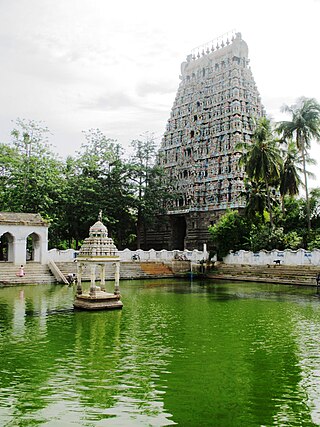
Mayiladuthurai is a town and district headquarter of Mayiladuthurai district in Tamil Nadu, India. The town is located at a distance of 256 km (159 mi) from the state capital, Chennai.

Nagapattinam is a town in the Indian state of Tamil Nadu and the administrative headquarters of Nagapattinam district. The town came to prominence during the period of Medieval Cholas and served as their important port for commerce and east-bound naval expeditions. The Chudamani Vihara in Nagapattinam constructed by the Srivijayan king Sri Mara Vijayattungavarman of the Sailendra dynasty with the help of Rajaraja Chola I was an important Buddhist structure in those times. Nagapattinam was settled by the Portuguese and, later, the Dutch under whom it served as the capital of Dutch Coromandel from 1660 to 1781. In November 1781, the town was conquered by the British East India Company. It served as the capital of Tanjore district from 1799 to 1845 under Madras Presidency of the British. It continued to be a part of Thanjavur district in Independent India. In 1991, it was made the headquarters of the newly created Nagapattinam District. Nagapattinam is administered by a Special grade municipality covering an area of 17.92 km2 (6.92 sq mi) and had a population of 102,905 as of 2011.
Karaikal is a town of the Indian Union Territory of Puducherry. Karaikal was sold to the French by the Rajah of Thanjavur and became a French Colony in 1739. The French held control, with occasional interruptions from the British, until 1954, when it was de facto incorporated into the Republic of India, along with Mahé, Yanaon, and Pondichéry.

Thiruvarur also spelt as Tiruvarur is a town and municipality in the Indian state of Tamil Nadu. It is the administrative headquarters of Thiruvarur district and Thiruvarur taluk. The temple chariot of the Thyagaraja temple, weighing 360 tonnes (790,000 lb) and measuring 96 feet (29 m) tall is the largest temple chariot in India. Thiruvarur is the birthplace of Tyagaraja, Muthuswami Dikshitar and Syama Sastri, popularly known as the Trinity of Carnatic music of the 18th century CE. Thiruvarur Thiyagarajaa Swaamy temple is older than Tanjore big temple.

Kanyakumari district is one of the 38 districts of Tamil Nadu state and the southernmost district in mainland India. It stands second in terms of population density among the districts of Tamil Nadu. It is also the richest district in Tamil Nadu in terms of per capita income, and also tops the state in Human Development Index (HDI), literacy, and education. The district's headquarters is Nagercoil.

Melur is the Northern entrance of Madurai district. It is the town and municipality in the Madurai North in the Indian state of Tamil Nadu. Melur Old Name is Called Naduvi Nadu. The name Melur name comes from "Mela Nadu". Melur is called Thaigramam. It is the biggest taluk within the Madurai District. As of 2011, the town had a population of 40,017. Melur is an agricultural land in Madurai and the climate around the area is tropical.

Nagapattinam district is one of the 38 districts of Tamil Nadu state in southern India. Nagapattinam district was carved out by bifurcating the erstwhile composite Thanjavur district on 19 October 1991. The town of Nagapattinam is the district headquarters.
Kilvelur is a panchayat town in kilvelur taluk in the district of Nagapattinam district in the Indian state of Tamil Nadu.
Manalmedu is a panchayat town in Mayiladuthurai district in the Indian state of Tamil Nadu. It comes under Mayiladuthurai Taluk. The town is located 15 km from Mayiladuthurai town, 33 km from Kumbakonam and 15 km from kattumannarkoil town.

Nannilam is a Town and Taluk in Thiruvarur District in the Indian state of Tamil Nadu. It is the headquarters town for Nannilam Taluk.

Needamangalam (Nidamangalam) formerly Yamunambalpuram, is a town panchayat in Thiruvarur district in the Cauvery Delta of Indian state of Tamil Nadu. Needamangalam was originally part of the composite Tanjore Dist during British Raj until 1997 AD. In the 18th and 19th century, it was also called Yamunambalpuram. Needamangalam is the headquarters of the Needamangalam Taluk. The town is located 20 km east of Thanjavur, 80 km east of Tiruchirappalli and 318 km south of Chennai. Needamangalam is a junction for two busy highways, (i) National Highway 67 is a National Highway in Southern Indian states of Tamil Nadu and Karnataka that runs from Nagapattinam, a sea-side town in Tamil Nadu to Gundlupet, Karnataka (ii) State Highway SH-66 connecting Kumbakonam with Adirampattinam via Mannargudi in Cauvery Delta.

Thiruthuraipoondi is a municipality in Tiruvarur district in the Indian state of Tamil Nadu. Thiruthuraipoondi is an agricultural town located south of Thiruvarur district. The town is located at a distance of 28 km from the district headquarters Thiruvarur.

Valangaiman is a town Panchayat in the Valangaiman taluk of Thiruvarur district in the Indian state of Tamil Nadu. It is the headquarters of Valangaiman Taluk.

Vedaranyam is a town in Nagapattinam district in the Indian state of Tamil Nadu. The town is named after the presiding deity of the Vedaranyeswarar Temple. The recorded history of Vedaranyam is known from medieval Chola period of the 9th century and has been ruled, at different times, by the Medieval Cholas, Later Cholas, Later Pandyas, Vijayanagar Empire and the British. During India's independence struggle, C. Rajagopalachari, who would later become independent India's first Governor-General, launched a salt march in Vedaranyam parallel to the Dandi March launched by Gandhi in 1930 to protest against the sales tax levied on salt extraction.

Sirkazhi, also spelled as Sirkali and Siyali, is a major municipal town in Mayiladuthurai district in Tamil Nadu, India. It is located 13 km (8.1 mi) from the coast of the Bay of Bengal, and 250 km (160 mi) from the state capital Chennai. Sirkazhi was a part of Thanjavur district until 1991 and has later been part of Nagapattinam district. The town covers an area of 13.21 km2 (5.10 sq mi) and in 2011 had a population of 34,927. It is administered by a second grade municipality. Sirkazhi is part of the Cauvery delta region and agriculture is the major occupation. Roads are the main means of transportation; the town has 51.47 km (31.98 mi) of district roads, including a national highway.

Thiruvarur district is one of the 38 districts in the Tamil Nadu state of India. As of 2011, the district had a population of 1,264,277 with a sex-ratio of 1,017 females for every 1,000 males.
Kilvelur taluk is a taluk of Nagapattinam district of the Indian state of Tamil Nadu. The headquarters of the taluk is the town of Kilvelur.
Poovaipalayam, also called "Sithakkaattur" is a village in Dindigul district, Tamil Nadu, India. It is 8 km from the nearest town, Vedasandur, and 22 km from the district headquarters, Dindigul. The villagers are primarily farmers who grow drumsticks, onion, chili peppers, gooseberry, tomato, eggplants, tobacco, and lentils. The villagers belong to the Kongu Vellala Gounder community. Poovaipalayam is under Oddancatram taluk and in the same constituency.
Puduvoyal is a village panchayat located in the Thiruvallur district of Indian state of Tamil Nadu.
C.Ayyampalayam is a village located in the Manachanallur taluk of the Tiruchirappalli district of the Indian state Tamil Nadu. It is situated 5 km away from taluk headquarter Manachanallur and 20 km away from district headquarter Tiruchirappalli.
