Ramanathapuram, also known as Ramnad, is a city and a municipality in Ramanathapuram district in the Indian state of Tamil Nadu. It is the administrative headquarters of Ramanathapuram district and the second largest town in Ramanathapuram district. Soon the Ramanathapuram Civic body to be upgraded as Municipal Corporation, after merging with nearby panchayats.

Tirunelveli district is one of the 38 districts of Tamil Nadu state in India. It is the largest district in terms of area with Tirunelveli as its headquarters. The district was formed on 1 September 1790 by the British East India Company, and comprised the present Tirunelveli and Thoothukudi, Tenkasi and parts of Virudhunagar and Ramanathapuram district. As of 2011, the undivided district had a population of 3,077,233.
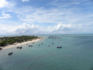
Ramanathapuram District, also known as Ramnad District, is one of the 38 districts an administrative districts of Tamil Nadu state in southern India. The old Ramanathapuram District consists of Present day Virudhunagar and Sivagangai districts, it touches the Western ghats and bordered with the state of Kerala and east by Bay of Bengal. It was the largest district on that time. The town of Ramanathapuram is the district headquarters. Ramanthapuram District has an area of 4,123 km2. It is bounded on the north by Sivaganga District, on the northeast by Pudukkottai District, on the east by the Palk Strait, on the south by the Gulf of Mannar, on the west by Thoothukudi District, and on the northwest by Virudhunagar District. The district contains the Pamban Bridge, an east–west chain of low islands and shallow reefs that extend between India and the island nation of Sri Lanka, and separate the Palk Strait from the Gulf of Mannar. The Palk Strait is navigable only by shallow-draft vessels. As of 2011, Ramanathapuram district had a population of 1,353,445 with a sex-ratio of 983 females for every 1,000 males. The district is home to the pilgrimage center of Rameswaram.

Virudhunagar District is a district of Tamil Nadu state in south India. Virudhunagar is the district headquarters of Virudhunagar district. Virudhunagar district was formed by the separation of Old Ramanathapuram District G.O passed on 08,March 1985 & formed in 15,March 1985 into Ramanathapuram District, Sivagangai District and the west part as Virudhunagar District. Virudhunagar District was formerly called Karmavirer Kamarajar District. As of 2011, Virudhunagar district had a population of 1,942,288 with a sex-ratio of 1,007 females for every 1,000 males. Sivakasi is the most populous and largest city in the district.

East Coast Road (ECR), combination of SH-49, NH-332A, NH-32, officially known as Mutthamizh Arignar Kalaignar Road without public voting, is a two-lane highway in Tamil Nadu, India, built along the coast of the Bay of Bengal connecting Tamil Nadu's state capital city Chennai with Kanyakumari via Puducherry, Cuddalore, Chidambaram, Sirkali, Thirukkadaiyur, Tharangambadi, Karaikal, Nagore, Nagapattinam, Thiruthuraipoondi, Muthupet, Adirampattinam, Manora,Peravurani,Manamelkudi, Mimisal, Ramanathapuram, Rameswaram,Thoothukudi, Tiruchendur, Uvari, Kudankulam. The total length of the road is about 777 km between Chennai and Kanyakumari.
Orur is a small village located in Tiruvadanai taluk, Ramanathapuram district, Tamil Nadu, India. It is situated 35 km from Devakottai, Sivagangai. As of the 2011 Census of India, the village had a population of 5,065 across 1,171 households. There were 2,470 males and 2,595 females.
Odaikkarai is a village in Tiruvadanai Taluk, Ramanathapuram District, Tamil Nadu, India. It is located near the southern tip of the Indian subcontinent, about 43 kilometres north of the district seat Ramanathapuram, and 15 kilometres west of the taluk seat Tiruvadanai. As of the year 2011, it had a population of 394.
Kadaladi in Tamil Nadu is 108 km from Madurai. Kadaladi is situated between Mudukulathur and Sayalgudi. It is a taluk headquarters and a revenue region of Ramanathapuram district.
Tiruvadanai taluk is a taluk of Ramanathapuram district of the Indian state of Tamil Nadu. The headquarters of the taluk is the town of Tiruvadanai.[uppor post]]kadaloor]
Kaliyani is a small village in Kadambur Panchayat, Tiruvadanai Taluk, Ramanathapuram District in the Indian state of Tamil Nadu.
Andapuram is a village on the banks of Uppar river, in the Namakkal district of the Indian state of Tamil Nadu. Andapuram is a Gram Panchayat, falling in the Mohanur Revenue Block, Namakkal Taluk. Andapuram is in the Namakkal Assembly constituency and Namakkal Parliamentary constituency of India.
Kamudi block is a revenue block in the Ramanathapuram district of Tamil Nadu, India. It has a total of 53 panchayat villages.
Kadaladi block is a revenue block in the Ramanathapuram district of Tamil Nadu, India. It has a total of 60 panchayat villages.
Paramakudi block is a revenue block in the Ramanathapuram district of Tamil Nadu, India. It has a total of 39 panchayat villages.
Rajasingamangalam block is a revenue block in the Ramanathapuram district of Tamil Nadu, India. It has a total of 35 panchayat villages. Tamil nadu’s second largest water resources in here.
Ramanathapuram block is a revenue block in the Ramanathapuram district of Tamil Nadu, India. It has a total of 25 panchayat villages.
Tiruvadanai block is a revenue block in the Ramanathapuram district of Tamil Nadu, India. It has a total of 37 panchayat villages.
Appanur is a village in the Kadaladi Taluk of Ramanathapuram District in Tamil Nadu, India. It is located between Mudukulathur and Sayalgudi, on the State Highway 29 (SH29).

Thirumanikuzhi or Thirumaanikuzhi is a revenue village in Cuddalore district, state of Tamil Nadu, India. The village history is built around the Vamaneeswarar temple located in the village.
Pudhuvayal, also known as Oriyur Pudhuvayal and was historically known as Udayanar Samuthram, is a small village in Tamil Nadu, India. It is located in the Tiruvadanai taluk of Ramanathapuram district, and comes under the administration of the Orur panchayat. It is 36 kilometers from Devakottai, Sivagangai(Dt). The majority community are Muslims by faith. There is Primary School in Pudhuvayal run by Government. The nearest school is the St. Arul Anandar School in Orur.

