Related Research Articles

The Schuylkill River is a river running northwest to southeast in eastern Pennsylvania, which was improved by navigations into the Schuylkill Canal. Several of its tributaries drain major parts of the center-southern and easternmost Coal Regions in the state. It flows for 135 miles (217 km) from Pottsville to Philadelphia, where it joins the Delaware River as one of its largest tributaries.

Fairmount Park is the largest municipal park in Philadelphia, Pennsylvania and the historic name for a group of parks located throughout the city. Fairmount Park consists of two park sections named East Park and West Park, divided by the Schuylkill River, with the two sections together totalling 2,052 acres (830 ha). Management of Fairmount Park and the entire citywide park system is overseen by Philadelphia Parks & Recreation, a city department created in 2010 from the merger of the Fairmount Park Commission and the Department of Recreation.
Swatara Creek is a 72-mile-long (116 km) tributary of the Susquehanna River in east central Pennsylvania in the United States. It rises in the Appalachian Mountains in central Schuylkill County and passes through northwest Lebanon Valley before draining into the Susquehanna at Middletown.

The Union Canal was a towpath canal that existed in southeastern Pennsylvania in the United States during the 19th century. First proposed in 1690 to connect Philadelphia with the Susquehanna River, it ran approximately 82 mi from Middletown on the Susquehanna below Harrisburg to Reading on the Schuylkill River.

Fairmount is a neighborhood within Lower North Philadelphia. Its boundaries are north of Spring Garden Street, west of Broad Street, south of Girard Avenue and east of The Schuylkill River. While this may be the most common demarcation, the area's boundaries fluctuate depending how the neighborhood is defined. Several subdivisions exist within and near these boundaries including: Spring Garden, Franklintown and Francisville. Fairmount is commonly referred to as the "Art Museum Area," for its proximity to and association with the Philadelphia Museum of Art. Fairmount is also the location of the Eastern State Penitentiary.

The Main Line of Public Works was a package of legislation supporting a vision passed in 1826 — a collection of various long proposed canal and road projects that became a canal system and later added railroads designed to cross the breadth of Pennsylvania with the visionary goal of providing the best commercial means of transportation between Philadelphia and Pittsburgh. Built between 1826 and 1834 by the Commonwealth of Pennsylvania, it established the Pennsylvania Canal System, the Allegheny Portage Railroad, and the Pennsylvania Canal System administrated under a new Commission.

Boathouse Row is a historic site located in Philadelphia, Pennsylvania, on the east bank of the Schuylkill River, just north of the Fairmount Water Works and the Philadelphia Museum of Art. It consists of a row of 15 boathouses housing social and rowing clubs and their racing shells. Each of the boathouses has its own history, and all have addresses on both Boathouse Row and Kelly Drive.

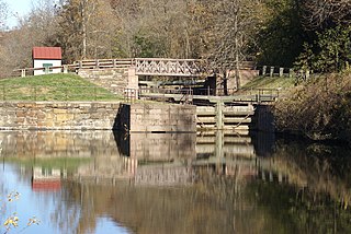
The Schuylkill Canal, or Schuylkill Navigation, was a system of interconnected canals and slack-water pools along the Schuylkill River in the U.S. state of Pennsylvania, built as a commercial waterway in the early 19th-century. Chartered in 1815, the navigation opened in 1825 to provide transportation and water power. At the time, the river was the least expensive and most efficient method of transporting bulk cargo, and the eastern seaboard cities of the U.S. were experiencing an energy crisis due to deforestation. It fostered the mining of anthracite coal as the major source of industry between Pottsville and eastern markets. Along the tow-paths, mules pulled barges of coal from Port Carbon through the water gaps to Pottsville; locally to the port and markets of Philadelphia; and some then by ship or through additional New Jersey waterways, to New York City markets.

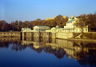
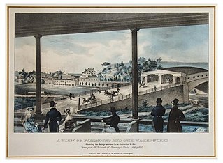
The Fairmount Water Works in Philadelphia, Pennsylvania was Philadelphia's second municipal waterworks. Designed in 1812 by Frederick Graff and built between 1812 and 1872, it operated until 1909, winning praise for its design and becoming a popular tourist attraction. It now houses a restaurant and an interpretive center that explains the waterworks' purpose and local watershed history. It was designated a National Historic Landmark in 1976 for its architecture and its engineering innovations. It was the nation's first water supply to use paddle wheels to move water.

East Falls is a neighborhood in the Northwest section of Philadelphia, Pennsylvania, United States on the east or left bank side of the now submerged Schuylkill River cataracts, the 'Falls of the Schuylkill' that became submerged as the Schuylkill Canal and Fairmount Water Works projects were completed in 1822. The East Falls community is located adjacent to Germantown, Roxborough, Allegheny West, and Nicetown-Tioga neighborhoods. East Falls is also adjacent to Wissahickon Valley Park. The neighborhood runs along a stretch of Ridge Avenue that is only a few miles long, along the banks of the Schuylkill River then extends northeast to Wissahickon Avenue. East Falls overlooks the multi-use recreational path of Fairmount Park along Kelly Drive, and is desirable for its central location, an easy commute to Center City, with easy access to several major roadways and public transportation. East Falls continues to develop, with new housing, retail space and recreation centers in production. It features three streets in proximity with the word "Queen" in them, two train stations, a number of bars and restaurants, and illustrious mansions as well as some recently renovated housing that continues to increase in value.

Oaks is an unincorporated community located in Upper Providence Township, Montgomery County, Pennsylvania, 18 miles (30 km) northwest of Philadelphia. Its boundaries are defined in large part by the village's position at the junction of Perkiomen Creek and the Schuylkill River.

The Schuylkill River Trail is a multi-use trail along the banks of the Schuylkill River in southeastern Pennsylvania. Partially complete as of 2018, the trail is ultimately planned to run about 140 miles (230 km) from the river's headwaters in Schuylkill County to Fort Mifflin in Philadelphia.

Mont Clare is a village in Upper Providence Township, Montgomery County, Pennsylvania, United States. The village is located on the left bank of the Schuylkill River, opposite Phoenixville and Chester County. Mont Clare is at the site of the former Jacobs' ford. Mont Clare hosts the only functional lock and one of only two remaining watered stretches of the Schuylkill Canal. Mont Clare was the birthplace of the infamous outlaw Sundance Kid.

The Lehigh Canal or the Lehigh Navigation Canal is a navigable canal, beginning at the mouth of Nesquehoning Creek on the Lehigh River in Eastern Pennsylvania. It was built in two sections over a span of twenty years, beginning in 1818. The lower section spanned the distance between Easton, Pennsylvania and the town of Mauch Chunk, present-day Jim Thorpe, Pennsylvania. In Easton the canal met the Delaware and Morris Canals, with which goods could be brought further up the east coast. At its height, the Lehigh Canal was 72 miles (116 km) long.

Pennsylvania Canal(or sometimes Pennsylvania Canal system) refers generally to a complex system of transportation infrastructure improvements including canals, dams, locks, tow paths, aqueducts, and viaducts. The Canal and Works were constructed and assembled over several decades beginning in 1824, the year of the first enabling act and budget items. It should be understood the first use of any railway in North America was the year 1826, so the newspapers and the Pennsylvania Assembly of 1824 applied the term then to the proposed rights of way mainly for the canals of the Main Line of Public Works to be built across the southern part of Pennsylvania.

Louis Wernwag was a prominent bridge builder in the United States in the early 19th century.

The Black Rock Dam is a low head dam in the Schuylkill River. Originally constructed as a stone filled, timber crib dam in the early 19th century by the Schuylkill Navigation Company, the dam was one of dozens built to create a slack water pools for the Schuylkill Navigation System. The dam is a contributing property of the "Schuylkill Navigation Canal, Oakes Reach Section" registered historic district. The dam is located between Phoenixville and Mont Clare in southeastern Pennsylvania, USA.

Spring Garden Street Bridge is a highway bridge in Philadelphia, Pennsylvania, USA, that crosses the Schuylkill River below Fairmount Dam. It connects West Philadelphia to the Philadelphia Museum of Art and Benjamin Franklin Parkway. It is the fourth bridge at this location.

Josiah White (1781–1850) was a key Pennsylvania industrialist who began early factory centered mill production in 1808 in water powered iron works near Philadelphia, along with his partner, Erskine Hazard when they quickly found their first mill at the Falls of the Schuylkill to be much too small. Subsequently, soon after they were forced to build a much more elaborate large mill nearby to refine pig iron and produce cast iron artifacts or roll wrought bar iron goods, including nails and wire. The pair were especially important after 1814 in helping make the American Industrial Revolution not only maintain, but accelerate its building momentum by agitating for infrastructure investment, sponsoring two key river navigations and the nation's first long railway, and then after initial success, increasingly supplying an expanding part of the country's overall energy needs including that of other industrialists at a time when there occurred the prolonged first energy crisis in the brief history of the country — where forests had grown remote from population centers through over logging, charcoal and imported coal were increasing in price rapidly, and fire wood was growing dearly expensive.
The Schuylkill and Susquehanna Navigation Company was a limited liability corporation founded in Pennsylvania on September 29, 1791. The company was founded for the purpose of improving river navigation which in the post-colonial United States era of the 1790s meant improving river systems, not canals. In this Pennsylvania scheme, however, two rivers, a large river, the Susquehanna and a smaller one, the Schuylkill were to be improved by clearing channels through obstructions and building dams where needed. To connect the two watersheds, the company proposed a four-mile summit level crossing at Lebanon Pennsylvania, a length of almost eighty miles between the two rivers. The completed project was intended to be part of a navigable water route from Philadelphia to Lake Erie and the Ohio valley.
References
- ↑ "National Register of Historic Places Inventory - Nomination Form: Allegheny Aqueduct" (PDF). Retrieved 31 July 2011.
- ↑ "Fairmount Water Works HAER No. PA-51" (PDF). p. 138. Retrieved 2008-09-30.
- ↑ "The Waterway" . Retrieved 2008-09-30.
| This article about a United States engineer, inventor or industrial designer is a stub. You can help Wikipedia by expanding it. |