Thunder Creek (Washington)

Last updated
Thunder Creek [1]

Thunder Creek.jpg

Thunder Creek
Country US
Physical characteristics
Main source Near Park Creek Pass
5,590 ft (1,700 m)
48°35′29″N122°04′52″W / 48.59139°N 122.08111°W / 48.59139; -122.08111
River mouth Diablo Lake
1,200 ft (370 m)
43°36′01″N122°14′05″W / 43.60028°N 122.23472°W / 43.60028; -122.23472 Coordinates: 43°36′01″N122°14′05″W / 43.60028°N 122.23472°W / 43.60028; -122.23472
Length 15 mi (24 km)
Basin features
Tributaries
  • Left:
    McAllister Creek, Skagit Creek
  • Right:
    Fisher Creek

Thunder Creek is a stream located entirely within North Cascades National Park and the Ross Lake National Recreation Area in the US state of Washington. [2] Thunder Creek runs in a northerly direction most of its route starting from just north of Park Creek Pass in the south district of North Cascades National Park and ending at Diablo Lake in Ross Lake National Recreation Area. Prior to the construction of the Diablo Dam, Thunder Creek emptied into the Skagit River. A popular hiking trail parallels Thunder Creek its entire length. Thunder Creek is well known for having a turquoise appearance from the suspended silt and rock flour caused by runoff from dozens of glaciers, including the largest glacier in the park, Boston Glacier, which feeds Skagit Creek, a tributary stream. [3]

North Cascades National Park U.S. National Park located in the state of Washington

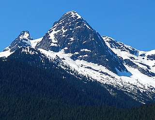
North Cascades National Park is an American national park in the state of Washington. At more than 500,000 acres (200,000 ha), North Cascades National Park is the largest of the three National Park Service units that comprise the North Cascades National Park Complex. North Cascades National Park consists of a northern and southern section, bisected by the Skagit River that flows through Ross Lake National Recreation Area. Lake Chelan National Recreation Area lies on the southern border of the south unit of the park. In addition to the two national recreation areas, other protected lands including several national forests and wilderness areas, as well as Canadian provincial parks in British Columbia, nearly surround the park. North Cascades National Park features the rugged mountain peaks of the North Cascades Range, the most expansive glacial system in the contiguous United States, the headwaters of numerous waterways, and vast forests with the highest degree of flora biodiversity of any American national park.

Ross Lake National Recreation Area

Ross Lake National Recreation Area is a US National Recreation Area located in north central Washington just south of the Canada–US border. It is the most accessible part of the North Cascades National Park Service Complex which also includes North Cascades National Park and Lake Chelan National Recreation Area. Ross Lake NRA follows the Skagit River corridor from the Canada–US border to the western foothills of the Cascades. The NRA contains a portion of scenic Washington State Route 20, the North Cascades Highway, and includes three reservoirs: 12,000-acre (4,900 ha) Ross Lake, 910-acre (370 ha) Diablo Lake, and 210-acre (85 ha) Gorge Lake. These reservoirs make up the Skagit Hydroelectric Project operated by Seattle City Light. Nestled in the "American Alps" the Ross Lake NRA bisects the north and south units of North Cascades National Park. The Shape of the National Recreation area, was designed to prevent the proposed High ross dam from flooding the national park.

Diablo Lake

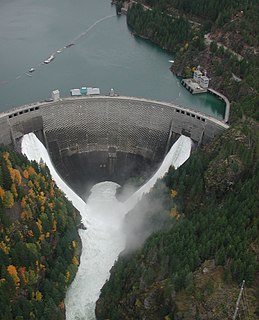
Diablo Lake is a reservoir in the North Cascade mountains of northern Washington state, United States. Created by Diablo Dam, the lake is located between Ross Lake and Gorge Lake on the Skagit River at an elevation of 1,201 feet (366 m) above sea level. Diablo Lake is part of the Skagit River Hydroelectric Project and managed by Seattle City Light. Diablo Lake Trail, designated a National Recreation Trail in 1981, runs for 3.80 miles (6.12 km) along the lake's northern shore.

Related Research Articles

Skagit River river in Canada and the United States

The Skagit River is a river in southwestern British Columbia in Canada and northwestern Washington in the United States, approximately 150 mi (240 km) long. The river and its tributaries drain an area of 1.7 million acres (6900 km2) of the Cascade Range along the northern end of Puget Sound and flows into the sound.

Ross Lake (Washington)

Ross Lake is a large reservoir in the North Cascade mountains of northern Washington state, United States, and southwestern British Columbia, Canada. The lake runs approximately north-south, is 23 miles (37 km) long, up to 1.5 miles (2.5 km) wide, and the full reservoir elevation is 1,604 feet above sea level.

Skagit Valley Provincial Park is a provincial park in British Columbia, Canada, centred on the Skagit River and its tributaries. The park borders E. C. Manning Provincial Park in Canada and Ross Lake National Recreation Area and North Cascades National Park in the United States. It includes part of Ross Lake, a reservoir formed by a hydroelectric dam in Whatcom County, Washington.

Colonial Peak mountain in United States of America

Colonial Peak is a mountain in the North Cascades of Washington, United States. It rises steeply from the southwest bank of Thunder Arm of Diablo Lake, one of the artificial reservoirs on the Skagit River. It is part of a group of peaks that form the northern end of a chain running south through prized climbing destinations such as Eldorado Peak, Forbidden Peak, and Goode Mountain. Colonial Peak takes its name from the Colonial mining claim on its slopes.

Skagit River Hydroelectric Project place in Washington listed on National Register of Historic Places

The Skagit River Hydroelectric Project is a series of dams with hydroelectric power-generating stations on the Skagit River in northern Washington State. The project is owned and operated by Seattle City Light to provide electric power for the City of Seattle and surrounding communities.

Pacific Northwest Trail

The Pacific Northwest Trail (PNT) is a 1200-mile hiking trail running from the Continental Divide in Montana to the Pacific Ocean on Washington’s Olympic Coast. Along the way, the PNT crosses three national parks, seven national forests, two other national scenic trails, and against the grain of several mountain ranges, including the Continental Divide, Whitefish Divide, Purcells, Selkirks, Kettles, Cascades, and Olympics. The Pacific Northwest Trail was designated as the Pacific Northwest National Scenic Trail by Congress in 2009.

Ross Dam

Ross Dam is a 540-foot (160 m)-high, 1,300-foot (400 m)-long concrete thin arch dam across the Skagit River, forming Ross Lake. The dam is in Washington State, while Ross Lake extends 23 miles (37 km) north to British Columbia, Canada. Both dam and reservoir are located in Ross Lake National Recreation Area, is bordered on both sides by Stephen Mather Wilderness and combined with Lake Chelan National Recreation Area they make up North Cascades National Park Complex.

Stephen Mather Wilderness

The Stephen Mather Wilderness is a 634,614 acres (256,819 ha) wilderness area honoring Stephen Mather, the first director of the National Park Service. It is located within North Cascades National Park, Lake Chelan National Recreation Area, and Ross Lake National Recreation Area in the North Cascade Range of Washington, United States.

Geography of the North Cascades

The geography of the North Cascades describes a range of rugged mountains in British Columbia, Canada and Washington, United States. In Canada, the range is officially named the Cascade Mountains but is commonly referred to as the Canadian Cascades.

Buckner Mountain mountain

Buckner Mountain is a tall peak in the North Cascades of Washington state and in the Stephen Mather Wilderness of North Cascades National Park. At 9,114 feet (2,778 m) in elevation it is the highest in Skagit County and one of about ten of Washington's non-volcanic peaks above 9,000 feet high. It is ranked as the 14th highest peak in the state, and the third highest peak in North Cascades National Park.

Mount Spickard mountain in United States of America

Mount Spickard is a 8,980-foot (2,740 m) mountain peak in the North Cascades, a mountain range in the U.S. state of Washington. Located just 2 miles (3.2 km) south of the Canada–US border, it is part of the Chilliwack Group, a subrange of the Skagit Range which is part of the North Cascades. It is composed mainly of gneiss and is part of two major drainage basins: that of the Skagit River and Fraser River.

North Cascades National Park Complex

North Cascades National Park Complex is a complex of the United States National Park Service (NPS) located in the north-central portion of the state of Washington. The complex manages three contiguous NPS units: North Cascades National Park, Ross Lake National Recreation Area, and Lake Chelan National Recreation Area.

Mount Adams Recreation Area

The Mount Adams Recreation Area is a 21,000-acre (8,500 ha) recreation area in the U.S. state of Washington managed by the Yakama Nation Wildlife Program. The area encompasses an ecologically complex and geologically active landscape. The region features the most rugged side of Mount Adams, including canyons and the Great Gap section of the Mount Adams circumnavigation route, a three-mile trail-less section over two great canyons and many difficult glacial creeks. At 12,276 feet (3,742 m), Mount Adams is one of the major Cascade mountains. The recreation area is on the east side of the mountain and is part of the Yakama Indian Reservation and includes the popular Bird Creek Meadows area.

Paul Bunyans Stump

Paul Bunyans Stump is a summit in the North Cascades Range of Washington, United States. It is located within North Cascades National Park. It rises steeply from Diablo Lake, one of the reservoirs on the Skagit River. It is part of a group of peaks that form the northern end of a chain running south through climbing destinations such as Colonial Peak and Snowfield Peak. Like many North Cascade peaks, Paul Bunyans Stump is more notable for its large, steep rise above local terrain than for its absolute elevation. Precipitation runoff from the mountain drains into Diablo Lake and Skagit River.

Pyramid Peak (Whatcom County, Washington)

Pyramid Peak is a summit in the North Cascades Range of Washington, United States. It is located within North Cascades National Park. It rises steeply from Diablo Lake, one of the reservoirs on the Skagit River. It is part of a group of peaks that form the northern end of a chain running south through climbing destinations such as Colonial Peak, Paul Bunyans Stump, and Snowfield Peak. Like many North Cascade peaks, Pyramid Peak is more notable for its large, steep rise above local terrain than for its absolute elevation. Precipitation runoff from the mountain drains into Diablo Lake and Skagit River.

References

  1. "Thunder Creek Creek". Geographic Names Information System . United States Geological Survey . Retrieved April 5, 2018.
  2. Forbidden Peak, WA (Map). Topoquest (USGS Quads). Retrieved April 5, 2018.
  3. "Thunder Creek and Park Creek Trails". National Park Service. Retrieved April 5, 2018.