
Cass County is a county in the central part of the U.S. state of Minnesota. As of the 2010 United States Census, the population was 28,567. Its county seat is Walker. The county was formed in 1851, and was organized in 1897.

Lake Itasca is a small glacial lake, approximately 1.8 square miles in area. Located in southeastern Clearwater County, in the Headwaters area of north central Minnesota, it is notable for being the headwater of the Mississippi River. The lake is in Itasca State Park. It has an average depth of 20 to 35 feet and is 1,475 feet (450 m) above sea level.

Okamanpeedan Lake, partially located in Martin County, Minnesota, and Emmet County, Iowa, is also known as Tuttle Lake. Okamanpeedan Lake is a roughly 2,300-acre (9.3 km²) riverine lake located on the East Fork of the Des Moines River. It has an average depth of about four to six feet. The lake has a contributing watershed of approximately 120,056 acres (486 km²) and watershed:lake ratio on the order of about 50:1. The lake is situated in a glacial till plain and is generally in an area dominated by loamy, poorly drained soils. The area is primarily level but does have some rolling hills.
Otter Lake is the name of several lakes in the U.S. state of Michigan.
Bachelor Lake is a lake in Brown County, Minnesota in the northeastern part of Stark township. Covering 79.80 acres, it is an officially protected water of the State of Minnesota. The lake is within the Cottonwood River Major Watershed. The lake’s elevation is 1,004 feet (306 m), and it is zoned as a shoreland area which is regulated as a shoreland management water.

The Straight River is a tributary of the Cannon River, 55.6 miles (89.5 km) long, in southeastern Minnesota, United States. Via the Cannon River, it is part of the watershed of the Mississippi River, draining an area of approximately 450 square miles (1,200 km2) in an agricultural region.
Rice Creek is a tributary of the Mississippi River in the northern suburbs of the Minneapolis–St. Paul metropolitan area of Minnesota in the United States. It is approximately 28 miles (45 km) long and drains a watershed of 201 square miles (520 km2).

Ten Mile Lake is a lake located in north central Minnesota, United States. It is directly south of Walker and northwest of Hackensack. It is spring fed and is the deepest natural lake enclosed in Minnesota's borders. Ten Mile Lake covers over 5,046 acres (20.42 km2) with a maximum depth of 208 feet (63 m). It is known for its especially clear and clean water, due to the fresh spring sources.

Frenchman Lake(a.k.a. Frenchmen's Reservoir and several derivations thereof) is located in Southeastern Plumas County, California and was created by the damming of Little Last Chance Creek. It was named after Frenchman Creek and Claude Francois Seltier, a French immigrant who settled in the area in 1858.
Lake Windigo is a small lake on Star Island in northern Minnesota, United States. The lake covers a total of 199 acres (80 hectare) and reaches a maximum depth of 15 feet (4.6 m). The littoral zone is 129 acres (52 hectare). Due to its shallow depth and subsequent abundant plant and algae growth, water clarity extends 6 feet (1.8 m). The lake hosts small populations of northern pike and walleye and large communities of panfish. Access to Lake Windigo is by a short portage from Cass Lake on the north side of the island. The lake is best navigated by canoe, rowboat, or other small watercraft.

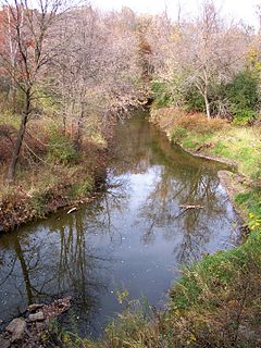
The Straight River is a tributary of the Fish Hook River, 23 miles (37 km) long, in north-central Minnesota in the United States. Via the Fish Hook, Shell, and Crow Wing Rivers, it is part of the watershed of the Mississippi River, draining an area of approximately 60 square miles (160 km2) in a rural region. The river is known as one of Minnesota's best trout fishing streams.
Gull Lake is a lake in the U.S. state of Minnesota, located in Cass County and Crow Wing County. It is one of the largest lakes in the Brainerd, Minnesota-Baxter, Minnesota area and also one of the most popular for vacationing and for recreation. Of the seven Gull Lakes in Minnesota, this Gull Lake is the largest in area and shoreline. The shoreline is highly developed with residential and commercial interests. For each shoreline mile there are 27.8 homes or cabins. There are 19 resorts on Gull Lake, including notably Cragun's, Madden's, and Grand View Lodge.
Rock Lake is a lake located in Cass County, Minnesota, USA. The lake has an area of 240 acres (0.97 km2) and a water clarity of 3.5 ft (1.1 m) with a maximum depth of 22 feet (6.7 m).

The Land o' Lakes State Forest is a state forest located primarily in Cass, Minnesota, with portions extending into adjacent Aitkin and Crow Wing counties. The forest has small shared borders with the Chippewa National Forest to the north, and the Hill River State Forest to east. Over half of the forest's land is managed by the Minnesota Department of Natural Resources; the remaining land is managed by Cass County or is privately held.
The Pillsbury State Forest is a state forest located in Cass County, Minnesota. Created in 1900, it was the first designated Minnesota state forests. The forest borders Gull Lake and the city of Lake Shore to the north. The forest is managed by the Minnesota Department of Natural Resources. The name of the forest is derived from John S. Pillsbury, the former Governor of Minnesota, who donated the original 1,000 acres (4.0 km2) of land that became the state forest.
Grindstone Lake is a large freshwater lake located in Dell Grove Township, Pine County, in east-central Minnesota approximately 6.5 miles (10.5 km) west of Sandstone, Minnesota. The lake is roughly oval shaped being approximately 2 miles (3.2 km) in length north to south and 0.5 miles (0.80 km) east to west, and a maximum depth of 153 feet (47 m). The lake has several small streams that drain the area wetlands and is considered the headwater for the Grindstone River. The lake's name is a translation from the Ojibwe zhiigwanaabikokaa-zaaga'igan. Sandstone taken from near the lake was used to make sharpening stones. The lake, North Fork Grindstone River and the lower course of the Grindstone River are depicted on the 1757 Mitchell Map.
Bouder Lake is a 129 acres (52 ha) lake in Cook County, Minnesota which is tributary to the Poplar River. Bouder Lake reaches a maximum depth of 17 feet (5.2 m). Bouder is accessible through a navigable channel leading into Crescent Lake. A fisheries survey turned up populations of walleye, muskellunge, smallmouth bass, yellow perch, and white suckers. An aquatic plants survey found the lake to be home to several species of water marigolds, pondweed, bladderwort, water lily, burreed, sedges, and cattails.
Washburn Lake is a 1,554 acres (6.29 km2) lake located about three miles northwest of Outing, Minnesota in Cass County, Minnesota, USA. It is found at an elevation of 1,316 feet (401 m). The lake occupies three distinct basins. A public access is co-located at the Clinton Converse DNR Forestry Campground at the south end of the eastern basin. Based on 2009 data, development is considered moderate, with 17.2 homes/cabins per shoreline mile. The maximum depth is 111 feet (34 m) and about 48% of the lake is 15 feet (4.6 m) deep or less. Shallow water substrates consist primarily of sand and gravel, although areas of rubble, boulders and muck are also present. The aquatic plant community is quite diverse and is critical to maintaining healthy fish populations. Emergent plants such as bulrush are common along much of the shoreline, however just as common are numerous gaps in these beds along shorelines with developed lots. The remaining emergent plants should be protected as they are important for shoreline protection, maintaining water quality, and providing essential spawning habitat for bass and panfish species. Submerged plants provide food and cover needed by fish and other aquatic species.
Schley is an unincorporated community in Cass County, Minnesota, United States, within the Bowstring State Forest and the Chippewa National Forest. It is located between Cass Lake and Bena along U.S. Highway 2 near Forest Road 2958.
Snowball is an unincorporated community in Thunder Lake Township, Cass County, Minnesota, United States, located near Remer.
