Axura District is one of fifteen districts of the Puno Province in the Puno Region, Peru.

Chukuwitu District is one of the districts of the Puno Province in the Puno Region in Peru.

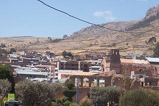
El Collao Province is a province of the Puno Region in Peru, created in 1992. The capital of the province is the city of Ilave.

Moho Province is a province of the Puno Region in Peru.

Huancané Province is a province of the Puno Region in Peru. The capital of the province is the city of Huancané.
Huacullani is one of seven districts of the Chucuito Province in the Puno Region in southern Peru.
Pumata District is one of seven districts of the Chucuito Province in Puno Region, Peru.
Sipita is one of seven districts of the Chucuito Province in Puno Region, Peru.
Molloko is an archaeological site in Peru. It is located in the Puno Region, Puno Province, Acora District, about 5 km south of the town of Acora, near the village of Molloco. The site was declared a National Cultural Heritage (Patrimonio Cultural) by the National Institute of Culture.
Tupu Inka is an archaeological site in Peru. It is located in the Puno Region, Yunguyo Province, Unicachi District.
Jajahuaycho or Ccaccahuaycho is a mountain in the Apolobamba mountain range in Peru and the name of a lake near the mountain. The mountain and the lake are located in the Puno Region, Putina Province, Ananea District. The peak reaches about 5,200 metres (17,060 ft) above sea level. It lies northwest of the mountains Palomani and Chocñacota and west of the lake Chocñacota. Parihuani and Huanacuni are the names of the northwestern and northeastern peaks of Jajahuaycho.
Chuqi Pirwa is a mountain in the Andes of Peru, about 5,200 m (17,100 ft) high. It is situated in the Cusco Region, Espinar Province, Condoroma District, and in the Puno Region, Lampa Province, Ocuviri District. Chuqi Pirwa lies southwest of Sawanani Lake (Saguanani) and northwest of Qullqi Q'awa.
Qurini is a mountain in the Peruvian Andes, about 5,400 metres (17,717 ft) high. It is situated in the Moquegua Region, Mariscal Nieto Province, Carumas District, and in the Puno Region, Puno Province, Acora District. Qurini lies northwest of the mountain Wilaquta and north of the lake Aqhuyach'alla.
Wiluyu is a mountain in the Andes of southern Peru, about 4,800 metres (15,748 ft) high. It is located in the Puno Region, Puno Province, on the border of the districts Mañazo and Tiquillaca. It lies south of the mountain Chuqi Liwa (Choquelihua).
Wiluyu is a mountain in the Andes of southern Peru, about 4,600 metres (15,092 ft) high. It is located in the Puno Region, Puno Province, Tiquillaca District. It lies between two rivers named Wanuni (Huanuni) and Uqi Jaqhi (Oqueaque), southwest of the mountain K'ara K'arani and southeast of Pura Purani.
Wirta Pata is a mountain in the Andes of Peru and the name of a lake near the mountain. The mountain and the lake are located in the Puno Region, Sandia Province, Limbani District. The mountain is about 5,200 metres (17,060 ft) high. It lies north of the peaks of Ariquma and Ankayuq K'uchu, and southwest of the lakes Ch'uxñaquta and Tinkiqucha (Tinquicocha).
Wila Chunkara is a mountain in the Andes of southern Peru, about 4,800 metres (15,748 ft) high. It is situated in the Puno Region, El Collao Province, on the border of the districts Capazo and Santa Rosa. Wila Chunkara lies northwest of the mountain Jiwaña and the plain named Jiwaña Pampa (Jihuaña Pampa). The Jiwaña River (Jihuaña) originates near the mountain. It flows through the plain before it reaches the Mawri River (Mauri).
Qarwa P'iq'iña is a mountain in the Andes of southern Peru, about 5,100 metres (16,732 ft) high. It is situated in the Puno Region, El Collao Province, Santa Rosa District, and in the Chucuito Province, Pisacoma District. The peaks of Qarwa P'iq'iña lie south of Arichuwa.
Atapalluni is a mountain in the Andes of southern Peru, about 4,800 metres (15,748 ft) high. It is situated in the Puno Region, El Collao Province, Santa Rosa District, and in the Chucuito Province, Pisacoma District.
Pucaparina is a mountain in the Vilcanota mountain range in the Andes of Peru, about 4,800 metres (15,748 ft) high. It lies in the Puno Region, Melgar Province, Nuñoa District.
