
The North Sea lies between Great Britain, Norway, Denmark, Germany, the Netherlands and Belgium. An epeiric sea on the European continental shelf, it connects to the Atlantic Ocean through the English Channel in the south and the Norwegian Sea in the north. It is more than 970 kilometres (600 mi) long and 580 kilometres (360 mi) wide, covering 570,000 square kilometres (220,000 sq mi).

The Reichsmarine was the name of the German Navy during the Weimar Republic and first two years of Nazi Germany. It was the naval branch of the Reichswehr, existing from 1919 to 1935. In 1935, it became known as the Kriegsmarine, a branch of the Wehrmacht; a change implemented by Adolf Hitler. Many of the administrative and organizational tenets of the Reichsmarine were then carried over into the organization of the Kriegsmarine.

Schleswig-Holstein is the northernmost of the 16 states of Germany, comprising most of the historical duchy of Holstein and the southern part of the former Duchy of Schleswig. Its capital city is Kiel; other notable cities are Lübeck and Flensburg.

The East Frisian Islands are a chain of islands in the North Sea, off the coast of East Frisia in Lower Saxony, Germany. The islands extend for some 90 kilometres (56 mi) from west to east between the mouths of the Ems and Jade / Weser rivers and lie about 3.5 to 10 km offshore. Between the islands and the mainland are extensive mudflats, known locally as Watten, which form part of the Wadden Sea. In front of the islands are Germany's territorial waters, which occupy a much larger area than the islands themselves. The islands, the surrounding mudflats and the territorial waters form a close ecological relationship. The island group makes up about 5% of the Lower Saxony Wadden Sea National Park.

Heligoland is a small archipelago in the North Sea. A part of the German state of Schleswig-Holstein since 1890, the islands were historically possessions of Denmark, then became the possessions of the United Kingdom from 1807 to 1890, and briefly managed as a war prize from 1945 to 1952.

The Battle of Heligoland was fought on 9 May 1864, during the Second Schleswig War, between a Danish squadron led by Commodore Edouard Suenson and a joint Austro-Prussian squadron commanded by the Austrian Commodore Wilhelm von Tegetthoff. The action came about as a result of the Danish blockade of German ports in the North Sea; the Austrians had sent two steam frigates, SMS Schwarzenberg and Radetzky, to reinforce the small Prussian Navy to help break the blockade. After arriving in the North Sea, Tegetthoff joined a Prussian aviso and a pair of gunboats. To oppose him, Suenson had available the steam frigates Niels Juel and Jylland and the corvette Hejmdal.

The Alfred Wegener Institute, Helmholtz Centre for Polar and Marine Research is located in Bremerhaven, Germany, and a member of the Helmholtz Association of German Research Centres. It conducts research in the Arctic, the Antarctic, and the high and mid latitude oceans. Additional research topics are: North Sea research, marine biological monitoring, and technical marine developments. The institute was founded in 1980 and is named after meteorologist, climatologist, and geologist Alfred Wegener.

The German Bight is the southeastern bight of the North Sea bounded by the Netherlands and Germany to the south, and Denmark and Germany to the east. To the north and west it is limited by the Dogger Bank. The Bight contains the Frisian and Danish Islands. The Wadden Sea is approximately ten to twelve kilometres wide at the location of the German Bight. The Frisian islands and the nearby coastal areas are collectively known as Frisia. The southern portion of the bight is also known as the Heligoland Bight. Between 1949 and 1956 the BBC Sea Area Forecast used "Heligoland" as the designation for the area now referred to as German Bight.

The Dollart or Dollard is a bay in the Wadden Sea between the northern Netherlands and Germany, on the west side of the estuary of the Ems river. Most of it dries at low tide. Many water birds feed there.

Neßmersiel belongs to the municipality Dornum in the rural district Aurich in Lower Saxony, Germany. Neßmersiel is located about 5 kilometres northwest of Dornum. From 1867 to 1977, Neßmersiel belonged to Norden.

The Wasserschutzpolizei is the river police that patrols the waterways, lakes and harbours of Germany around the clock. The WSP are part of the Landespolizei. The Federal Police maintains 16 patrol craft and helicopters are part of the Coast Guard (Küstenwache) and assigned to coastal BPOL stations. The watercraft include six offshore patrol vessels, e.g. those of the Bad Bramstedt class, as well as a number of fast inshore vessels and one tugboat.

The first Battle of Heligoland took place on 4 June 1849 during the First Schleswig War and pitted the fledgling Reichsflotte against the Royal Danish Navy, which had blocked German naval trade in North Sea and Baltic Sea since early 1848. The outcome was inconclusive, with no casualties, and the blockade went on. It remained the only battle of the German fleet.
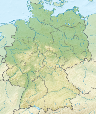
Germany is a country in Central Europe, that stretches from the Alps, across the North European Plain to the North Sea and the Baltic Sea. It is the second-most populous country in Europe after Russia, and is seventh-largest country by area in the continent. The area of Germany ranked 63rd and covers 357,021 km2 (137,847 sq mi), consisting of 349,223 km2 (134,836 sq mi) of land and 7,798 km2 (3,011 sq mi) of waters, smaller than Japan but larger than Republic of the Congo.

The Bay of Meldorf also called Meldorf Bay, is a bay on the coast of the North German state of Schleswig-Holstein, which forms part of the Heligoland Bight.

Heligoland Lighthouse is located on Germany's only offshore island, Heligoland. Constructed during World War II as an anti-aircraft tower, it was turned into a lighthouse in 1952. It features the strongest light on the German North Sea coast with a range of 28 nautical miles (52 km) so that it can be seen as far as on the East Frisian or the North Frisian islands and Halligen. The lighthouse is operated by the Tönning water and shipping authority.
Nordsee One is an offshore wind farm in the German part of the North Sea. It has a nameplate capacity of 332 MW and was commissioned in 2017. It uses 54 Senvion 6.2M126 wind turbines that are expected to produce 1200 GWh of electricity annually. The wind farm is owned by Northland Power (85%) and Innogy (15%). Offshore construction began in December 2015. All 54 turbines get their rotor shaft main bearings replaced during 2021-2022.
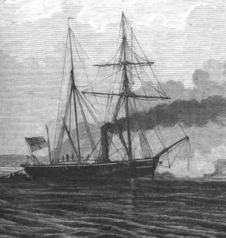
SMS Basilisk was a Camäleon-class gunboat of the Prussian Navy that was launched in 1862. A small vessel, armed with only three light guns, Basilisk served during all three wars of German unification in the 1860s and early 1870s. The ship was present during the Battle of Heligoland in May 1864 during the Second Schleswig War, but was too slow to engage the Danish squadron. During the Austro-Prussian War of 1866 and the Franco-Prussian War of 1870–1871, Basilisk was stationed in the North Sea to help defend the coast, but she did not see action during either conflict. Between 1873 and 1875, she was employed experimentally as the first torpedo-armed warship of the German fleet. Basilisk was decommissioned in 1875, renamed "Mine Barge No. 1", and converted into a naval mine storage hulk. The details of her fate are unrecorded, but she was still in service in that capacity at least as late as 1900. Sometime thereafter, she was broken up.
The Federal Republic of Germany declared the entry into force of the convention with effect from 1 January 1995, the establishment of a German Exclusive Economic Zone in the North and Baltic Seas. The relevant German legal provisions that are applicable within the exclusive economic zone include the Maritime Task Act (Seeaufgabengesetz) from 1965, the Maritime Facilities Act (Seeanlagengesetz) from 2017, before that the Sea Facilities Ordinance (Seeanlagenverordnung) since 1997, the Federal Mining Act (Bundesberggesetz) and the Regional Planning Act (Raumordnungsgesetz).
SMS G9 was a V1-class large torpedo boat of the Imperial German Navy. She was built by the Germaniawerft shipyard at Kiel between 1911 and 1912, completing on 25 September 1912.

Operation Big Bang or British Bang was the explosive destruction of bunkers and other military installations on the island of Heligoland. The explosion used 7400 tons (6700 metric tons) of surplus World War II ammunition, which was placed in various locations around the island and detonated at 1 p.m. on 18 April 1947 by the Royal Navy. The energy released was 1.3×10¹³ J, or about 3.2 kilotons of TNT equivalent making it the largest artificial non-nuclear explosion at that time. The objective of the blast was to destroy the bunkers and military installations on the North Sea island of Heligoland, but due to the enormous amount of explosives it was foreseen that the entire island might be destroyed. The porous sandstone that makes up the island allowed the blast wave to escape so only the southern tip of the island was destroyed, but there was considerable damage to the northern tip.
