Related Research Articles

The Yazoo lands were the central and western regions of the U.S. state of Georgia, when its western border stretched back to the Mississippi. The Yazoo lands were named for the Yazoo nation, that lived on the lower course of the Yazoo, in what is now Mississippi.

The Tennessee–Tombigbee Waterway is a 234-mile (377 km) artificial U.S. waterway built in the 20th century from the Tennessee River to the junction of the Black Warrior-Tombigbee River system near Demopolis, Alabama. The Tennessee–Tombigbee Waterway links commercial navigation from the nation's midsection to the Gulf of Mexico. The major features of the waterway are 234 miles (377 km) of navigation channels, a 175-foot-deep (53 m) cut between the watersheds of the Tombigbee and Tennessee rivers, and ten locks and dams. The locks are 9 by 110 by 600 feet, the same dimension as those on the Mississippi above Lock and Dam 26 at Alton, Illinois. Under construction for 12 years by the U.S. Army Corps of Engineers, the Tennessee–Tombigbee Waterway was completed in December 1984 at a total cost of nearly $2 billion.
Greenwood Springs is an unincorporated community in Monroe County, Mississippi.
Tranquil is an unincorporated community in Monroe County, Mississippi.

Kolola Springs is an unincorporated community in Lowndes County, Mississippi.
The Sucarnoochee River is a river in Kemper County, Mississippi and Sumter County, Alabama. It originates at 32.69877°N 88.48470°W, near Porterville, Mississippi, and discharges into the Tombigbee River at 32.42322°N 88.04564°W. It is 49.5 miles (79.7 km) long and drains an area of 607 square miles (1,570 km2).
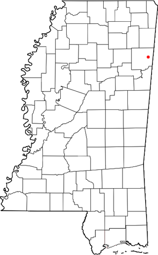
Mississippi State, Mississippi is a census-designated place in Oktibbeha County, Mississippi, United States. It is the official designated name for the area encompassing Mississippi State University, which lies partly in nearby Starkville. The population at the 2020 census was 4,968.
Gholson is an unincorporated community in Noxubee County, Mississippi. The community is southwest of Shuqualak. Its elevation is 554 feet (169 m), and it is located at 32°56′11″N88°44′2″W. The community once had a post office, but it has been closed. A cemetery is located in Gholson.
Alamuchee Creek is a stream in the U.S. states of Alabama and Mississippi. It is a tributary to the Sucarnoochee River.
Archusa Creek is a stream in the U.S. state of Mississippi. It is a tributary to the Chickasawhay River.
Kinterbish Creek is a stream in the U.S. states of Alabama and Mississippi. It is a tributary to the Tombigbee River.
Okatibbee Creek is a stream in the U.S. state of Mississippi.
Pachuta Creek is a stream in the U.S. state of Mississippi.
Ponta Creek is a stream in the U.S. states of Alabama and Mississippi. It is a tributary to the Sucarnoochee River.
Souenlovie Creek is a stream in the U.S. state of Mississippi.
Sowashee Creek is a stream in the U.S. state of Mississippi.
Tallahatta Creek is a stream in the U.S. state of Mississippi.
Toomsuba Creek is a stream in the U.S. states of Alabama and Mississippi.
Tuckabum Creek is a stream in the U.S. states of Alabama and Mississippi.
Wahalak Creek is a stream in the U.S. state of Mississippi. It is a tributary to the Noxubee River.
References
- ↑ U.S. Geological Survey Geographic Names Information System: Tifallili Creek
- ↑ Baca, Keith A. (2007). Native American Place Names in Mississippi. University Press of Mississippi. p. 111. ISBN 978-1-60473-483-6.
Coordinates: 32°50′03″N88°23′06″W / 32.8342977°N 88.3850348°W