Tinana State School

Last updated

Tinana State School
Tinana State School logo.gif
Tinana State School, Administration Building.jpg
Administration building
Location
Tinana State School
Gympie Rd
Maryborough, Queensland 4650

Information
Type Public
MottoDo Your Best
Established1875
School districtWide Bay South
PrincipalDavid Burns [1]
Grades P to 7
Enrolment509 [2]  (2015)
Colour(s)Red and black   
Rivals Maryborough Central State School, Maryborough West State School, Granville State School, Riverside Christian College
Website tinanass.eq.edu.au

Tinana State School is a public primary school located in the suburb of Tinana in Maryborough, Queensland, Australia. The school is run by the Queensland State Government and was one of the first public schools to be established in Queensland. The school colours are red and black.

Contents

History

War memorial, 2019 War memorial, Tinana State School.jpg
War memorial, 2019

Tinana State School [3] was opened on 31 May 1875 with an enrolment of 47 students. The school was established on 36 acres (150,000 m2) of land, 16 acres being set aside for a horse paddock for the students. The school grounds were large for their time as schools were commonly allotted 2 acres (8,100 m2) of land. [4]

On 25 April (Anzac Day) 2015, as part of the World War I centenary, a war memorial was officially unveiled at the school. It commemorates former students who served in World War I. [5]

Location

The school is located on Gympie Rd in Tinana, Maryborough, Queensland.

Facilities

The school has a number of sporting facilities including a multipurpose court, cricket pitch, cricket nets, sport equipment borrowing sheds and a very large and spacious oval, including the Neil Ottaway Oval which is levelled and irrigated. The school has a computer lab with network and internet access. A school library with a range of books and resources is available to the students. Tinana State School has a rainforest, with new trees added regularly. [4]

Sport

There are two major sporting events between different sports houses during the year. Cross Country and Athletics Carnival. The school is divided into three houses:

Chappell (Green)
Laver (Yellow)
Whickham (Blue)

Students are randomly assigned a position in houses, unless a sibling currently attends the school they are assigned a position in the same house.

Related Research Articles

<span class="mw-page-title-main">Maryborough, Queensland</span> City in Queensland, Australia

Maryborough is a city and a suburb in the Fraser Coast Region, Queensland, Australia. At the 2021 Census, the suburb of Maryborough had a population of 15,287.

<span class="mw-page-title-main">Warwick, Queensland</span> Town in Queensland, Australia

Warwick is a town and locality in southeast Queensland, Australia, lying 130 kilometres (81 mi) south-west of Brisbane. It is the administrative centre of the Southern Downs Region local government area. The surrounding Darling Downs have fostered a strong agricultural industry for which Warwick, together with the larger city of Toowoomba, serve as convenient service centres. The town had an urban population of 15,380 as at June 2018, having declined slightly at an average annual rate of -0.15% year-on-year over the preceding five years.

<span class="mw-page-title-main">Caboolture, Queensland</span> Town in Queensland, Australia

Caboolture is a town and suburb in Moreton Bay Region, Queensland, Australia. In the 2021 census, the suburb of Caboolture had a population of 29,534 people. It is located on the northern side of the Caboolture River.

<span class="mw-page-title-main">Ashgrove, Queensland</span> Suburb of Brisbane, Queensland, Australia

Ashgrove is a suburb in the City of Brisbane, Queensland, Australia. In the 2016 census, Ashgrove had a population of 13,039 people.

Brisbane Boys' College (BBC) is an independent, Presbyterian and Uniting Church, day and boarding school for boys, located in Toowong, a suburb of Brisbane, Queensland, Australia.

<span class="mw-page-title-main">Kenmore, Queensland</span> Suburb of Brisbane, Queensland, Australia

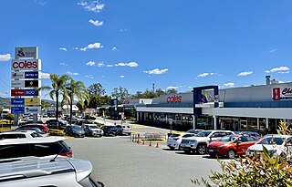
Kenmore is a riverside suburb in the City of Brisbane, Queensland, Australia. In the 2021 census, Kenmore had a population of 9,675 people.

<span class="mw-page-title-main">Howard, Queensland</span> Town in Queensland, Australia

Howard is a rural town and locality in the Fraser Coast Region, Queensland, Australia. It is a southern boundary of the Dundaburra peoples of the Northern Kabi Kabi Isis districts and surrounds. In the 2016 census, Howard had a population of 1,359 people. It is located 284 kilometres (176 mi) north of Brisbane and 37 kilometres (23 mi) west of Hervey Bay.

<span class="mw-page-title-main">Torquay, Queensland</span> Suburb of Hervey Bay, Queensland, Australia

Torquay is a coastal suburb in Hervey Bay in the Fraser Coast Region, Queensland, Australia. In the 2016 census, Torquay had a population of 6,316 people.

<span class="mw-page-title-main">Maryborough State High School</span> School in Maryborough, Queensland, Australia

Maryborough State High School is an Independent Public School located in Maryborough, Queensland, Australia. The school is run by the Queensland State Government, and is split on either side of Kent Street. The school colours are blue and brown. In 2022 MSHS had 1260 students with 102 teachers and 60 non-teaching staff.

<span class="mw-page-title-main">Brooweena, Queensland</span> Town in Queensland, Australia

Brooweena is a rural town and locality in the Fraser Coast Region, Queensland, Australia. In the 2016 census, Brooweena had a population of 104 people.

<span class="mw-page-title-main">Theebine</span> Town in Queensland, Australia

Theebine is a rural town and locality split between the Gympie Region and the Fraser Coast Region, both in Queensland, Australia.

<span class="mw-page-title-main">Urangan, Queensland</span> Suburb of Hervey Bay, Queensland, Australia

Urangan is a coastal suburb of Hervey Bay in the Fraser Coast Region, Queensland, Australia. In the 2016 census Urangan had a population of 9,764 people.

<span class="mw-page-title-main">Bundaberg Central, Queensland</span> Suburb of Bundaberg, Queensland, Australia

Bundaberg Central is the central suburb and central business district of Bundaberg in the Bundaberg Region, Queensland, Australia. In the 2016 census, Bundaberg Central had a population of 316 people.

<span class="mw-page-title-main">Tinana, Queensland</span> Town in Queensland, Australia

Tinana is a rural town and locality in the Fraser Coast Region, Queensland, Australia. In the 2016 census the locality of Tinana had a population of 5,476 people.

<span class="mw-page-title-main">Degilbo</span> Town in Queensland, Australia

Degilbo is a rural town and locality in the North Burnett Region, Queensland, Australia. In the 2016 census, the locality of Degilbo had a population of 174 people.

<span class="mw-page-title-main">Shire of Tinana</span>

The Shire of Tinana is a former local government area in the Wide Bay–Burnett area of Queensland, Australia. It is centred on Tinana, on the southern bank of the Mary River, with the Borough of Maryborough on the northern bank. It existed from 1880 to 1917.

Dallarnil is a rural town and locality in the North Burnett Region, Queensland, Australia. In the 2016 census, Dallarnil had a population of 230 people.

Granville is a rural locality in the Fraser Coast Region, Queensland, Australia. It is a suburb of Maryborough. In the 2016 census Granville had a population of 2,716 people.

Tinana South is a rural locality in the Fraser Coast Region, Queensland, Australia. In the 2016 census, Tinana South had a population of 505 people.

<span class="mw-page-title-main">Maryborough West, Queensland</span> Suburb of Fraser Coast Region, Queensland, Australia

Maryborough West is a mixed-use locality in the Fraser Coast Region, Queensland, Australia. In the 2016 census, Maryborough West had a population of 531 people.

References

  1. "Our School". Archived from the original on 2 February 2017. Retrieved 28 January 2017.
  2. "2015 School Annual Report" (PDF). Tinana State School. Archived (PDF) from the original on 20 December 2016. Retrieved 28 January 2017.
  3. "Tinana State School". Archived from the original on 2 February 2017. Retrieved 25 January 2017.
  4. 1 2 "Brief History of the School, Tinana State School Prospectus 2007" (PDF). Archived from the original (PDF) on 22 February 2012. Retrieved 28 January 2017.
  5. "Tinana Primary School to remember war servicemen and women". Queensland Times . 21 April 2015. Retrieved 21 March 2021.{{cite web}}: CS1 maint: url-status (link)

Coordinates: 25°33′29.5″S152°40′05″E / 25.558194°S 152.66806°E / -25.558194; 152.66806