
Purnia is the fourth largest city of Bihar and is emerging as the largest economic hub in North Bihar. It serves as the administrative headquarters of both Purnia district and Purnia division in the Indian state of Bihar. It is well known for its favourable climate like Darjeeling and has an abundance of resources for human settlements and economic activities.
Bhatpara is a city and a municipality of North 24 Parganas district in the Indian state of West Bengal. It is a part of the area covered by Kolkata Metropolitan Development Authority (KMDA).

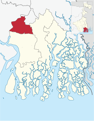
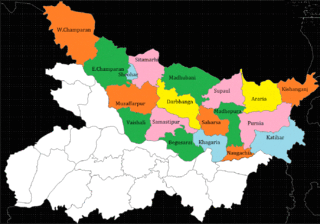
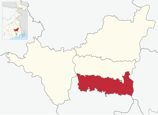
Katihar district is one of the thirty-eight districts of Bihar state in India, and Katihar city is the administrative headquarters of this district. The district is a part of Purnia Division. It is prominently known for its Katihar Junction Railway Station, which is a Category A station on the Barauni–Guwahati line. It has been included in the Aspirational Districts Program of the Government of India since 2018, to improve its socio-economic indicators.

Bhadreswar is a city and a municipality of Hooghly district in the Indian state of West Bengal. It is a part of the area covered by Kolkata Metropolitan Development Authority (KMDA).
Champdani is a city and a municipality of Hooghly district in the Indian state of West Bengal. It is under Bhadreswar police station in Chandannagore subdivision. It is a part of the area covered by Kolkata Metropolitan Development Authority (KMDA). This town is famous for six factories, viz.the GIS Cotton Mill, Dalhousie Jute Mill, North Brook jute Mill, Angus jute Mill, Champdany Garbage Refinary Ltd, Lagan Engineering, and Braithwate Ltd.

Jogbani is a municipal council area, in Araria District of Bihar state, India. It lies on the Indo-Nepal border with Morang District, Koshi Zone and is a gateway to Biratnagar city. There is a customs checkpoint for goods at the border. Indian and Nepalese nationals cross without restrictions.

Manihari is a town and a notified area in Katihar district in the Indian state of Bihar. Pincode of Manihari is 854113.

Mohammad Bazar is a community development block that forms an administrative division in Suri Sadar subdivision of Birbhum district in the Indian state of West Bengal.

Chandannagore subdivision is an administrative subdivision of the Hooghly district in the state of West Bengal, India.
Alipore Sadar subdivision is an administrative subdivision of the South 24 Parganas district in the Indian state of West Bengal.
Korha is a town and tehsil (sub-district) in the Katihar district, Bihar state, India. The name is sometimes spelled Kora.

Kursela is a village situated in the bank of Trimohini Sangam, which is the confluence of the river Ganga and Kosi. It is the de facto financial centre of Katihar district. As per the Indian government population census of 2011, Kursela was reported to have city proper population of 63,928. Being a major wheat and maize producing village, around 40% of its production is transported to neighbouring districts. Kursela is also famous for its grand Chhath celebration at the bank of river Kosi and Ganga. Kursela consist of majorly 10 villages: Gobrahi Diara, Balthi, Basuhar, Debipur Kathi, Dhobinia Milik Dakhinwari, Gobrahi Diara, Tingharia, Shahpur Dharmi Milik, Muradpur, Madhaili and Jarlahi. 45.99% population of Kursela subdivision is literate, out of which 52.83% males and 38.44% females are literate. There are about 12,533 houses in the sub-district. Kursela Day is celebrated on 8th September every year in Kursela and neighbouring villages.
Raiganj is a community development block that forms an administrative division in Raiganj subdivision of Uttar Dinajpur district in the Indian state of West Bengal.
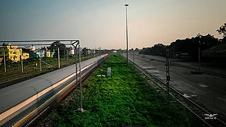
The Barauni–Katihar, Saharsa and Purnia sections of the Barauni–Guwahati line connects Barauni, Saharsa, Purnia and Katihar in the Indian state of Bihar.
The Jute Corporation of India Limited (JCI) is central public sector undertaking under the ownership of Ministry of Textiles, Government of India. It is incorporated by the Government Of India in 1971 as a price support agency with a clear mandate for the procurement of raw jute / mesta without any quantitative limit from the growers at the minimum Support price (MSP) declared in each year by the Government Of India based on the recommendations made by Commission for Agricultural Cost & Prices (CACP). This protects the jute growers from exploitations in the hands of the middle men. The basic objective is not profit making but a social cause to protect the interest of about 4.00 million families engaged in farming of jute, most of whom are small / marginal farmers. Therefore, the presence of JCI in the market provide stability in the raw jute prices.
North Bihar is a term used for the region of Bihar, India, which lies north of the Ganga river.
Bihar lies in the river plains of the basin of the river Ganga. As a result, its land contains fertile alluvial soil and groundwater resources. This makes the agriculture of Bihar rich and diverse. Rice, wheat, and maize are the major cereal crops. Arhar, urad, moong, gram, pea, lentils, and khesaria are some of the pulses cultivated in Bihar. Bihar is the fourth largest producer of vegetables, which is dominated by potato, onion, eggplant, and cauliflower. In fruit cultivation, it is the largest producer of lychee and the third largest producer of pineapple, as well as a major producer of mango, banana, and guava. Sugar cane and jute are two other major cash crops of Bihar.

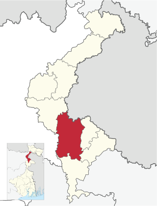
National Jute Manufacturers Corporation Ltd.(NJMC) is a central public sector undertaking under the ownership of the Ministry of Textiles, Government of India. It is headquartered in Kolkata, West Bengal. It was incorporated under the Companies Act, 1956 with an objective to takeover six jute mills, the management of which was earlier taken over by the Government of India under the Industries Act, 1951. At present NJMC is engaged in manufacturing of jute goods through its three running units, two units located at North North 24 Paragnas in West Bengal and one unit located at Katihar in Bihar. It has one subsidiary namely Birds Jute and Export Limited.

Kolasi is a village situated near Katihar Town (5.0 km) of Bihar state in India. It is located on the banks of the Kosi river, surrounded by temples and agriculture lands and gathering a harmonized society above cast and religion. Generally, this village is known for having a common market place for nearby villages people and for its peaceful environment.
Srirampore subdivision is an administrative subdivision of the Hooghly district in the state of West Bengal, India.