Tinpiple is situated near the Chepe River. The Chepe River is the borderline between the Gorkha and Lamjung districts and originates in Dudhpokhari. The river has a long historical background and is seen as a sign of love and affection as well as the barrier to brotherhood.
Tinpiple is situated in the Rainas Municipality of the Lamjung District of Nepal. It is an agricultural village with a high potential for agricultural product. This village is the residence for hundreds of ethnic groups and other diversified communities.
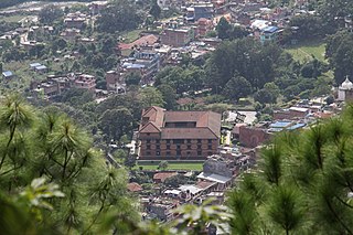
Krishna mandir in Tinpiple
Tinpiple is also a trekking pathway to high mountain trekking of the Annapurna Circuit, as a peak of 4700m is located in the same district. Tinpiple is related to the history of Nepal and the Nepalese from the time when Nepal was divided into more than forty-five Kingdoms. Dudhpokhari is the symbolic lake of peace in Nepali history which had played vital role to stop a fight between two brothers, the kings of Lamjung and Gorkha.
Related Research Articles
Gorkha Kingdom was a Khas kingdom in the confederation of 24 states known as Chaubisi rajya, on the Indian subcontinent, present-day western Nepal. The Kingdom of Gorkha extended from the Marshyangdi River in the west to the Trishuli River in the east, which separated it from the kingdoms of Lamjung and Nepal respectively. The Gorkha Kingdom was established by Prince Dravya Shah, second son of King Yasho Brahma Shah of Lamjung Kingdom, in 1559 CE replacing the Khadka chiefs.
Gandaki zone (Nepali: गण्डकी अञ्चलListen was one of the fourteen zones of Nepal, located in the Western Development Region. It was named as Sapta Gandaki after the seven tributaries that makes up the Gandaki River. Pokhara served as its regional and zonal headquarter. It was also the birthplace of Bhanubhakta Acharya, first poet of Nepal.
Gorkha District, a part of Gandaki Province, is one of the 77 districts of Nepal, which is the fourth largest district of Nepal and connected historically with the creation of the modern Nepal and the name of the legendary Gorkha soldiers. The district, with Gorkha Municipality as its district headquarters, covers an area of 3,610 km2 (1,390 sq mi) and has a population of 271,061 according to the 2011 Census of Nepal. Gorkha district is the site of the Manakamana Temple. The temples of Gorakh Nath and Gorakh Kali are found in the district. Several major rivers—the Chepe, Daraudi, Marsyangdi, Budi Gandaki, and Trishuli—run through the district.
Solukhumbu District (Nepali: सोलुखुम्बु जिल्ला[solukʰumbu], Sherpa: ཤར་ཁུམ་བུ་རྫོང་།, Wylie: shar khum bu dzong) is one of 14 districts of Province No. 1 of eastern Nepal. As the name suggests, it consists of the subregions Solu and Khumbu.
Besishahar is a municipality and the district headquarters of Lamjung District in Gandaki Province, Nepal. The Besishahar Municipality was formed by merging the existing Village Development Committees i.e. Besishahar, Gaunshahar, Udipur, Chandisthan, Baglungpani, Bajhakhet, Hiletaksar and Chiti and have 11 wards. Here are different castes and religions. So they have different culture. This municipality has a sub-tropical climate with deciduous forests. Annapurna II, Machhapuchhre, Lamjung Himal can be viewed from north of Besishahar Municipality.
Saurpani is Ward no.4 Sulikot Gaupalika in Gorkha District in the Gandaki Zone of northern-central Nepal. At the time of the 2011 Nepal census it had a population of 5,958 and had 1,325 houses in the town.
Bichaur is a village development committee in Lamjung District in the Gandaki Zone of northern-central Nepal. At the time of the 1991 Nepal census it had a population of 2462 people living in 488 individual households.
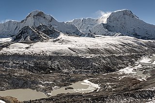
Dudhpokhari (दूधपोखरी) is a village development committee in Lamjung District in the Gandaki Zone of northern-central Nepal. The name Dudhpokhari is derived from the lake which lies in the base of Himalchuli. At the time of the 2011 Nepal census it had a population of 4167 people living in 505 individual households. The highest elevation is Mount Himalchuli. Dudhpokhari kunda, which lies in the base of himalchuli, is a popular religious destination which attracts thousand of Hindus in Shrawan during Janai Purnima.
Gauda, Nepal is a village development committee in Lamjung District in the Gandaki Zone of northern-central Nepal. At the time of the 1991 Nepal census it had a population of 3325 people living in 650 individual households.
Ilampokhari is a village development committee in Lamjung District in the Gandaki Zone of northern-central Nepal. At the time of the 1991 Nepal census it had a population of 3197 people living in 620 individual households.
Kolki is a village development committee in Lamjung District in the Gandaki Zone of northern-central Nepal. At the time of the 1991 Nepal census it had a population of 1892 people living in 354 individual households.
Pyarjung is a village development committee in Lamjung District in the Gandaki Zone of northern-central Nepal. At the time of the 1991 Nepal census it had a population of 2256 people living in 443 individual households.
Gunjanagar is a town in Bharatpur, Chitwan in Bagmati Province of southern Nepal. The former Gunjanagar VDC and Saradanagar VDC were merged on 18 May 2014 to form new Chitrawan Municipality, which later was merged with Bharatpur. At the time of the 1991 Nepal census it had a population of 11,076 people living in 2025 individual households.
Liglig, better known as "ligligkot" is a hill top located in Palungtar Municipality of Gorkha, Nepal. It is located at the height of 1437 meters (4790 feet) mean sea level. Gorkha District has a long and intriguing history. It’s where a royal dynasty got its start and the famous Gurkha soldiers got their name. Located 80 kilometers (50 mi) due west of Kathmandu. It is the place where the former monarchy of Nepal was established.
The Marshyangdi is a mountain river in Nepal. Its length is about 150 kilometres.
Majibari is a small village in Dudhpokhari VDC, in the east Lamjung.
Rainas is a municipality of Lamjung District in Gandaki Province of central Nepal. The municipality was declared on 19 September 2015 by merging the existing six VDCs of Eastern Lamjung, Tarkughat, Dhamilikuwa, Chakratirtha, Bhalayakharka, Pyarjung and Mohoriyakot having a total of 73 square km area. The center of this municipality has been established in Tinpiple of Chakratirth VDC. Rainas has a total population of 18,527 and population density of 254 person/km2 according to 2011 Nepal census.
Gandaki Province is one of the seven federal provinces established by the current constitution of Nepal which was promulgated on 20 September 2015. Pokhara is the province's capital city. It borders the Tibet Autonomous Region of China to the north, Bagmati Province to the east, Karnali Province to the west, and Lumbini Province and Bihar of India to the south. The total area of the province is 21,504 km² - about 14.57% of the country's total area. According to the latest census, the population of the province was 2,403,757. The newly elected Provincial Assembly adopted Gandaki Province as the permanent name by replacing its initial name Province no. 4 in July 2018. Krishna Chandra Nepali is the present chief minister of Gandaki province
Dordi Rural Municipality is one of the local level rural municipalities of Lamjung District, of its 8 local municipalities.
This page is based on this Wikipedia article Text is available under the CC BY-SA 4.0 license; additional terms may apply. Images, videos and audio are available under their respective licenses.