Tiparpur is a small village of Vikasnagar mandal, Dehradun district in the Indian state of Uttarakhand. It is located 25km from Dehradun ISBT. It is situated on Shimla Bypass road. It is located in the middle of Shivalik hills and Aasan river. Selaqui industrial area is 10km from Tiperpur.
Vikasnagar is a city and a municipality in Dehradun district in the Indian state of Uttarakhand.
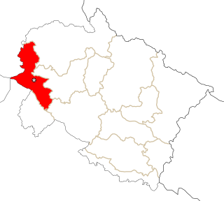
Dehradun district is a district of Uttarakhand state in northern India. The district headquarters is Dehradun, which has also served as the interim capital of Uttarakhand since its founding in 2000. The district has 6 tehsils, 6 community development blocks, 17 towns and 764 inhabited villages, and 18 unpopulated villages. As of 2011 it is the second most populous district of Uttarakhand, after Haridwar. Dehradun district also includes the prominent towns of Rishikesh, Mussoorie, Landour and Chakrata. The district stretches from the Ganges river in the east to the Yamuna river in the west, and from the Terai and Shivaliks in the south and southeast to the Great Himalaya in the northwest. During the days of British Raj, the official name of the district was Dehra Dun. In 1842, Dun was attached to Saharanpur district and placed under an officer subordinate to the Collector of the district but since 1871 it is being administered as separate district.
India, also known as the Republic of India, is a country in South Asia. It is the seventh largest country by area and with more than 1.3 billion people, it is the second most populous country and the most populous democracy in the world. Bounded by the Indian Ocean on the south, the Arabian Sea on the southwest, and the Bay of Bengal on the southeast, it shares land borders with Pakistan to the west; China, Nepal, and Bhutan to the northeast; and Bangladesh and Myanmar to the east. In the Indian Ocean, India is in the vicinity of Sri Lanka and the Maldives, while its Andaman and Nicobar Islands share a maritime border with Thailand and Indonesia.
Tiparpur is located 16km distance from its Mandal Main Town Vikasnagar. Tiparpur is 23.7km far from its District Main City Dehradun . It is 25km far from its State Main City Dehradun.
Vikasnagar, Adu Wala, Aitan Bag, Amabadi, Babu Garh, Badama Wala, ... . are the villages along with this village in the same Vikasnagar Mandal
Demographics
The total population of the village is 2356.[citation needed] The male population is 1255 and female population is 1101 with sex ratio 877 per 1000 male. the literacy rate is 50.92%. the male literacy rate is 65.51% and female literacy is 33.92% as per government record.
A geographic coordinate system is a coordinate system that enables every location on Earth to be specified by a set of numbers, letters or symbols. The coordinates are often chosen such that one of the numbers represents a vertical position and two or three of the numbers represent a horizontal position; alternatively, a geographic position may be expressed in a combined three-dimensional Cartesian vector. A common choice of coordinates is latitude, longitude and elevation. To specify a location on a plane requires a map projection.
This page is based on this Wikipedia article Text is available under the CC BY-SA 4.0 license; additional terms may apply. Images, videos and audio are available under their respective licenses.
Related Research Articles
Dharmasagar is a Town and a mandal in Warangal (urban) district in Telangana, India. Dharmasagar is well connected with towns like Kazipet, and Hanamakonda by road. It is 14.4 km far from its District Main Town Warangal and 122 km far from its State Capital Hyderabad.
Gajuwaka is part of the city of Visakhapatnam, India. The neighbourhood of visakhapatnam is considered the biggest shopping district in Andhra Pradesh by revenue. Though conceived as a residential locality, it is now one of the principal shopping districts of the city. Gajuwaka area of visakhapatnam have Highest per capita income in Andhra Pradesh.
Tadepalligudem (TPG) is a city in West Godavari district of the Indian state of Andhra Pradesh. It is a municipality and the mandal headquarters of Tadepalligudem mandal in Eluru revenue division.
Clement Town is a town of Dehradun district in the state of Uttarakhand, India. It borders Rajaji National Park and is home to several renowned institutions. Schools such as Raja Ram Mohan Roy Academy and St. Mary's are in the neighbourhood. Country singer Bobby Cash resides in Clement Town.
Dhilwan is a town and a nagar panchayat in Kapurthala district in the state of Punjab, India.
Herbertpur is a town and a nagar panchayat in Dehradun district in the Indian state of Uttarakhand.
Kothavalasa is a census town in Vizianagaram district of the Indian state of Andhra Pradesh. It is located in Kothavalasa mandal of Vizianagaram revenue division. It is located 30 km from City Visakhapatanam
Nallur (Nalloor) is a panchayat town in Kanniyakumari district in the Indian state of Tamil Nadu.
Pratitnagar is a census town in Dehradun district in the Indian state of Uttarakhand.
Sahaspur is a town and a nagar panchayat in Bijnor district in the Indian state of Uttar Pradesh.
Uravakonda is a census town in Anantapur district of the Indian state of Andhra Pradesh. It is the headquarters of Uravakonda mandal in Anantapur revenue division. The town is a constituent of urban agglomeration.
Nagari is a town in Chittoor district of the Indian state of Andhra Pradesh. It is the mandal headquarters of Nagari mandal in Chittoor revenue division.
Challapalli, officially known as Challapalle, is a village in Krishna district of the Indian state of Andhra Pradesh. It is located in Challapalli mandal of Machilipatnam revenue division. Challapalli is one of the villages in the mandal to be a part of Andhra Pradesh Capital Region.
Pathapatnam is a town in Srikakulam district of the Indian state of Andhra Pradesh. It is located in Pathapatnam mandal of Palakonda revenue division. Pathapatnam is located on the border of Srikakulam district of Andhra Pradesh and Gajapati district of Orissa. Parlakhemundi, the headquarters of Gajapati District, can be considered as twin town of Pathapatnam because of its close proximity. It is located around 65 km from srikakulam.
Thirumalaigoundenvalasu is a village and a panchayat in the oddanchatram Taluk of Dindigul district in the South Indian state of Tamil Nadu.
Mehalchauri (Hindi) or Milchori (Garhwali) is a village in Gairsain Tehsil located in Chamoli district in the Indian state of Uttarakhand. It is situated in Garhwal mandal nearby the center of the Garhwal and Kumaon mandal.
Ibrahimpatnam mandal is one of the fifty mandals that constitute the Krishna district of the State of Andhra Pradesh in India. It is under the administration of the Vijayawada revenue division and the mandal headquarters are located at Ibrahimpatnam town. The mandal is located on the banks of Krishna River and is bounded by Kanchikacherla, Veerullapadu, G. Konduru and Vijayawada (rural) mandals. The mandal is also a part of the Andhra Pradesh Capital Region under the jurisdiction of APCRDA.
Bidholi is a small village of Vikasnagar mandal, Dehradun district in the Indian state of Uttarakhand. It is located around 21 km from Dehradun ISBT and 11 Km from Premnagar. It falls under Sahaspur constituency of Uttarakhand Legislative Assembly.
Jand is a village in Jalandhar district of Punjab State, India. It is located 3.2 km away from postal head office in Goraya, 13 km from Phillaur, 36.6 km from district headquarter Jalandhar and 122 km from state capital Chandigarh. The village is administrated by a sarpanch who is an elected representative of village as per Panchayati raj (India).