
Ariyalur district is an administrative district, one of the 38 districts in the state of Tamil Nadu in India. The district headquarters is located at Ariyalur. The district encompasses an area of 1,949.31 km².

Porur is a neighbourhood of Chennai, India. It is situated in the Maduravoyal taluk of Chennai district in the southern part of the city. Since 2011, it has been a part of the Chennai Corporation and included in zone number 11.

Madurai district is one of the 38 districts of the state of Tamil Nadu in southeastern India. The city of Madurai serves as the district headquarters. It houses the famous Sri Meenakshi Sundareshwarar temple and is situated on the banks of the river Vaigai. Thiruparankundram is one of the major tourist place in the district. As of 2011, the district had a population of 3,038,252 with a sex-ratio of 990 females for every 1,000 males. Aside from the city of Madurai, the larger towns are Melur, Vadipatti, Thirumangalam, Thirupparankundram, Peraiyur, and Usilampatti. It is an important hub for various film shootings. Alanganallur is a popular spot in the district for Jallikattu, as are Palamedu and Avaniyapuram.

Kanyakumari district is one of the 38 districts of Tamil Nadu state and the southernmost district in mainland India. It stands second in terms of population density among the districts of Tamil Nadu. It is also the richest district in Tamil Nadu in terms of per capita income, and also tops the state in Human Development Index (HDI), literacy, and education. The district's headquarters is Nagercoil.
Thiruneermalai is a neighborhood in the city of Tambaram, situated within the Chennai Metropolitan Area, Tamil Nadu, India.

Tiruchendur is a municipality located in Thoothukudi District, Tamil Nadu, India. It is home to the Arulmigu Subramaniya Swamy Temple, which is one of the Six Abodes of Murugan. It is also the only abode of Murugan that is situated on a seashore.

Nagapattinam district is one of the 38 districts of Tamil Nadu state in southern India. Nagapattinam district was carved out by bifurcating the erstwhile composite Thanjavur district on 19 October 1991. The town of Nagapattinam is the district headquarters.
Virudhunagar District is a district of Tamil Nadu state in south India. Virudhunagar is the district headquarters of Virudhunagar district. Virudhunagar district was formed by the separation of Old Ramanathapuram District G.O passed on 08,March 1985 & formed in 15,March 1985 into Ramanathapuram District, Sivagangai District and the west part as Virudhunagar District. Virudhunagar District was formerly called Karmavirer Kamarajar District. As of 2011, Virudhunagar district had a population of 1,942,288 with a sex-ratio of 1,007 females for every 1,000 males. Sivakasi is the most populous and largest city in the district.

Ayothiapattinam is a panchayat town located in Vazhapadi taluk of Salem district in the state of Tamil Nadu, India. This village is called Ayothyapatinam because of its Rama temple. The temple is thought to remain from the time of Ramayana.
Karungal is a panchayat town in Kanniyakumari district in the Indian state of Tamil Nadu.
Mandapam is a panchayat town in Ramanathapuram district in the Indian state of Tamil Nadu. The famed Pamban Railway bridge and Vehicular bridge lie to the East of this Panchayat Town. Mandapam is Tamil Nadu’s largest refugee camp for Sri Lankans in India.
Pallipattu is a town in Tamil Nadu and a border town located between the Chittoor District of Andhra Pradesh and Tiruvallur District of Tamil Nadu. It is known for its fertile agricultural lands and the west-to-east flowing river Kusasthalai.

Sirkazhi, also spelled as Sirkali and Siyali, is a major municipal town in Mayiladuthurai district in Tamil Nadu, India. It is located 13 km (8.1 mi) from the coast of the Bay of Bengal, and 250 km (160 mi) from the state capital Chennai. Sirkazhi was a part of Thanjavur district until 1991 and has later been part of Nagapattinam district. The town covers an area of 13.21 km2 (5.10 sq mi) and in 2011 had a population of 34,927. It is administered by a second grade municipality. Sirkazhi is part of the Cauvery delta region and agriculture is the major occupation. Roads are the main means of transportation; the town has 51.47 km (31.98 mi) of district roads, including a national highway.
Pennalurpet (Tamil: Velamakandriga is a village in India located on the Andhra Pradesh and Tamil Nadu border. The village is under the control of Tamil Nadu government. Farming is the main income source for this village.
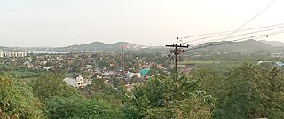
Periapalayam is a village about 40 km north of Chennai, in Tiruvallur district, Tamil Nadu State, India. The nearest Railway station is Thiruninravur.It is in Ellapuram block which stretches from east Thanakulam village, west Uthukottai, north Kosavanpettai and in the south up to Komakambedu village. It has one of the main routes to Andhra Pradesh.

Tiruppur District is one of the 38 districts of the Indian state of Tamil Nadu, formed in 22 February 2009. Dharapuram was the largest taluk by area in the district. The district is well-developed and industrialized. The Tiruppur banian industry, the cotton market, Kangeyam bull and Uthukkuli butter, among other things, provide for a vibrant economy. The city of Tiruppur is the administrative headquarters for the district. As of 2011, the district had a population of 2,479,052 with a sex-ratio of 989 females for every 1,000 males.
Orathanadu taluk, which is pronounced as 'Oraththanaadu' taluk, is a taluk of Thanjavur district in the Indian state of Tamil Nadu. The headquarters of the taluk are located at Orathanadu.
Papanasam taluk is a taluk of Thanjavur district of the Indian state of Tamil Nadu. The headquarters of the taluk is the town of Papanasam.
Tirumangalakottai West is a village in the Orathanadu taluk of Thanjavur district, Tamil Nadu, India.
Vadamadurai is a panchayat village in Thiruvallur district in the Indian state of Tamil Nadu.

