The Open Systems Interconnection model is a conceptual model that characterizes and standardizes the communication functions of a telecommunication or computing system without regard to its underlying internal structure and technology. Its goal is the interoperability of diverse communication systems with standard protocols. The model partitions a communication system into abstraction layers. The original version of the model defined seven layers.

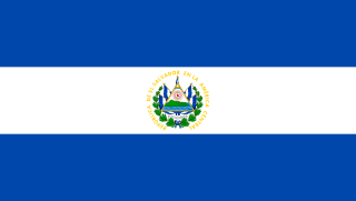
Cabañas is a department of El Salvador in the north central part of the country. Its capital is Sensuntepeque and it is one of coolest parts of El Salvador. Classified as a department in February 1873, it covers an area of 1,103.5 km2 (426.1 sq mi) and has over 164,900 inhabitants. The other major city of the department is Ilobasco. Agricultural produce includes coffee, sugar cane and sesame seeds, as well as dairy products. Gold, silver and copper are the principal minerals mined in the department. Its main industrial activity is oriented to manufacture of potteries, cheese, lime and also distilleries.
Taco Cabana is an American fast casual restaurant chain specializing in Mexican cuisine. A wholly owned subsidiary of Fiesta Restaurant Group, Inc, it is headquartered in San Antonio, Texas. As of September 2014, Taco Cabana had 166 locations throughout Texas, Oklahoma and New Mexico. As of July 2017, there were 176 Taco Cabana restaurants. Taco Cabana is known for its pink stores and semi-enclosed patio dining areas. Most menu items are handmade daily on site in open display cooking areas.

Cabañas is a municipality in the Honduran department of La Paz.
San Lorenzo is a municipality in the Honduran department of Valle.

Ilobasco is a municipality in the Cabañas department of El Salvador. It is located 30 miles northeast of the capital, San Salvador.

Fortaleza de San Carlos de la Cabaña, colloquially known as La Cabaña, is an 18th-century fortress complex, the third-largest in the Americas, located on the elevated eastern side of the harbor entrance in Havana, Cuba. The fort rises above the 200-foot hilltop, along with Morro Castle.
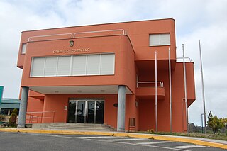
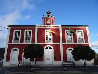
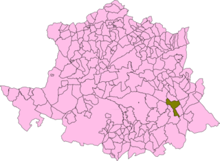
Cabana de Bergantiños or Cabana is a municipality in the Province of A Coruña, in the autonomous community of Galicia in northwestern Spain. It used to be known as Cesullas.

Lucanas is the largest province in the Ayacucho Region in Peru. Its seat is Puquio.
Ourol is a municipality in the Spanish province of Lugo. It belongs to the comarca of A Mariña Occidental.
Osorno la Mayor is a municipio in Palencia province, Castile and León, Spain. The Chilean city of Osorno (Chile) is named after this place.
Cabañas del Castillo is a municipality located in the province of Cáceres, Extremadura, Spain. According to the 2006 census (INE), the municipality has a population of 477 inhabitants.

Sargentes de la Lora is a municipality located in the province of Burgos, Castile and León, Spain. According to the 2004 census (INE), the municipality has a population of 196 inhabitants.
Janjaillo District is one of thirty-four districts of the province Jauja in Peru.
San Félix is one of 44 parishes in Tineo, a municipality within the province and autonomous community of Asturias, in northern Spain.
The Rosedale neighborhood is located in north central Austin, Texas. The neighborhood is bordered by on 38th Street to the south, Shoal Creek to the west, North Loop / Hancock Drive to the north, and Lamar Boulevard to the east. Ramsey Park is located in the heart of the neighborhood, and has a swimming pool, tennis courts, a baseball diamond, a basketball court, playgrounds, and picnic areas. There are over 1200 homes in the area, a variety of businesses within walking distance, and a network of medical services close by
Na Phak Khuang railway station is a railway station located in Kamnoet Nopphakun Subdistrict, Bang Saphan District, Prachuap Khiri Khan. It is a class 3 railway station located 371.04 km (230.6 mi) from Thon Buri railway station.

The Sanford International is a PGA Tour Champions event in Sioux Falls, South Dakota, at Minnehaha Country Club, making its debut in September 2018.