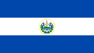
El Salvador, officially the Republic of El Salvador, is a country in Central America. It is bordered on the northeast by Honduras, on the northwest by Guatemala, and on the south by the Pacific Ocean. El Salvador's capital and largest city is San Salvador. The country's population in 2023 was estimated to be 6.5 million.

San Salvador is the capital and the largest city of El Salvador and its eponymous department. It is however the country's largest agglomeration. It is the country's political, cultural, educational and financial center. The Municipality of San Salvador has 525,990 inhabitants (2024). The Metropolitan Area of San Salvador, which comprises the capital itself and 13 of its municipalities, has a population of 2,404,097. The urban area of San Salvador has a population of 1,600,000 inhabitants.

The Pipil are an Indigenous group of Mesoamerican people inhabiting the western and central areas of present-day El Salvador. They are a subgroup of the larger Nahua ethnic group of Central America. They speak the Nawat language, which belongs to the Nahuan language branch of the Uto-Aztecan language family. The Nawat language is distinct from the Nahuatl language, as Nawat is descended from the central Mexican Nahuatl, and spoken mainly in Central America. There are very few speakers of the language left, which is a reason for the current efforts being made to revitalize it.

Cabañas is a department of El Salvador in the north central part of the country. Its capital is Sensuntepeque and it is one of coldest parts of El Salvador. Classified as a department in February 1873, it covers an area of 1,103.5 km2 (426.1 sq mi) and has over 164,900 inhabitants. The other major city of the department is Ilobasco. Agricultural produce includes coffee, sugar cane and sesame seeds, as well as dairy products. Gold, silver and copper are the principal minerals mined in the department. Its main industrial activity is oriented to manufacture of potteries, cheese, lime and distilleries.

A pupusa is a thick griddle cake or flatbread from El Salvador and Honduras made with cornmeal or rice flour, similar to the Colombian and Venezuelan arepa. In El Salvador, it has been declared the national dish and has a specific day to celebrate it. It is usually stuffed with one or more ingredients, which may include cheese, chicharrón, squash, or refried beans. It is typically accompanied by curtido and tomato salsa, and is traditionally eaten by hand.

The culture of El Salvador is a Central American culture nation influenced by the clash of ancient Mesoamerica and medieval Iberian Peninsula. Salvadoran culture is influenced by Native American culture as well as Latin American culture. Mestizo culture, Afro-Latin culture and the Catholic Church dominates the country. Although the Romance language, Castilian Spanish, is the official and dominant language spoken in El Salvador, Salvadoran Spanish which is part of Central American Spanish has influences of Native American languages of El Salvador such as Lencan languages, Cacaopera language, Mayan languages and Pipil language, which are still spoken in some regions of El Salvador.

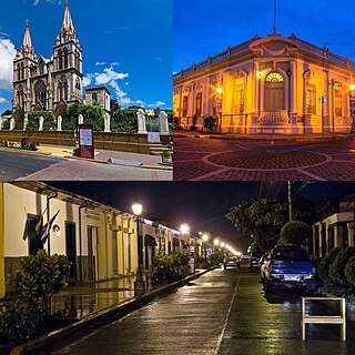
Suchitoto is a municipality in the Department of Cuscatlán, El Salvador that has seen continuous human habitation long before Spanish colonization. Within its municipal territory, Suchitoto holds the site of the original founding of the Villa of San Salvador in 1528 that existed for a short time before the site was abandoned. In more recent times, the municipality has prospered even after the severe effects of civil war in El Salvador that lasted between 1980 - 1992 and saw the population of Suchitoto decrease from 34,101 people in 1971 to 13,850 by 1992. It has become an important tourist destination partly due to its well conserved colonial architecture and cobblestone roads that provide a sense of Spanish colonial living. This rise in tourism has attracted service sector businesses to open up in the small city including hostels, restaurants, and picturesque cafes. As a result of tourism, many arts and cultural spaces have opened up in Suchitoto that are also providing positive alternative opportunities for youth in the community. According to the 2007 Official Census, the small city has a population of 24,786 people with 7,654 people living in the urban area and 17,132 people living in the rural communities.

Ilobasco is a district in the Cabañas department of El Salvador. It is located 30 miles northeast of the capital, San Salvador.

San Isidro is a district in the Cabañas department of El Salvador, roughly 70 kilometres (43 mi) northeast of San Salvador.
Santa Tecla is a city and a municipality in the La Libertad department of El Salvador. It is the capital of the department of La Libertad.

Tazumal is a pre-Columbian archeological site in Chalchuapa, El Salvador. Tazumal is an architectural complex within the larger area of the ancient Mesoamerican city of Chalchuapa, in western El Salvador. The Tazumal group is located in the southern portion of the Chalchuapa archaeological zone. Archaeologist Stanley Boggs excavated and restored the Tazumal complex during the 1940s and 1950s.
Nawat is a Nahuan language native to Central America. It is the southernmost extant member of the Uto-Aztecan family. Before Spanish colonization it was spoken in several parts of present-day Central America, most notably El Salvador and Nicaragua, but now is mostly confined to western El Salvador. It has been on the verge of extinction in El Salvador, and has already gone extinct elsewhere in Central America. In 2012, a large number of new Nawat speakers started to appear. As of today, the language is currently going through a revitalization.

Cuzcatlan was a pre-Columbian Nahua state confederation of the Mesoamerican postclassical period that extended from the Paz river to the Lempa river ; this was the nation that Spanish chroniclers came to call the Pipils or Cuzcatlecos. No codices survive that shed light on this confederation except the Annals of the Cakchiquels, although Spanish chroniclers such as Domingo Juarros, Palaces, Lozano, and others claim that some codices did exist but have since disappeared. Their Nawat language, art and temples revealed that they had significant Mayan and Toltec influence from the ties they had with the Itza in Yucatan. It is believed that the first settlers to arrive came from the Toltec people in central Mexico, mostly Puebla during the Chichimeca-Toltec civil wars in the 10th century AD.
Salvadorans, also known as Salvadorians, are citizens of El Salvador, a country in Central America. Most Salvadorans live in El Salvador, although there is also a significant Salvadoran diaspora, particularly in the United States, with smaller communities in other countries around the world.
El Salvador – sovereign country located on the Pacific Coast of Central America. The area was originally called by the Pipil "Cuzcatan", in Spanish "Cuzcatlan", which in Nahuat means "The Land Of Precious Things". After the Spanish conquest, the land was divided into the province of San Salvador and the province of Izalcos ; until in 1824 the two jurisdictions were united in the State, now Republic, of El Salvador. The country borders the Pacific Ocean between Guatemala and Honduras. With a population of approximately 5.8 million people, it is the most densely populated nation in Central America and is undergoing rapid industrialization.

The Spanish conquest of El Salvador was the campaign undertaken by the Spanish conquistadores against the Late Postclassic Mesoamerican polities in the territory that is now incorporated into the modern Central American country of El Salvador. El Salvador is the smallest country in Central America, and is dominated by two mountain ranges running east–west. Its climate is tropical, and the year is divided into wet and dry seasons. Before the conquest the country formed a part of the Mesoamerican cultural region, and was inhabited by a number of indigenous peoples, including the Pipil, the Lenca, the Xinca, and Maya. Native weaponry consisted of spears, bows and arrows, and wooden swords with inset stone blades; they wore padded cotton armour.

El Salvador–Spain relations are the current and historical relations between El Salvador and Spain. Both nations are members of the Association of Academies of the Spanish Language, Organization of Ibero-American States and the United Nations.
The Cuernavaca Municipality is one of 36 municipalities in the State of Morelos, Mexico. Located in the northwest of the state, it consists of the City of Cuernavaca, which is the state and municipal capital, as well as other, smaller towns. The population is 378,476 (2020).

The blockade of the Cabañas Department was a military operation in El Salvador during the Salvadoran gang crackdown which started on 1 August 2023, when Salvadoran President Nayib Bukele announced that 7,000 soldiers of the Armed Forces of El Salvador (FAES) and 1,000 police officers of the National Civil Police (PNC) had surrounded the department of Cabañas to capture gang members.
 ]]
]]


