
Villanúa is a Pyrenean municipality in Spain in the north of Huesca province, in la Jacetania, set where the Aragon valley gets wider. Its name refers to the "new village" repopulated in the late 10th century. Villanúa's altitude is 953 m and it covers 58.2 km2. The village is at the bottom of mount Collarada and in 2018 had 447 inhabitants.
San Juan de Opoa is a municipality in the Honduran department of Copán.

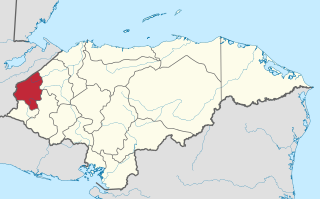
Tomalá is a municipality in the Honduran department of Lempira.

Santa Catarina Barahona is a municipality in the Guatemalan department of Sacatepéquez.

Santa Catarina Masahuat is a municipality in the Sonsonate department of El Salvador.
Obanos is a town and municipality located in the province and autonomous community of Navarre, northern Spain.

Grenadines is an administrative parish of Saint Vincent and the Grenadines, comprising the islands of the Grenadines other than those belonging to Grenada. The capital is Port Elizabeth.

Çınar is a district of Diyarbakır Province of Turkey. Its population is 74,207 according to Turkish government statistics as of 2018.

Alamillo is a municipality in Ciudad Real, Castile-La Mancha, Spain. It has a population of 674.
Paim Filho is a municipality in the state of Rio Grande do Sul, Brazil. As of 2020, the estimated population was 3,778.
Tusova is a village in the Lerik Rayon of Azerbaijan.
Skajboty is a village in the administrative district of Gmina Barczewo, within Olsztyn County, Warmian-Masurian Voivodeship, in northern Poland.
Rio Rufino is a municipality in the state of Santa Catarina in the South region of Brazil.
Batavia is a village and municipality in San Luis Province in central Argentina.

Tlaxiaco District is located in the south of the Mixteca Region of the State of Oaxaca, Mexico. The main city is the Heroic City of Tlaxiaco
Jigalur is a village in Dharwad district of Karnataka, India.

Point Martin is a point on the east side of Mossman Peninsula, 1.5 km (0.93 mi) north-west of Cape Murdoch, on the south coast of Laurie Island in the South Orkney Islands of Antarctica. It was charted in 1903 by the Scottish National Antarctic Expedition under Bruce, who named it for J. Martin, an able seaman on the expedition ship Scotia.
Kandovan Rural District is a rural district (dehestan) in Kandovan District, Meyaneh County, East Azerbaijan Province, Iran. At the 2006 census, its population was 8,444, in 1,913 families. The rural district has 33 villages.
The Titihuapa is a river of El Salvador. A tributary of the Zapotal, it flows for 15 kilometres (9.3 mi) through the municipalities of San Isidro, Cabañas, Sensuntepeque, San Sebastián, San Esteban Catarina and Santa Clara, spanning the Cabañas and San Vicente departments. In 2004 excavations along the bank discovered petroglyphs.
This page is based on this
Wikipedia article Text is available under the
CC BY-SA 4.0 license; additional terms may apply.
Images, videos and audio are available under their respective licenses.


