
Franklin County is a county located in the U.S. state of Texas. As of the 2020 census, its population was 10,359. The county seat is Mount Vernon.

Titusville is a city in and the county seat of Brevard County, Florida, United States. As of the 2020 census, the population of the city was 48,789, up from 43,761 at the 2010 census. Titusville is located along the Indian River, west of Merritt Island and the Kennedy Space Center, and south-southwest of the Canaveral National Seashore. It is a principal city of the Palm Bay–Melbourne–Titusville, Florida Metropolitan Statistical Area.

LaGrange is a town in Dutchess County, New York, United States. The population was 15,975 at the 2020 census. The town was named after the estate of the Marquis de Lafayette.

Blooming Grove is a town in Orange County, New York, United States. The population was 18,811 at the 2020 census. It is located in the central part of the county, southwest of Newburgh.

Malone is a town in Franklin County, New York, United States. The population was 12,433 at the 2020 census. The town contains a village also named Malone. The town is an interior town located in the north-central part of the county.

Otsego Lake is a 4,046-acre (16.37 km2) lake located in Otsego County in the U.S. state of New York. It is the source of the Susquehanna River and largest lake in Otsego County. The Village of Cooperstown is located at the lake's southern end. Glimmerglass State Park is located on the lake's northeastern shore, and includes Hyde Hall, a large mansion constructed in 1817, that overlooks the lake. The Glimmerglass Opera, opened in June 1987, is located on the western shore.

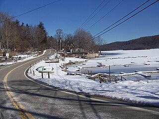
Canadarago Lake is a 1,917-acre (7.76 km2) lake located in Otsego County, New York and is the source of Oaks Creek. The Village of Richfield Springs is located at the lake's northern end. It is the second largest lake in Otsego County, lying to the west of and parallel to the larger Otsego Lake. The lake's name is also spelled "Candajarago Lake" or "Caniadaraga Lake".

New York State Route 590 (NY 590) is a 4.98-mile (8.01 km) north–south freeway located in the eastern suburbs of Rochester, New York, in the United States. The route is a northward extension of Interstate 590 (I-590) that begins at the Can of Worms, an interchange between I-490, I-590, and NY 590 on the boundary between the town of Brighton and the city of Rochester, and ends at a roundabout with Titus Avenue in the town of Irondequoit. NY 590 is known as the Sea Breeze Expressway, a name derived from the small community of Sea Breeze located near the highway's former northern terminus at Culver Road near the southern shore of Lake Ontario.
Lake Pleasant is located in the Adirondack Park in New York in the United States. The lake is in the town of Lake Pleasant in Hamilton County.

The Niagara Frontier refers to the stretch of land in the United States that is south of Lake Ontario and north of Lake Erie, and extends westward to Cleveland, Ohio. The term dates to the War of 1812, when the northern border was in contention between the United States and British forces in Canada. It refers only to the land east of the Niagara River and north of Lake Erie within the United States. The western side of the Niagara River, on the Canada/Ontario side, is the Niagara Peninsula; it is considered part of the Golden Horseshoe.
Whaley Lake is located in the town of Pawling in southeastern Dutchess County in New York State, United States. It is the largest lake in Dutchess County.

Balsam Lake Mountain is one of the Catskill Mountains, located in the Town of Hardenburgh, New York, United States. It is the westernmost of the range's 35 High Peaks. Its exact height has not been determined, but the highest contour line on topographic maps, 3,720 feet (1,130 m), is usually given as its elevation.

Indian Lake is a 12-mile (19 km) long, 4,255-acre (1,722 ha) reservoir with a southwest to northeast orientation in the towns of Indian Lake and Lake Pleasant in Hamilton County, in the Adirondack Park of New York State, in the United States. The hamlet of Indian Lake is located 2 miles (3.2 km) north of the north end of Indian Lake. New York State Route 30 runs along the west shore of the lake. Most of the shore is part of the Forest Preserve. Indian Lake is fed by the Jessup River, and drains through the Indian River into Lake Abanakee, and from there through the Indian River to the Hudson River.

The Smoky Mountains are part of the Rocky Mountains and located on the west side of the Wood River Valley near Sun Valley, Idaho, in the Western United States. The range is within Sawtooth National Forest, while part of it is within the Sawtooth National Recreation Area. The highest point in the range is Saviers Peak at 10,441 ft (3,182 m).
Titus is an unincorporated community in Elmore County, Alabama, United States. Titus is 13.2 miles (21.2 km) north-northwest of Wetumpka. Titus has a post office with ZIP code 36080. Much of the community borders Jordan Lake.

Rum Hill is a mountain located in Central New York Region of New York northwest of the Hamlet of Pierstown. Red House Hill is located southeast, Metcalf Hill is located south, Allen Lake and Mohegan Hill are located north-northwest and Otsego Lake is located east of Rum Hill.

Mount Wellington is a mountain located in the Central New York Region of New York. It is located south of the Hamlet of Springfield Center at the northern end of Otsego Lake. Mount Wellington rises 600 feet (180 m) above lake level. The extreme southern point of the mountain is called Clarke Point and also referred to as the Shad Cam. It is known as "The Sleeping Lion", as it looks similar to a lion laying down, viewed from Cooperstown, New York. It was originally named Mount Millington, but was renamed by George Hyde Clarke in honor of Field Marshal The 1st Duke of Wellington, the victor of Waterloo, who had been Clarke's schoolmate at Eton College in England.

Mount Morris is a 3,117-foot-tall (950 m) mountain located in Adirondack Mountains of New York. It is located in the south-southwest of the village of Tupper Lake in Franklin County, and is "the highest peak immediately east of Tupper Lake." It is named after the town in which it was then located.

Pompton Junction is a former railroad station and active railroad junction in the borough of Pompton Lakes, New Jersey, United States. The station is located on the New York and Greenwood Lake Railway and the New York, Susquehanna and Western Railway, both subsidiaries of the Erie Railroad. Pompton Junction contained two side platforms at a diamond crossing, with a station depot on the Susquehanna Railroad side and a station canopy on the Greenwood Lake side. A railroad tower with the telegraph call letters "PJ" was present on the Greenwood Lake side of the station.
