Tobyhanna Creek

Last updated
Tobyhanna Creek in 2017 Tobyhanna Creek (4) (33102194274).jpg
Tobyhanna Creek in 2017

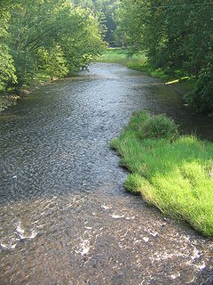
Tobyhanna Creek is a 29.9-mile-long (48.1 km) [1] tributary of the Lehigh River in the Pocono Mountains of eastern Pennsylvania in the United States. [2]

Tributary stream or river that flows into a main stem river or lake

A tributary or affluent is a stream or river that flows into a larger stream or main stem river or a lake. A tributary does not flow directly into a sea or ocean. Tributaries and the main stem river drain the surrounding drainage basin of its surface water and groundwater, leading the water out into an ocean.

Lehigh River river located in eastern Pennsylvania, in the United States

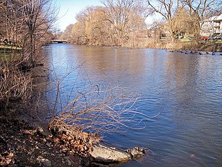
The Lehigh River, a tributary of the Delaware River, is a 109-mile-long (175 km) river located in eastern Pennsylvania, in the United States. Part of the Lehigh, along with a number of its tributaries, is designated a Pennsylvania Scenic River by the state's Department of Conservation and Natural Resources. "Lehigh" is an Anglicization of the Lenape name for the river, Lechewuekink, meaning "where there are forks".

Pocono Mountains geographical, geological, and cultural region located in northeastern Pennsylvania, United States

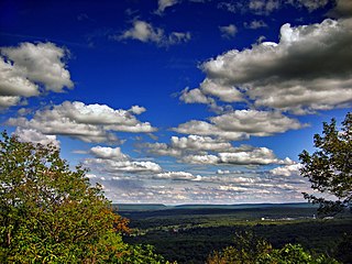
The Pocono Mountains, commonly referred to as The Poconos, are a geographical, geological, and cultural region in Northeastern Pennsylvania, United States. The Poconos are an upland of the larger Allegheny Plateau. Forming a 2,400-square-mile (6,200 km2) escarpment overlooking the Delaware River and Delaware Water Gap to the east, the mountains are bordered on the north by Lake Wallenpaupack, on the west by the Wyoming Valley and the Coal Region, and to the south by the Lehigh Valley. The name comes from the Munsee word Pokawachne, which means "Creek Between Two Hills." Much of the Poconos region lies within the Greater New York-Newark, NY-NJ-CT-PA Combined Statistical Area. The wooded hills and valleys have long been a popular recreation area, accessible within a two-hour drive to millions of metropolitan area residents, with many communities having resort hotels with fishing, hunting, skiing, and other sports facilities.

Contents

The upper reaches of the creek pass through or near Tobyhanna Township, Tobyhanna Army Depot and Tobyhanna State Park. [2]

Tobyhanna Army Depot, is a logistics center for the United States Department of Defense (DoD), specializing in electronic systems and located in Coolbaugh Township, Monroe County, near Tobyhanna, Pennsylvania. Established February 1, 1953, as Tobyhanna Signal Depot, today it is a facility for the repair, upgrade and integration of Command, Control, Computer, Communications, Intelligence, Surveillance and Reconnaissance (C4ISR) systems for all branches of the Armed Forces.

Tobyhanna State Park

Tobyhanna State Park is a Pennsylvania state park on 5,440 acres (2,201 ha) mostly in Coolbaugh Township, Monroe County, with a small portion of the park in Dreher and Lehigh townships in Wayne County, all in Pennsylvania in the United States. The park includes the 170-acre (69 ha) Tobyhanna Lake and a portion of Tobyhanna Creek. It is located 2.1 miles (3.4 km) north of the town of Tobyhanna, with the main park entrance on Pennsylvania Route 423, and a portion that borders on Pennsylvania Route 196. The park lies immediately adjacent to Gouldsboro State Park, Pennsylvania State Game Lands 312, and State Game Land 127.

Tunkhannock Creek joins Tobyhanna Creek near Blakeslee in Monroe County. [2]

Blakeslee, Pennsylvania Unincorporated community in Pennsylvania, United States

Blakeslee is an unincorporated community in Tobyhanna Township in Monroe County, Pennsylvania, United States. Blakeslee is located at the intersection of Pennsylvania Route 115 and Pennsylvania Route 940.

Monroe County, Pennsylvania County in the United States

Monroe County is a county in the U.S. state of Pennsylvania. As of the 2010 census, the population was 169,842. Its county seat is Stroudsburg. The county was formed from sections of Northampton and Pike counties. Named in honor of James Monroe, the fifth president of the United States, the county is located in northeastern Pennsylvania, along its border with New Jersey. Monroe County is coterminous with the East Stroudsburg, PA Metropolitan Statistical Area, within the Greater New York–Newark, NY–NJ–CT–PA Combined Statistical Area. It also borders the Lehigh Valley and has connections to the Delaware Valley, being a part of Philadelphia's Designated Media Market.

Tobyhanna Creek (Native American for "a stream whose banks are fringed with alder") joins the Lehigh River at the community of Stoddartsville, 6.1 miles (9.8 km) upstream of the Francis E. Walter Dam. [2]

Native Americans in the United States Indigenous peoples of the United States (except Hawaii)

Native Americans, also known as American Indians, Indigenous Americans and other terms, are the indigenous peoples of the United States, except Hawaii. There are over 500 federally recognized tribes within the US, about half of which are associated with Indian reservations. The term "American Indian" excludes Native Hawaiians and some Alaska Natives, while Native Americans are American Indians, plus Alaska Natives of all ethnicities. Native Hawaiians are not counted as Native Americans by the US Census, instead being included in the Census grouping of "Native Hawaiian and other Pacific Islander".

Francis E. Walter Dam Recreation area

The Francis E. Walter Dam is an embankment dam located in Bear Creek Township, Luzerne County, Pennsylvania. Constructed in 1961 by the United States Army Corps of Engineers, it spans the Lehigh River at its confluence with the tributary Bear Creek, creating the Francis E. Walter Reservoir. Although the dam was originally constructed for flood management, its reservoir has since become a popular recreational area for fishing, kayaking, and boating. It was originally called Bear Creek Dam, but was renamed in 1963 after United States Congressman Francis E. Walter.

See also

Related Research Articles

Red Clay Creek is a 13.6-mile-long (21.9 km) tributary of White Clay Creek, running through southeastern Pennsylvania and northern Delaware in the United States. As of 2000, portions of the creek are under wildlife habitat protection.

Little Pine Creek creek in Pennsylvania, United States

Little Pine Creek is a tributary of Pine Creek in Lycoming County, Pennsylvania, in the United States. It is approximately 15.8 miles (25.4 km) long and flows through Pine Township and Cummings Township.

Aquashicola Creek, also known as Aquanchicola Creek, or Aquanshicola Creek, is a 20.8-mile-long (33.5 km) tributary of the Lehigh River in the Poconos of eastern Pennsylvania in the United States.

Monocacy Creek (Lehigh River tributary) river in the United States of America

Monocacy Creek is a tributary of the Lehigh River in Northampton County, Pennsylvania, in the United States.

Wysox Creek is a tributary of the Susquehanna River in Bradford County, Pennsylvania, in the United States. It is approximately 15.0 miles (24.1 km) long and flows through Windham Township, Orwell Township, Rome Township, and Wysox Township. It is possible to canoe on part of the creek's length.

Perkiomen Creek creek in southeastern Pennsylvania, United States

Perkiomen Creek is a 37.7-mile-long (60.7 km) tributary of the Schuylkill River in Berks, Lehigh and Montgomery counties, Pennsylvania in the United States. The water course was also named Perquaminck Creek, on Thomas Holme's 1687 map.

Meshoppen Creek is a tributary of the Susquehanna River in Susquehanna and Wyoming counties, Pennsylvania, in the United States. It is approximately 30.6 miles (49.2 km) long and flows through Bridgewater Township, Dimock Township, and Springville Township in Susquehanna County and Lemon Township, Washington Township, Meshoppen Township, and Meshoppen in Wyoming County. The watershed of the creek has an area of 114 square miles (300 km2). It is possible to canoe on 17.0 miles (27.4 km) of Meshoppen Creek.

Little Lehigh Creek river in the United States of America

The Little Lehigh Creek is approximately 24.0 miles (38.6 km) long, in eastern Pennsylvania, in the United States. It is also sometimes referred to as the Little Lehigh River. It is called the Little Lehigh because it is the largest tributary of the Lehigh River.

Raystown Branch Juniata River river in the United States of America

The Raystown Branch Juniata River is the largest and longest tributary of the Juniata River in south-central Pennsylvania in the United States.

Jordan Creek (Pennsylvania)

Jordan Creek, also known as Hollenbach in Deitsch, is a 34.1-mile-long (54.9 km) tributary of the Little Lehigh Creek in Lehigh County, Pennsylvania, in the United States.

Tunkhannock Creek (Tobyhanna Creek tributary) tributary of Tobyhanna Creek

Tunkhannock Creek is a 19.2-mile-long (30.9 km) tributary of Tobyhanna Creek in the Poconos of eastern Pennsylvania in the United States.

Codorus Creek is a 42.4-mile-long (68.2 km) tributary of the Susquehanna River in York County, Pennsylvania in the United States.

Kitchen Creek (Pennsylvania) tributary of Huntington Creek

Kitchen Creek is a tributary of Huntington Creek in Luzerne County, Pennsylvania, in the United States. It is approximately 10.6 miles (17.1 km) long and flows through Fairmount Township and Huntington Township. The watershed of the creek has an area of 20.10 square miles (52.1 km2). The creek is designated as a high-quality coldwater fishery.

Mountain Creek (Yellow Breeches Creek tributary) river in the United States of America

Mountain Creek is a 20.9-mile-long (33.6 km) tributary of Yellow Breeches Creek in Cumberland County, Pennsylvania.

Mahoning Creek is a 16.7-mile-long (26.9 km) tributary of the Lehigh River in Schuylkill and Carbon counties, Pennsylvania, in the United States.

Acahela is an historic community located in Monroe County, Pennsylvania, United States. It had a summer post office that operated from 1930 until 1944.

Pisgah Mountain

Pisgah Mountain or Pisgah Ridge is a long ridgeline 12.5 miles (20.1 km) Tamaqua to Jim Thorpe oriented NNE-to-SSW whose northside valley is followed by U.S. Route 209 from river gap to river gap. The ridge is a succession of peaks exceeding 1,440 feet (438.9 m) looming 300–540 feet above the towns of Lansford, Coaldale, Summit Hill, and Tamaqua in the Panther Creek valley. Near Summit Hill was the 'Sharpe Mountain' (peak), where in 1791 Phillip Ginter is documented as having discovered Anthracite leading to the formation of the Lehigh Coal Mine Company. In 1818 the Lehigh Coal Company took over the mines and the mining camp gradually became a settlement and grew into Summit Hill.

Nesquehoning Mountain

Nesquehoning Mountain or Nesquehoning Ridge is a 15–17-mile-long (24–27 km) coal bearing ridge dividing the waters of Lehigh Valley to the north from the Schuylkill River valley and the several near parallel ridgelines of the Ridge-and-valley Appalachians barrier range all local members of which run generally WSW-ENE in the greater overall area.

References

  1. U.S. Geological Survey. National Hydrography Dataset high-resolution flowline data. The National Map, accessed April 1, 2011
  2. 1 2 3 4 Gertler, Edward. Keystone Canoeing, Seneca Press, 2004. ISBN   0-9749692-0-6

Coordinates: 41°07′20″N75°38′56″W / 41.122339°N 75.648758°W / 41.122339; -75.648758

Geographic coordinate system Coordinate system

A geographic coordinate system is a coordinate system that enables every location on Earth to be specified by a set of numbers, letters or symbols. The coordinates are often chosen such that one of the numbers represents a vertical position and two or three of the numbers represent a horizontal position; alternatively, a geographic position may be expressed in a combined three-dimensional Cartesian vector. A common choice of coordinates is latitude, longitude and elevation. To specify a location on a plane requires a map projection.