High Bradfield is a rural village 6.5 miles (10 km) north-west of the centre of Sheffield in South Yorkshire, England and within the city's boundaries. The village lies just within the Peak District National Park, 1.3 miles (2 km) inside the park's north-eastern border, is at an altitude of 260 metres (850 feet) AOD, and has extensive views across Bradfield Dale towards Derwent Edge and the Dark Peak.

A motte-and-bailey castle is a European fortification with a wooden or stone keep situated on a raised area of ground called a motte, accompanied by a walled courtyard, or bailey, surrounded by a protective ditch and palisade. Relatively easy to build with unskilled labour, but still militarily formidable, these castles were built across northern Europe from the 10th century onwards, spreading from Normandy and Anjou in France, into the Holy Roman Empire in the 11th century. The Normans introduced the design into England and Wales. Motte-and-bailey castles were adopted in Scotland, Ireland, the Low Countries and Denmark in the 12th and 13th centuries. Windsor Castle, in England, is an example of a motte-and-bailey castle. By the end of the 13th century, the design was largely superseded by alternative forms of fortification, but the earthworks remain a prominent feature in many countries.

South Mimms is a village and civil parish in the Hertsmere district of Hertfordshire in the East of England. It is a small settlement located near to the junction of the M25 motorway with the A1(M) motorway and is perhaps more widely known because of the naming of the service station at that junction.

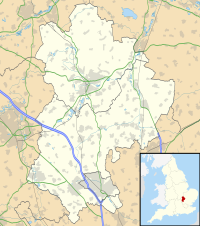
Toddington is a large village and civil parish in the county of Bedfordshire, England. It is situated 5 miles north-north-west of Luton, 4 miles (6 km) north of Dunstable, 6 miles (10 km) south-west of Woburn, and 35 miles north-north-west of London on the B5120 and B579. It is 0.5 miles from Junction 12 of the M1 motorway and lends its name to the nearby motorway service station. The hamlet of Fancott also forms part of the Toddington civil parish.

West Woodhay is a rural scattered village and civil parish in West Berkshire, England. At the 2011 census it had 59 households.

English Bicknor is a village and civil parish in the Forest of Dean district of west Gloucestershire, England. The 2011 Census recorded the population as 408. The village is near the county boundary with Herefordshire, opposite which is the village of Welsh Bicknor. The two villages are on opposite sides of the River Wye.

Skipsea Castle was a Norman motte and bailey castle near the village of Skipsea, East Riding of Yorkshire, England. Built around 1086 by Drogo de la Beuvrière, apparently on the remains of an Iron Age mound, it was designed to secure the newly conquered region, defend against any potential Danish invasion and control the trade route across the region leading to the North Sea. The motte and the bailey were separated by Skipsea Mere, an artificial lake that was linked to the sea during the medieval period via a navigable channel. The village of Skipsea grew up beside the castle church, and the fortified town of Skipsea Brough was built alongside the castle around 1160 to capitalise on the potential trade.

Hough-on-the-Hill is a village and civil parish in the South Kesteven district of Lincolnshire, England. The population of the civil parish including Brandon was 399 at the 2011 census. It is situated approximately 7 miles (11 km) due north from the market town of Grantham. The hamlets of Gelston and Brandon are part of the parish. Hough-on-the-Hill is on a significant rise, hence the name.

Aslockton Castle is a ruined fortification, a motte-and-bailey castle, in the village of Aslockton, Nottinghamshire. The original name of the settlement was Aslachetone, which suggests a possible Norse origin; it was mentioned in the Domesday Book of 1086 where it was described as a large settlement.

Coldred is a settlement in the Shepherdswell with Coldred civil parish in the Dover District of Kent, England. The main part of the village is Coldred Street which lies 1⁄2 mile (0.80 km) to the south-west.

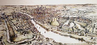
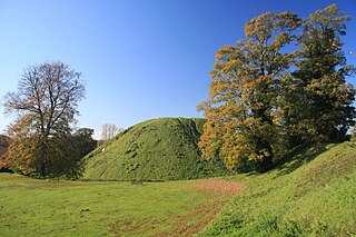
Thetford Castle is a medieval motte and bailey castle in the market town of Thetford in the Breckland area of Norfolk, England. The first castle in Thetford, a probable 11th-century Norman ringwork called Red Castle, was replaced in the 12th century by a much larger motte and bailey castle on the other side of the town. This new castle was largely destroyed in 1173 by Henry II, although the huge motte, the second largest man-made mound in England, remained intact. The motte, recognised as a scheduled monument, now forms part of a local park, and the remains are known variously as Castle Hill, Castle Mound and Military Parade.

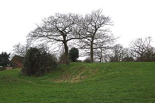
Flitwick Castle was an 11th-century castle located in the town of Flitwick, in the county of Bedfordshire, England.

Burrow Mump is a hill and historic site overlooking Southlake Moor in the village of Burrowbridge within the English county of Somerset. It is a scheduled monument, with a never completed church on top of the hill a Grade II listed building.
A moot hill or mons placiti is a hill or mound historically used as an assembly or meeting place, as a moot hall is a meeting or assembly building, also traditionally to decide local issues. In early medieval Britain, such hills were used for "moots", meetings of local people to settle local business. Among other things, proclamations might be read; decisions might be taken; court cases might be settled at a moot. Although some moot hills were naturally occurring features or had been created long before as burial mounds, others were purpose-built.

Pilsbury Castle was a Norman castle in Derbyshire near the present-day village of Pilsbury, overlooking the River Dove.

Stowting is a village and civil parish in the English county of Kent. It is 6 miles (9.7 km) east of Ashford, 7 miles (11 km) north-west of Folkestone and 10 miles (16 km) south of Canterbury.

Cymbeline's Castle, also known as Cymbeline's Mound and Belinus's Castle, is the remains of a motte-and-bailey castle in woods north-east of Great Kimble in Buckinghamshire, England. It is scheduled under the Ancient Monuments and Archaeological Areas Act 1979.
Tothill is a hamlet in the East Lindsey district of Lincolnshire, England. It is situated about 6 miles (10 km) south-east from Louth, and about 5 miles (8 km) north-west from Alford.

Burgh Castle is the site of one of nine Roman Saxon Shore forts constructed in England around the 3rd century AD, to hold troops as a defence against Saxon raids up the rivers of the east and south coasts of southern Britain. It is located on the summit of ground sloping steeply towards the estuary of the River Waveney, in the civil parish of Burgh Castle, in the county of Norfolk.

Whittington Tump or Crookbarrow Hill is a partly artificial mound in central Worcestershire, England. There is evidence of prehistoric activity at the site and may have been used as a religious site or burial mound. A Romano-British settlement was established nearby in the early 2nd century AD but was apparently abandoned by the 4th century. An Anglo-Saxon enclosure was established on Whittington Tump by the 7th century and during the mediaeval period it is thought to have been the site of a motte castle. Crookbarrow Manor was established at the foot of the hill by 1314 and the site, including the former motte, was given over to agricultural use. The site was listed as a scheduled monument in 1923 and is a landmark for motorists on the nearby M5 motorway.


