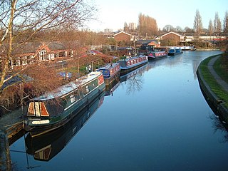
The Wyrley and Essington Canal, known locally as "the Curly Wyrley", is a canal in the English Midlands. As built it ran from Wolverhampton to Huddlesford Junction near Lichfield, with a number of branches: some parts are currently derelict. Pending planned restoration to Huddlesford, the navigable mainline now terminates at Ogley Junction near Brownhills. In 2008 it was designated a Local Nature Reserve.
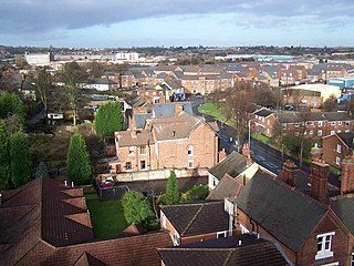
Tipton is an industrial town in the West Midlands in England with a population of around 38,777 at the 2011 UK Census. It is located 16 kilometres (9.9 mi) northwest of Birmingham.
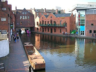
Birmingham Canal Navigations (BCN) is a network of canals connecting Birmingham, Wolverhampton, and the eastern part of the Black Country. The BCN is connected to the rest of the English canal system at several junctions.
Great Bridge is a village in the Metropolitan Borough of Sandwell. It is situated in Tipton, near the border of West Bromwich, and it is within the metropolitan county of the West Midlands.

Dudley Port railway station serves the Dudley Port and Great Bridge areas of Tipton, West Midlands, England, Situated on the Stour Valley Line, the station is operated by West Midlands Railway.

Tipton railway station is located in the town of Tipton in the borough of Sandwell, West Midlands, England and was known as Tipton Owen Street until 1968. It is situated on the West Coast Main Line. The station is operated by West Midlands Railway, which also provides all services.

The Dudley Canal is a canal passing through Dudley in the West Midlands of England. The canal is part of the English and Welsh connected network of navigable inland waterways, and in particular forms part of the popular Stourport Ring narrowboat cruising route.
The Black Country New Road is a major road which runs through the West Midlands of England.

Tipton Green is the central area of Tipton, a town in the West Midlands of England. It was heavily developed for heavy industry and housing during the 19th century, as Tipton was one of the most significant towns during the Industrial Revolution. Tipton Green is one of three electoral wards covering Tipton for Sandwell Metropolitan Borough Council. The population of this Sandwell ward taken at the 2011 census was 12,834. It is represented by three Labour councillors.

Brettell Lane railway station was a station on the Oxford-Worcester-Wolverhampton Line which served the town of Brierley Hill in England.

Wednesbury Town railway station was a station on the South Staffordshire Line.

Ocker Hill is a residential area of Tipton in the West Midlands of England.
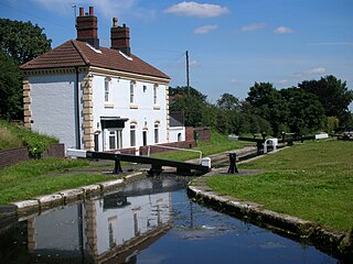
The Tame Valley Canal is a relatively late (1844) canal in the West Midlands of England. It forms part of the Birmingham Canal Navigations. It takes its name from the roughly-parallel River Tame.
The BCN Main Line, or Birmingham Canal Navigations Main Line describes the evolving route of the Birmingham Canal between Birmingham and Wolverhampton in England.

The Birmingham Canal Navigations (BCN), a network of narrow canals in the industrial midlands of England, is built on various water levels. The three longest are the Wolverhampton, Birmingham, and Walsall levels. Locks allow boats to move from one level to another.

The Walsall Canal is a narrow canal, seven miles (11 km) long, forming part of the Birmingham Canal Navigations, and passing around the western side of Walsall, West Midlands, England.

The Tipton Green Branch and Toll End Branch were narrow canals comprising part of the Birmingham Canal Navigations near Tipton, West Midlands, England. These canals no longer exist.
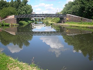
Wednesbury Old Canal is part of the Birmingham Canal Navigations (BCN) in West Midlands (county), England. It opened in 1769, and although parts of it were abandoned in 1955 and 1960, the section between Pudding Green Junction and Ryder's Green Junction is navigable, as it provides a link to the Walsall Canal. A short stub beyond Ryder's Green Junction is connected to the network but difficult to navigate.

The Wednesbury Oak Loop, sometimes known as the Bradley Arm, is a canal in the West Midlands, England. It is part of the Birmingham Canal Navigations (BCN), and was originally part of James Brindley's main line, but became a loop when Thomas Telford's improvements of the 1830s bypassed it by the construction of the Coseley Tunnel. The south-eastern end of the loop was closed and in parts built over, following the designation of the entire loop as "abandoned" in 1954, including the section which was filled in at the beginning of the 1960s to make way for the Glebefields Estate in Tipton.

The Bradley Branch or Bradley Locks Branch was a short canal of the Birmingham Canal Navigations in the West Midlands, England. Completed in 1849, it included nine locks, and had a number of basins which enabled it to service local collieries and industrial sites. The locks were unusual, as they had a single gate at both ends, rather than double gates at the bottom end. The route closed in the 1950s, and the top seven locks were covered over and landscaped.


