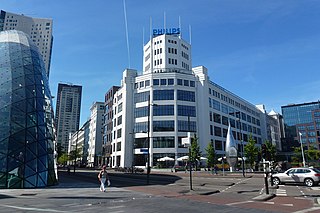
Eindhoven is a city and municipality of the Netherlands, located in the southern province of North Brabant of which it is its largest and is also located in the Dutch part of the natural region the Campine. With a population of 246,443 on a territory of 88.92 km², it is the fifth-largest city of the Netherlands and the largest outside the Randstad conurbation.

North Brabant, also unofficially called Brabant, is a province in the south of the Netherlands. It borders the provinces of South Holland and Gelderland to the north, Limburg to the east, Zeeland to the west, and the Flemish provinces of Antwerp and Limburg to the south. The northern border follows the Meuse westward to its mouth in the Hollands Diep strait, part of the Rhine–Meuse–Scheldt delta. North Brabant had a population of about 2,626,000 as of January 2023. Major cities in North Brabant are Eindhoven, Tilburg, Breda, its provincial capital 's-Hertogenbosch, and Helmond

IJsselmonde is a river island in the Netherlands, between the Nieuwe Maas, Noord and Oude Maas branches rivers of the Rhine-Meuse delta in the province of South Holland. The city of Rotterdam now occupies most of the northern part of the island and includes the eponymous former village of IJsselmonde, once a separate community. The island was once a rich agricultural region but is mostly suburbs today. Only the mid-south parts of the island have retained their agricultural character.

Sint-Oedenrode is a town in the province of North Brabant.

Son en Breugel is a municipality in the southern Netherlands just outside Eindhoven. The municipality covers an area of 26.51 km2 (10.24 sq mi) of which 0.56 km2 (0.22 sq mi) is water. It had a population of 17,552 in 2021. Son en Breugel used to be two different villages: 'Son' and 'Breugel', with the stream the Dommel separating the two villages. Son en Breugel also borders the following larger municipalities: Eindhoven, Meierijstad, Nuenen, Gerwen en Nederwetten, and Best. The spoken language is North Meierijs.

The Gender is a stream in the Dutch province of North Brabant. It originates in originally marshy flatlands near Steensel and flows through Veldhoven and its eastern district Meerveldhoven in a general east-northeast direction towards Eindhoven.

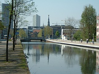
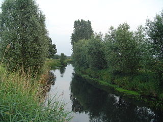
The Dommel is a small river in Belgium and the Netherlands, left tributary of the Dieze. It is 120 km long, of which 85 km in the Netherlands. The Dommel takes in water from the Keersop, Tongelreep, Run, Gender and Kleine Dommel streams and merges at 's-Hertogenbosch with the Aa stream to form the river Dieze, which subsequently flows towards the Meuse. The main cities and towns along the Dommel's course are Peer, Neerpelt, Valkenswaard, Dommelen, Eindhoven, Son en Breugel, Sint-Oedenrode, Boxtel, Sint-Michielsgestel and 's-Hertogenbosch.

Liempde is a village in the Netherlands in the municipality Boxtel. Annually the Flevo Christian music festival is held here. In 2005 the event What the Hack took place in Liempde.
Woensel is a former town in the Dutch province of North Brabant, but nowadays a borough of Eindhoven.
Gestel is a borough in the southwestern part of the city of Eindhoven, Netherlands. Gestel used to be a separate village, and until 1920 was part of the separate municipality of Gestel en Blaarthem.

Riethoven is a village in the Dutch province of North Brabant. It is located in the municipality of Bergeijk, about 15 km (9.3 mi) southwest of Eindhoven. The adjacent township of Walik is in general considered to be a part of Riethoven. Riethoven was originally called Rijthoven, but with time it changed into Riethoven. In Dutch The name means: farms at the Rijt, the Rijt being a river near the municipality.
Stratum is a former village in the Dutch province of North Brabant, now one of the seven boroughs of Eindhoven.
Strijp is a former town in the Dutch province of North Brabant, now a borough of Eindhoven.
The Eindhovensch Kanaal is a canal in the Dutch province of North Brabant. It connects the center of Eindhoven with the Zuid-Willemsvaart. It was dug in the period 1843-1846, commissioned by the town of Eindhoven. The canal is 13.9 kilometers long and runs by a number of Eindhoven industrial areas and the towns of Geldrop, Mierlo and Helmond. The canal runs over the Kleine Dommel and the Goorloop, which are led under the canal by ducts.
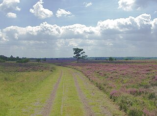
The Strabrechtse Heide is a natural heathland area about 1500 ha in size, located in the municipalities of Heeze-Leende, Someren and Geldrop-Mierlo, in North Brabant, the Netherlands. It is largely under the care of Staatsbosbeheer. In July 2010, around 200 hectares of the area were damaged or destroyed in a wildfire that took over a week to put out.
Nijnsel is a village in the province of North Brabant, located in the Meierij of 's-Hertogenbosch. Nijnsel is a parish of the municipality of Meierijstad.

The Moerkuilen are, along with the Dommelbeemden a forestry area in a bend of the Dommel river north east of Nijnsel in Meierijstad. It is located at the Lieshoutse Dijk, not far from the A50 motorway. The protected area measures over 100 acres and connects with the Vresselse Bossen in the south. The Moerkuilen are part of the larger area Het Groene Woud.
The Dommelbeemden are, along with the Moerkuilen a forestry area in a bend of the Dommel river northeast of Nijnsel in Meierijstad. It is located at the Lieshoutse Dijk, not far from the A50 motorway. The protected area measures over 100 acres. The Dommelbeemden are part of the larger area Het Groene Woud.
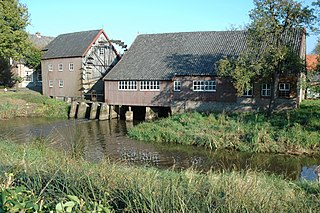
The Watermill at Opwetten is a watermill along the river Kleine Dommel, located on the Opwettenseweg 203 in Opwetten, Nuenen, Gerwen en Nederwetten, in the province of North Brabant, Netherlands. First mentioned in the 11th century, the watermill burned down and was rebuilt in 1764.

The Kleine Dommel or Rul is a brook in the Campine and Meierij van 's-Hertogenbosch, Netherlands.
