Torlesse Greywacke

Last updated

Torlesse Greywacke is a type of sedimentary rock. It is a hard and rather drab grey sandstone that is found in New Zealand. Torlesse Greywacke is found east of the Alpine Fault in the Southern Alps of New Zealand. It lies between the western edge of the Haast Schists and the Canterbury Plains, and is named for the surveyor Charles Torlesse.

Sedimentary rock Rock formed by the deposition and subsequent cementation of material

Sedimentary rocks are types of rock that are formed by the deposition and subsequent cementation of mineral or organic particles on the floor of oceans or other bodies of water at the Earth's surface. Sedimentation is the collective name for processes that cause these particles to settle in place. The particles that form a sedimentary rock are called sediment, and may be composed of geological detritus (minerals) or biological detritus. Before being deposited, the geological detritus was formed by weathering and erosion from the source area, and then transported to the place of deposition by water, wind, ice, mass movement or glaciers, which are called agents of denudation. Biological detritus was formed by bodies and parts of dead aquatic organisms, as well as their fecal mass, suspended in water and slowly piling up on the floor of water bodies. Sedimentation may also occur as dissolved minerals precipitate from water solution.

Sandstone A clastic sedimentary rock composed mostly of sand-sized particles

Sandstone is a clastic sedimentary rock composed mainly of sand-sized mineral particles or rock fragments.

New Zealand Constitutional monarchy in Oceania

New Zealand is a sovereign island country in the southwestern Pacific Ocean. The country geographically comprises two main landmasses—the North Island, and the South Island —and around 600 smaller islands. New Zealand is situated some 2,000 kilometres (1,200 mi) east of Australia across the Tasman Sea and roughly 1,000 kilometres (600 mi) south of the Pacific island areas of New Caledonia, Fiji, and Tonga. Because of its remoteness, it was one of the last lands to be settled by humans. During its long period of isolation, New Zealand developed a distinct biodiversity of animal, fungal, and plant life. The country's varied topography and its sharp mountain peaks, such as the Southern Alps, owe much to the tectonic uplift of land and volcanic eruptions. New Zealand's capital city is Wellington, while its most populous city is Auckland.

Contents

Deposition

Torlesse Greywacke was deposited on the eastern side of New Zealand from the Upper Carboniferous through to the Middle Cretaceous. It was deposited in giant undersea fans that extended beyond the ends of ancient submarine canyons.

The Carboniferous is a geologic period and system that spans 60 million years from the end of the Devonian Period 358.9 million years ago (Mya), to the beginning of the Permian Period, 298.9 Mya. The name Carboniferous means "coal-bearing" and derives from the Latin words carbō ("coal") and ferō, and was coined by geologists William Conybeare and William Phillips in 1822.

The Cretaceous is a geologic period and system that spans 79 million years from the end of the Jurassic Period 145 million years ago (mya) to the beginning of the Paleogene Period 66 mya. It is the last period of the Mesozoic Era, and the longest period of the Phanerozoic Eon. The Cretaceous Period is usually abbreviated K, for its German translation Kreide.

A fan starts with a submarine canyon in the continental shelf. Then turbidity currents rush down the canyon like giant undersea avalanches. As it does this it carries all sorts of sediments from the shallower seafloor of the continental shelf. At the end of the canyon the turbidity current spreads out and creates giant fans of sediment that blanket the deep seafloor.

Submarine canyon A steep-sided valley cut into the seabed of the continental slope

A submarine canyon is a steep-sided valley cut into the seabed of the continental slope, sometimes extending well onto the continental shelf, having nearly vertical walls, and occasionally having canyon wall heights of up to 5 km, from canyon floor to canyon rim, as with the Great Bahama Canyon. Just as above-sea-level canyons serve as channels for the flow of water across land, submarine canyons serve as channels for the flow of turbidity currents across the seafloor. Turbidity currents are flows of dense, sediment laden waters that are supplied by rivers, or generated on the seabed by storms, submarine landslides, earthquakes, and other soil disturbances. Turbidity currents travel down slope at great speed, eroding the continental slope and finally depositing sediment onto the abyssal plain, where the particles settle out.

Continental shelf A portion of a continent that is submerged under an area of relatively shallow water known as a shelf sea

A continental shelf is a portion of a continent that is submerged under an area of relatively shallow water known as a shelf sea. Much of the shelves were exposed during glacial periods and interglacial periods.

Turbidity current An underwater current of usually rapidly moving, sediment-laden water moving down a slope

A turbidity current is most typically an underwater current of usually rapidly moving, sediment-laden water moving down a slope; although current research (2018) indicates that water-saturated sediment may be the primary actor in the process.. Turbidity currents can also occur in other fluids besides water.

That the Torlesse Greywacke was derived from the granitic rocks of northeastern Australia has been suggested by detailed studies of the mineral grains. [1]

Australia Country in Oceania

Australia, officially the Commonwealth of Australia, is a sovereign country comprising the mainland of the Australian continent, the island of Tasmania and numerous smaller islands. It is the largest country in Oceania and the world's sixth-largest country by total area. The neighbouring countries are Papua New Guinea, Indonesia and East Timor to the north; the Solomon Islands and Vanuatu to the north-east; and New Zealand to the south-east. The population of 25 million is highly urbanised and heavily concentrated on the eastern seaboard. Australia's capital is Canberra, and its largest city is Sydney. The country's other major metropolitan areas are Melbourne, Brisbane, Perth and Adelaide.

Metamorphism

The Torlesse Greywacke has undergone metamorphism and been transformed into Haast Schist. In the Haast Schists, the minerals that make up Torlesse Greywacke became coarser grained. These minerals include quartz, feldspar and biotite.

Metamorphism The change of minerals in pre-existing rocks without melting into liquid magma

Metamorphism is the change of minerals or geologic texture in pre-existing rocks (protoliths), without the protolith melting into liquid magma. The change occurs primarily due to heat, pressure, and the introduction of chemically active fluids. The chemical components and crystal structures of the minerals making up the rock may change even though the rock remains a solid. Changes at or just beneath Earth's surface due to weathering or diagenesis are not classified as metamorphism. Metamorphism typically occurs between diagenesis, and melting (~850°C).

Haast Schist

The Haast Schist which contains both the Alpine and Otago Schist is a metamorphic unit in the South Island of New Zealand. It extends from Central Otago, along the eastern side of the Alpine Fault to Cook Strait. There are also isolated outcrops of the Haast Schist within the central North Island. The schists were named after Haast Pass on the West Coast. The Haast Schist can be divided geographically from north to south into the Kaimanawa, Terawhiti, Marlborough, Alpine, Otago and Chatham schist.

Mineral Element or chemical compound that is normally crystalline and that has been formed as a result of geological processes

A mineral is, broadly speaking, a solid chemical compound that occurs naturally in pure form. A rock may consist of a single mineral, or may be an aggregate of two or more different minerals, spacially segregated into distinct phases. Compounds that occur only in living beings are usually excluded, but some minerals are often biogenic and/or are organic compounds in the sense of chemistry. Moreover, living beings often syntesize inorganic minerals that also occur in rocks.

Related Research Articles

Greywacke A hard, dark sandstone with poorly sorted angular grains in a compact, clay-fine matrix

Greywacke or graywacke is a variety of sandstone generally characterized by its hardness, dark color, and poorly sorted angular grains of quartz, feldspar, and small rock fragments or lithic fragments set in a compact, clay-fine matrix. It is a texturally immature sedimentary rock generally found in Paleozoic strata. The larger grains can be sand- to gravel-sized, and matrix materials generally constitute more than 15% of the rock by volume. The term "greywacke" can be confusing, since it can refer to either the immature aspect of the rock or its fine-grained (clay) component.

Blueschist A metavolcanic rock that forms by the metamorphism of basalt and rocks with similar composition

Blueschist, also called glaucophane schist, is a metavolcanic rock that forms by the metamorphism of basalt and rocks with similar composition at high pressures and low temperatures, approximately corresponding to a depth of 15 to 30 kilometers. The blue color of the rock comes from the presence of the predominant minerals glaucophane and lawsonite.

Penninic

The Penninic nappes or the Penninicum are one of three nappe stacks and geological zones in which the Alps can be divided. In the western Alps the Penninic nappes are more obviously present than in the eastern Alps, where they crop out as a narrow band. The name Penninic is derived from the Pennine Alps, an area in which rocks from the Penninic nappes are abundant.

Austroalpine nappes

The Austroalpine nappes are a geological nappe stack in the European Alps. The Alps contain three such stacks, of which the Austroalpine nappes are structurally on top of the other two. The name Austroalpine means Southern Alpine, because these nappes crop out mainly in the Eastern Alps.

Geology of New Zealand

The geology of New Zealand is noted for its volcanic activity, earthquakes and geothermal areas because of its position on the boundary of the Australian Plate and Pacific Plates. New Zealand is part of Zealandia, a microcontinent nearly half the size of Australia that broke away from the Gondwanan supercontinent about 83 million years ago. New Zealand's early separation from other landmasses and subsequent evolution have created a unique fossil record and modern ecology.

The Auckland Region of New Zealand is built on a basement of greywacke rocks that form many of the islands in the Hauraki Gulf, the Hunua Ranges, and land south of Port Waikato. The Waitakere Ranges in the west are the remains of a large andesitic volcano, and Great Barrier Island was formed by the northern end of the Coromandel Volcanic Zone. The main isthmus and North Shore are composed of Waitemata sandstone and mudstone, and portions of the Northland Allochthon extend as far south as Albany. Little Barrier Island was formed by a relatively isolated andesitic volcano, active around 1 to 3 million years ago.

The Waikato and King Country regions of New Zealand are built upon a basement of greywacke rocks, which form many of the hills. Much of the land to the west of the Waikato River and in the King Country to the south has been covered by limestone and sandstone, forming bluffs and a karst landscape. The volcanic cones of Karioi and Pirongia dominate the landscape near Raglan and Kawhia Harbours. To the east, the land has been covered with ignimbrite deposits from the Taupo Volcanic Zone. Large amounts of pumice from the Taupo Volcanic Zone have been deposited in the Waikato Basin and Hauraki Plains.

The Wellington Region of New Zealand has a foundation of Torlesse Greywacke rocks, that make up the Tararua and Rimutaka Ranges, that go from Wellington in the south to the Manawatu Gorge, where they are renamed as the Ruahine Ranges, and continue further north-northeast, towards East Cape. To the west of the Tararua Ranges are the Manawatu coastal plains. To the east of the Ruahine Ranges is the Wairarapa-Masterton Basin, then the Eastern Uplands that border the eastern coast of the North Island from Cape Palliser to Napier.

The Raukumara Region of New Zealand corresponds to the East Cape of the North Island, and associated mountain ranges.

Geology of Canterbury, New Zealand

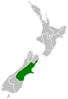
Canterbury in New Zealand is the portion of the South Island to the east of the Southern Alps, from the Waiau River in the north, to the Waitaki River in the south.

Geology of the Northland Region

New Zealand's Northland Region is built upon a basement consisting mainly of greywacke rocks, which are exposed on the eastern side of the peninsula. In-place Eocene coal measures crop out at Kamo, near Whangarei, and Oligocene limestone crops out at Hikurangi, near Whangarei.

Geology of the Tasman District

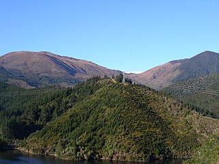
The Tasman Region, and the small adjoining Nelson Region, form one of the more geologically interesting regions of New Zealand. It contains the oldest rocks of anywhere on New Zealand’s main islands. It contains all the main terranes that make up New Zealand’s basement. These basement rocks include Ultramafic rocks, such as Serpentine and Dunite, and valuable minerals, such as Gold. The Nelson Region is bordered to the south by the Alpine Fault, the main fault forming the boundary between the Pacific Plate and the Indo-Australian Plate, that generated the Southern Alps.

The geology of Cyprus is part of the regional geology of Europe. Cyprus lies on the southern border of the Eurasian Plate and on the southern margin of the Anatolian Plate. The southern margin of the Anatolian Plate is in collision with the African Plate, which has created the uplift of the Cyprus arc and Cyprus itself.

The geology of Nigeria formed beginning in the Archean and Proterozoic eons of the Precambrian. The country forms the Nigerian Province and more than half of its surface is igneous and metamorphic crystalline basement rock from the Precambrian. Between 2.9 billion and 500 million years ago, Nigeria was affected by three major orogeny mountain-building events and related igneous intrusions. Following the Pan-African orogeny, in the Cambrian at the time that multi-cellular life proliferated, Nigeria began to experience regional sedimentation and witnessed new igneous intrusions. By the Cretaceous period of the late Mesozoic, massive sedimentation was underway in different basins, due to a large marine transgression. By the Eocene, in the Cenozoic, the region returned to terrestrial conditions.

The geology of Alaska includes Precambrian igneous and metamorphic rocks formed in offshore terranes and added to the western margin of North America from the Paleozoic through modern times. The region was submerged for much of the Paleozoic and Mesozoic and formed extensive oil and gas reserves due to tectonic activity in the Arctic Ocean. Alaska was largely ice free during the Pleistocene, allowing humans to migrate into the Americas.

Dun Mountain-Maitai Terrane

The Dun Mountain-Maitai Terrane comprises the Dun Mountain Ophiolite Belt, Maitai Group and Patuki Mélange. The Dun Mountain Ophiolite is an ophiolite of Permian age located in New Zealand's South Island. Prehistorically this ophiolite was quarried by Māori for both metasomatized argillite and pounamu (jade) which was used in the production of tools and jewellery.

Takaka Terrane

The Takaka Terrane from New Zealand's Western Province outcrops in the mountains of Nelson's Tasman District. The terrane is mostly made up of marble and volcanic rocks but is highly variable in composition. It ranges in age from mid-Cambrian to Devonian time, including New Zealand's oldest rocks, which are found in the Cobb Valley in north-west Nelson. The Cobb Valley is also the location of "Trilobite Rock" a glacial dropstone made from the moulted exoskeletons of trilobites. Asbestos was mined in the Cobb Valley from the Takaka Terrene between the late 1880's and 1917. The Takaka Terrane is highly deformed and has been intruded by many batholiths.

Stratigraphy of New Zealand

This is a list of the units into which the rock succession of New Zealand is formally divided. As new geological relationships have been discovered new names have been proposed and others are made obsolete. Not all these changes have been universally adopted. This table is based on the 2014 New Zealand Stratigraphic Lexicon (Litho2014). However, obsolete names that are still in use and names postdating the lexicon are included if it aids in understanding.

Geology of the West Coast Region

The geology of the West Coast of New Zealand's South Island is divided in two by the Alpine Fault, which runs through the Region in a North-East direction. To the West of the fault Paleozoic basement rocks are interluded by plutones and both are unconformably covered in a sedimentary sequence. To the East of the Alpine Fault are the Mesozoic Alpine Schist and Greywacke of the Southern Alps. There are numerous active faults throughout the region.

References