
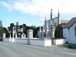
Rathvilly is a village in County Carlow, Ireland. The village is located on the River Slaney near the border with County Wicklow, 11 km from Tullow and 8 km from Baltinglass. It is also on the N81 national secondary route. Rathvilly won the Irish Tidy Towns Competition in 1961, 1963, and 1968.
The Dunlavin Green executions refers to the summary execution of 36 suspected rebel prisoners in County Wicklow by the British military shortly after the outbreak of the rebellion of 1798. There are several accounts of the events, recorded at differing times and differing in detail.

Dunlavin is a village in County Wicklow, Ireland, situated about 50 kilometres (31 mi) south-west of Dublin. It is centred on the junction of the R412 and R756 regional roads. It was founded around the end of the 17th century and became a prominent town in the area for a time.

The R756 road is a regional road in Ireland running west–east from Dunlavin to Laragh. Its entire 32 km (20 mi) length is within County Wicklow crossing east–west through the Wicklow Gap.

Wicklow Gap is one of the highest Irish mountain passes served by an asphalted road. It is located in County Wicklow, Ireland.

Rathdangan is a village in County Wicklow, Ireland. It is in the Electoral Division of Rathdangan, in Civil Parish of Kiltegan, in the Barony of Upper Talbotstown.

Two Rock is a mountain in Dún Laoghaire–Rathdown, Ireland. It is 536 metres high and is the 382nd highest mountain in Ireland. It is the highest point of the group of hills in the Dublin Mountains which comprises Two Rock, Three Rock, Kilmashogue and Tibradden Mountains. The mountain takes its name from the two granite tors that lie to the south-east of the summit. From the summit, which is called Fairy Castle, there are views of much of the Dublin area from Tallaght to Howth to the north while Bray Head, Killiney Hill, the Great Sugar Loaf and the Wicklow Mountains are visible to the south. The summit area is mostly shallow bog while ferns and gorse cover the lower slopes. The mountain is also an important habitat for red grouse.
Valleymount is a small village in western County Wicklow, Ireland.
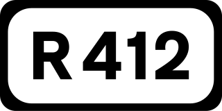
The R412 road is a regional road in Ireland, which runs north-south from the R448 in County Kildare to the N81 in County Wicklow. En route is passes through the town of Dunlavin where it is joined by the road from Glendalough which crosses over the Wicklow Gap.
Dunlavin Green is an Irish ballad referring to the Dunlavin Green executions in 1798 of 36 suspected rebels.

Carrickgollogan is a hill in Dún Laoghaire-Rathdown in Ireland, towards the southern border of the historic County Dublin. It is 276 metres high, on the eastern edge of the Dublin Mountains, rising above the districts of Rathmichael and Shankill. Its summit is noted for the panoramic views it offers of south Dublin and north Wicklow.
The High Sheriff of Wicklow was the British Crown's judicial representative in County Wicklow, Ireland from Wicklow's formation in 1606 until 1922, when the office was abolished in the new Free State and replaced by the office of Wicklow County Sheriff. The sheriff had judicial, electoral, ceremonial and administrative functions and executed High Court Writs. In 1908, an Order in Council made the Lord-Lieutenant the Sovereign's prime representative in a county and reduced the High Sheriff's precedence. However the sheriff retained his responsibilities for the preservation of law and order in the county. The usual procedure for appointing the sheriff from 1660 onwards was that three persons were nominated at the beginning of each year from the county and the Lord Lieutenant then appointed his choice as High Sheriff for the remainder of the year. Often the other nominees were appointed as under-sheriffs. Sometimes a sheriff did not fulfil his entire term through death or other event and another sheriff was then appointed for the remainder of the year. The dates given hereunder are the dates of appointment. All addresses are in County Wicklow unless stated otherwise.
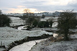
The River Greese is a small, fast-flowing river in south-east, Ireland, and a tributary of the River Barrow.

Lower Talbotstown is a barony in County Wicklow, Republic of Ireland.
Realtogue Fort is a ringfort (rath) and National Monument located in County Meath, Ireland.
Lemonstown Motte is a motte and National Monument located in County Wicklow, Ireland.
Crossoona Rath is a ringfort located in County Wicklow, Ireland. Together with a nearby ogham stone, it forms a National Monument.
Rathcoran is a passage grave and hillfort and National Monument located atop Baltinglass Hill, County Wicklow, Ireland.

Ballyallaban ringfort or sometimes An Rath is an earthen ringfort south of Ballyvaughan in the Burren area, in County Clare, Ireland. It is a National Monument.
