Spring Creek Township is a township in Warren County, Pennsylvania, United States. The population was 872 at the 2000 census.

Khamis is a village located between Salmaniya and Isa town in the Kingdom of Bahrain. It is largely a residential area with a number of shops and business establishments.

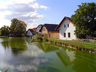
Doubek is a village in the Central Bohemian Region of the Czech Republic. On the date August 28, 2006 it has 201 inhabitants. First written notice about village is from year 1413. The municipality lies at an altitude of 406 metres and covers an area of 3.67 km².

Mnichów is a village in the administrative district of Gmina Sieradz, within Sieradz County, Łódź Voivodeship, in central Poland. It lies approximately 3 kilometres (2 mi) north of Sieradz and 54 km (34 mi) west of the regional capital Łódź.
Kapisówka is a village in the administrative district of Gmina Tomaszów Lubelski, within Tomaszów Lubelski County, Lublin Voivodeship, in eastern Poland.
Troski is a village in the administrative district of Gmina Naruszewo, within Płońsk County, Masovian Voivodeship, in east-central Poland.

Budki is a village in the administrative district of Gmina Główczyce, within Słupsk County, Pomeranian Voivodeship, in northern Poland. It lies approximately 12 kilometres (7 mi) east of Główczyce, 40 km (25 mi) north-east of Słupsk, and 77 km (48 mi) north-west of the regional capital Gdańsk.

Modła is a village in the administrative district of Gmina Ustka, within Słupsk County, Pomeranian Voivodeship, in northern Poland. It lies approximately 5 kilometres (3 mi) south-west of Ustka, 18 km (11 mi) north-west of Słupsk, and 121 km (75 mi) west of the regional capital Gdańsk.
Grabowo-Osada is a settlement in the administrative district of Gmina Lubawa, within Iława County, Warmian-Masurian Voivodeship, in northern Poland.
Niesłusz is a settlement in the administrative district of Gmina Myślibórz, within Myślibórz County, West Pomeranian Voivodeship, in north-western Poland.
Dobřeň is a village and municipality in Mělník District in the Central Bohemian Region of the Czech Republic.
The Ruins of Waldeck, a spur castle, are located above the river Nagold near the town of Calw, Germany. They appear to be dated from the 12th century, but their exact origin is not well documented. The ruins are within the Black Forest, and the forest has partly covered the site, but there is still a well defined structure, the inside of which can be accessed by foot.
Jusi is the residual of a volcano, an erosional outlier of the Swabian Alb, Baden-Württemberg, Germany.

Baohua station is a Metro station of Shenzhen Metro Line 5. It opened on 22 June 2011. This station is an underground station.

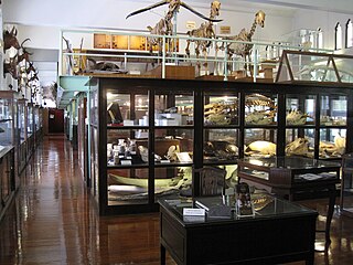
The Chulalongkorn University Museum of Natural History, founded in 1954, is operated by the Chulalongkorn University's Faculty of Science in the Biology Building at the university's main campus in Bangkok, Thailand. The museum features exhibits of various organisms, including mounts of the endangered white-eyed river martin. The majority of the museum's exhibits are housed in its main hall, with dedicated rooms featuring Thai turtles and softshells, insects and land snails.
Lincoln Park is a neighborhood in Warwick, Rhode Island. It was established early in the twentieth century.
Lock Port is an unincorporated community in Williams County, in the U.S. state of Ohio.

Forest Park is an unincorporated community in Otsego Township, Steuben County, in the U.S. state of Indiana.

Oakwood is an unincorporated community in Otsego Township, Steuben County, in the U.S. state of Indiana.
Illauneeragh is an island in County Galway, Ireland.


