| Totnansberg | |
|---|---|
View of the Totnansberg from the area of the Kissinger Hut | |
| Highest point | |
| Elevation | 839.4 m above sea level (NHN) (2,754 ft) [1] |
| Prominence | 177 m ↓ Guckaspaß |
| Isolation | 6.0 km → Kreuzberg |
| Coordinates | 50°19′16″N9°55′49″E / 50.32111°N 9.930167°E Coordinates: 50°19′16″N9°55′49″E / 50.32111°N 9.930167°E |
| Geography | |
| Parent range | Rhön (Black Mountains) |
| Climbing | |
| Access | Forest tracks |
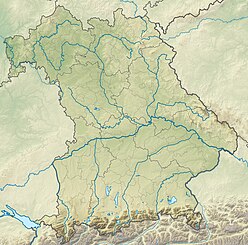
The Totnansberg, occasionally also called the Totmannsberg, is the highest peak in the Black Mountains, a subunit of the Rhön in central Germany.

The Black Mountains are part of the High Rhön in Germany, in particular of the Southern High Rhön, which lies south of the Kreuzberg Group and is thus the southernmost part of the High Rhön. Since 1993, most of the region has been protected by the Black Mountain Nature Reserve, the second largest in Bavaria outside of the Alps, in order to counteract its afforestation by coniferous forest.

Germany, officially the Federal Republic of Germany, is a country in Central and Western Europe, lying between the Baltic and North Seas to the north, and the Alps to the south. It borders Denmark to the north, Poland and the Czech Republic to the east, Austria and Switzerland to the south, France to the southwest, and Luxembourg, Belgium and the Netherlands to the west.

