Related Research Articles

The Welsh Government is the devolved government of Wales. The government consists of ministers and deputy ministers. It is led by the first minister, usually the leader of the largest party in the Senedd, who selects ministers and deputy ministers with the approval of the Senedd. The government is responsible for tabling policy in devolved areas for consideration by the Senedd and implementing policy that has been approved by it.

The Quality Assurance Agency for Higher Education, usually referred to simply as the Quality Assurance Agency or QAA, is the UK higher education sector's independent expert quality body, with a remit to maintain and enhance the quality of teaching and learning in tertiary education in the UK and beyond. It conducts quality assessment reviews, develops reference points and guidance for providers, and conducts or commissions research on relevant issues.
Communities First was a Welsh Government programme aimed at reducing poverty. The programme was community focused and supported the most disadvantaged people in the most deprived areas of Wales with the aim of contributing to alleviating persistent poverty.
Town and country planning in the United Kingdom is the part of English land law which concerns land use planning. Its goal is to ensure sustainable economic development and a better environment. Each country of the United Kingdom has its own planning system that is responsible for town and country planning, which outside of England is devolved to the Northern Ireland Assembly, the Scottish Parliament and the Senedd.

The Scottish Environment Protection Agency is Scotland's environmental regulator and national flood forecasting, flood warning and strategic flood risk management authority. Its main role is to protect and improve Scotland's environment. SEPA does this by helping business and industry to understand their environmental responsibilities, enabling customers to comply with legislation and good practice and to realise the economic benefits of good environmental practice. One of the ways SEPA does this is through the NetRegs environmental guidance service. It protects communities by regulating activities that can cause harmful pollution and by monitoring the quality of Scotland's air, land and water. The regulations it implements also cover the storage, transport and disposal of radioactive materials.
Local transport plans, divided into full local transport plans (LTP) and local implementation plans for transport (LIP) are an important part of transport planning in England. Strategic transport authorities, are expected to prepare them as forward-looking plans covering a number of years, and present them to the Department for Transport (DfT). For instance, Oxfordshire County Council developed its second LTP in April 2006, and the LTP was implemented until March 2011.
Regional spatial strategies (RSS) provided regional level planning frameworks for the regions of England outside London. They were introduced in 2004. Their revocation was announced by the new Conservative/Liberal Democrat government on 6 July 2010.

A local development framework is the spatial planning strategy introduced in England and Wales by the Planning and Compulsory Purchase Act 2004 and given detail in Planning Policy Statements 12. In most parts of the two countries, maintaining the framework is the responsibility of English district councils and Welsh principal area councils.

A development plan sets out a local authority's policies and proposals for land use in their area. The term is usually used in the United Kingdom. A local plan is one type of development plan. The development plan guides and shapes day-to-day decisions as to whether or not planning permission should be granted, under the system known as development control. In order to ensure that these decisions are rational and consistent, they must be considered against the development plan adopted by the authority, after public consultation and having proper regard for other material factors.
Development Management, formerly known as planning control, or development control, is the element of the United Kingdom's system of town and country planning through which local government or the Secretary of State, regulates land use and new building, i.e. development. It relies on a "plan-led system" whereby development plans are produced, involving various stages of public consultation prior to being adopted. Subsequently, development that requires planning permission, which is granted or refused with reference to the development plan as the starting point, then other material considerations are taken into account. The term "development management" is often abbreviated to DM.

The Town and Country Planning (England) Order 2015 is a statutory instrument, applying in England, that grants planning permission for certain types of development without the requirement for approval from the local planning authority.
Structure planning is a type of spatial planning and is part of urban planning practice in the United Kingdom and Western Australia. A structure plan in any jurisdiction will usually consist of a written component, supported by maps, photographs, sketches, tables and diagrams and a 'plan' component consisting of one or more plans illustrating land use and infrastructure proposals for the area being planned.
The New Approach to Appraisal was the name given to a multi-criteria decision framework used to appraise transport projects and proposals in the United Kingdom. NATA was built on the well established cost–benefit analysis and environmental impact assessment techniques for assessing transport projects and proposals.
The City and County of Swansea is an urban centre with a largely rural hinterland in Gower; the city has been described as the regional centre for South West Wales. Swansea's travel to work area, not coterminous with the local authority, also contained the Swansea Valley in 1991; the new 2001-based version merges the Swansea, Neath & Port Talbot, and Llanelli areas into a new Swansea Bay travel to work area. Formerly an industrial centre, most employment in the city is now in the service sector.

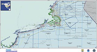
Marine spatial planning (MSP) is a process that brings together multiple users of the ocean – including energy, industry, government, conservation and recreation – to make informed and coordinated decisions about how to use marine resources sustainably. MSP generally uses maps to create a more comprehensive picture of a marine area – identifying where and how an ocean area is being used and what natural resources and habitat exist. It is similar to land-use planning, but for marine waters.
The Swansea Bay area of Wales is located north of the sea area of Swansea Bay. The term Swansea Bay is used by the Welsh Government for policy planning purposes as well as by a number of other organisations.

The regions of England, formerly known as the government office regions, are the highest tier of sub-national division in England. They were established in 1994 and follow the 1974–96 county borders. They are a continuation of the former 1940s standard regions which followed the 1889–1974 administrative county borders. Between 1994 and 2011, all nine regions had partly devolved functions; they no longer fulfil this role, continuing to be used for limited statistical purposes.

The National Planning Policy Framework (NPPF) is a land-use planning policy in England. It was originally published by the UK's Department of Communities and Local Government in March 2012, consolidating over two dozen previously issued documents called Planning Policy Statements (PPS) and Planning Policy Guidance Notes (PPG) for use in England. It has since been revised in 2018, 2019, 2021 and twice in 2023. The live version is from December 2023.
Local and national public authorities in the Welsh town of Merthyr Tydfil have taken considerable steps towards improving social, economic, cultural and environmental sustainability in the area. This has included funding from charities, organisations and local government. The Merthyr Tydfil council has put in place policies to regulate development on natural heritage sites, along with preserving the local history and culture. The building of homes within Merthyr Tydfil has also been influenced to create environmentally sustainable homes, with the use of renewable energy sources.

The Flood and Water Management Act 2010 (c.29) is a UK Act of Parliament relating to the management of the risk concerning flooding and coastal erosion. The Act aims to reduce the flood risk associated with extreme weather, compounded by climate change. It created the role of Lead Local Flood Authority, which is the local government authority responsible for managing flood risk in the local government area. The Act gave new powers to local authorities, the Environment Agency, The Welsh Ministers and water companies.
References
- ↑ One Wales: One Planet: Consultation on a new sustainable development scheme for Wales
- ↑ Guide to RTPI Cymru
- ↑ Welsh Government | Policy and guidance
- ↑ http://wales.gov.uk/dpsp/40382121/wsp-101104-pt1-e.pdf?lang=en%5B%5D
- ↑ Background to Wales Spatial Plan
- ↑ Welsh Government | People, Places, Futures: The Wales Spatial Plan 2008 Update Consultation [ permanent dead link ]
- ↑ Wales Spatial Plan Archived 2009-09-24 at the Wayback Machine
- ↑ Welsh Government | Local Development Plans Wales Archived 2011-05-24 at the Wayback Machine
- ↑ A public guide to the land use planning system in Wales, Planning Aid Wales, 2006, p.9