Flanders is the Dutch-speaking northern portion of Belgium and one of the communities, regions and language areas of Belgium. However, there are several overlapping definitions, including ones related to culture, language, politics, and history, and sometimes involving neighbouring countries. The demonym associated with Flanders is Fleming, while the corresponding adjective is Flemish, which can also refer to the collective of Dutch dialects spoken in that area, or more generally the Belgian variant of Standard Dutch.

The Meuse or Maas is a major European river, rising in France and flowing through Belgium and the Netherlands before draining into the North Sea from the Rhine–Meuse–Scheldt delta. It has a total length of 925 km.

Baarle-Nassau is a municipality and town in the southern Netherlands, located in the province of North Brabant. It had a population of 6,899 in 2019. The town is the site of a complicated borderline between Belgium and the Netherlands: it encloses 22 small exclaves of the Belgian town Baarle-Hertog, of which the two largest contain seven counter-enclaves of Baarle-Nassau, and the main body of Belgium contains another.

Baarle-Hertog is a Flemish municipality of Belgium, much of which consists of a number of small Belgian enclaves fully surrounded by the Netherlands.

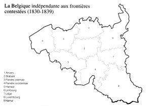
The Treaty of London of 1839, was signed on 19 April 1839 between the major European powers, the United Kingdom of the Netherlands, and the Kingdom of Belgium. It was a direct follow-up to the 1831 Treaty of the XVIII Articles, which the Netherlands had refused to sign, and the result of negotiations at the London Conference of 1838–1839 which sought to maintain the Concert of Europe.

Nahwa is a territory that forms part of the Emirate of Sharjah in the United Arab Emirates. It is a counter-enclave within the Omani territory of Madha, which is itself an exclave of Oman and an enclave within the United Arab Emirates.

The India–Bangladesh enclaves, also known as the Chiṭmahals and sometimes called Pasha enclaves, were the enclaves along the Bangladesh–India border, in Bangladesh and the Indian states of West Bengal, Tripura, Assam and Meghalaya. The main body of Bangladesh contained 102 Indian enclaves, which in turn contained 21 Bangladeshi counter-enclaves, one of which contained Dahala Khagrabari, an Indian counter-counter-enclave, the world's only third-order enclave when it existed. The Indian mainland contained 71 Bangladeshi enclaves, which in turn contained 3 Indian counter-enclaves. A joint census in 2010 found 51,549 people who were residing in these enclaves: 37,334 in Indian enclaves within Bangladesh and 14,215 in Bangladeshi enclaves within India.

The Iron Rhine or Steel Rhine is a partially operational freight rail corridor connecting the port of Antwerp (Belgium) and Mönchengladbach (Germany) by way of Neerpelt and the Dutch towns of Weert and Roermond.

Baarle is a village in Northwestern Europe which consists of a patchwork of Belgian and Dutch territories. The Belgian parts of the village are called Baarle-Hertog and the Dutch elements are called Baarle-Nassau. The Belgian part includes 16 exclaves within Dutch territory. The exclaves, in turn, surround seven Dutch areas. Belgian territory also surrounds an eighth Dutch area near Ginhoven. In 1995, the border was finalized to include a formerly neutral grassland. Baarle also includes a quadripoint shared by two of the exclaves.

An enclave is a territory that is entirely surrounded by the territory of only one other state or entity. An enclave can be an independent territory or part of a larger one. Enclaves may also exist within territorial waters. Enclave is sometimes used improperly to denote a territory that is only partly surrounded by another state. Enclaves that are not part of a larger territory are not exclaves, for example Lesotho, and San Marino and Vatican City are enclaved sovereign states.
A quadripoint is a point on Earth where four distinct political territories meet. The territories can be of different types, such as national and provincial. In North America, several such places are commonly known as Four Corners. Several examples exist throughout the world that use other names.

Rail transport in the Netherlands uses a dense railway network which connects nearly all major towns and cities. There are more train stations than there are municipalities in the Netherlands. The network totals 3,223 route km (2,003 mi) on 6,830 kilometres (4,240 mi) of track; a line may run both ways, or two lines may run on major routes. Three-quarters of the lines have been electrified.
The Vennbahn is a former railway line that was built partly across what was then German territory by the Prussian state railways. It is now entirely in Belgium, because the trackbed of the line, as well as the stations and other installations, were made provisional Belgian territory in 1919 under an article of the Treaty of Versailles.

The Redemptiedorpen are a group of small villages north of Liège, Belgium. Their ownership was disputed between the United Provinces and the Duchy of Brabant since the 17th century. The areas retained independence, with the condition that they pay taxes to both powers. In practice, they were closely linked to the tweeherigheid of Maastricht.

The Belgian province of Limburg in Flanders is a region which has had many names and border changes over its long recorded history. Its modern name is a name shared with the neighbouring province of the Netherlands, with which it was for a while politically united. The two provinces received their modern name after 1815, based upon the name of the medieval Duchy of Limburg, which had actually been in what is now neighbouring Wallonia, centred upon the town of Limbourg on the Vesdre.

The Wire of Death was a lethal electric fence created by the German military to control the Dutch–Belgian frontier after the occupation of Belgium during the First World War.

Zondereigen is a village in the municipality of Baarle-Hertog, in the province of Antwerp, Belgium. In 2021, it was home to 478 inhabitants. Zondereigen borders the Dutch province of North Brabant, and contains a Dutch enclave.

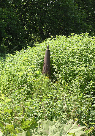
The Belgium–Netherlands border separates Belgium and the Netherlands and is 450 km (280 mi) long.

Belgium shares borders with France, Germany, Luxembourg and the Netherlands. Belgium became de facto independent from the United Kingdom of the Netherlands in 1830. Its borders were formalized between 1839 and 1843. Over the years there have been various adjustments, notably after the Treaty of Versailles (1919) when some territory was transferred to Luxembourg. There remain enclaves of Germany and the Netherlands within Belgium and enclaves of Belgium within the Netherlands.


