Tripureshwor

Last updated
Tripureshwor
त्रिपुरेश्वर
Tripureshwor view during rainy weather .jpg
Nepal rel location map.svg
Red pog.svg
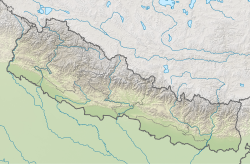
Tripureshwor
Location in Nepal
Coordinates: 28°0′0″N84°53′24″E / 28.00000°N 84.89000°E / 28.00000; 84.89000 Coordinates: 28°0′0″N84°53′24″E / 28.00000°N 84.89000°E / 28.00000; 84.89000 Tripureshwor
CountryFlag of Nepal.svg    Nepal
Zone Bagmati Zone
District Dhading District
Population
 (1991)
  Total2,707
  Religions
Hindu
Time zone UTC+5:45 (Nepal Time)

Tripureshwor is a village development committee in Dhading District in the Bagmati Zone of central Nepal. At the time of the 1991 Nepal census it had a population of 2707 and had 497 houses in it. This is one of the mid-north village development committee which was politically popular during 10 year of insurgency. The rising number of population is making this part much more populated than last five years. The biggest river of the district, Netrawati passes from this village. One of the popular town of the district, Khahare is located in the north of Tripureshwor.Khahare is now well doing in the field of agriculture. People here are dependent in their agriculture for their livelihood. There are 8 wards. [1]

Related Research Articles

<span class="mw-page-title-main">Village development committee (Nepal)</span> Former lower administrative part of Nepals local development ministry

A village development committee in Nepal was the lower administrative part of its Ministry of Federal Affairs and Local Development. Each district had several VDCs, similar to municipalities but with greater public-government interaction and administration. There were 3,157 village development committees in Nepal. Each village development committee was further divided into several wards depending on the population of the district, the average being nine wards.

Amalachaur is a village development committee in Baglung District in the Dhaulagiri Zone of central Nepal. At the time of the 1991 Nepal census it had a population of 5,055 and had 943 houses.

Dhamja is a village development committee in Baglung District in the Dhaulagiri Zone of central Nepal. At the time of the 1991 Nepal census it had a population of 2,571 and had 497 houses in the village. Only some basic developmental infrastructure are on its way to Dhamja. Most people are dependent to the traditional agriculture for their living. Millet, barley, rice, wheat, and various kinds of seasonal fruits and vegetables are the major crops. The foreign remittance is also considered one of the major source of income for the people living there.

Listikot is a village in Sindhupalchok District in the Bagmati Zone of central Nepal. At the time of the 1991 Nepal census it had a population of 3664 and had 714 houses in the village.

Srikot is a village development committee in Baitadi District in the Mahakali Zone of western Nepal. At the time of the 1991 Nepal census it had a population of 3,076 and had 498 houses in the village.

Khahare Pangu is a village development committee in Kabhrepalanchok District in the Bagmati Zone of central Nepal. At the time of the 1991 Nepal census it had a population of 2,648.

<span class="mw-page-title-main">Rupakot Gulmi</span> Village Development Committee in Lumbini Zone, Nepal

Rupakot is a Village Development Committee (VDC) in Gulmi District in the Lumbini Zone of central Nepal. Its headquarters is in Myal pokhara. It is located in about the center of Gulmi District. It is surrounded by hills. Its main religion is Hinduism. There are many temples like Chhatra Thaan, Shiddababa temple, Shiva Temple, Ram Temple, Debi deurali temple etc. The main sources of revenue for the village are agriculture and foreign employment. At the time of the 2001 Nepal census, it had a population of 3521 persons residing in 704 individual households. 76.48% of students attend school. The most populated parts of this VDC is Damuka, Sota & Ekle Pipal.

Lele is a village development committee in Lalitpur District in the Bagmati Zone of central Nepal. At the time of the 1991 Nepal census it had a population of 6928 living in 1245 individual households, but the population has increased greatly since then.

Dipsung is a village and Village Development Committee in Khotang District in the Sagarmatha Zone of eastern Nepal. At the time of the 1991 Nepal census, it had a population of 950 living in 205 individual households.

Lahachowk is a village in Machhapuchchhre Gaunpalika, in the Kaski District, in the Gandaki Zone of northern-central Nepal. According to the 2011 National Population and Housing Census, it had a population of 3,129 in 829 individual households.

Bhalam was a Village Development Committee, north of Pokhara in the Valam Municipality of Kaski District, situated in the Gandaki Zone of the Western Development Region, located in northern-central Nepal. In 2015, the VDC was amalgamated with Pokhara.

<span class="mw-page-title-main">Kaskikot</span> Subdivision of Pokhara Metropolitan City in Gandaki Province, Nepal

Kaskikot, commonly known as Kaski, is a Ward no. 24 of the Pokhara metropolitan city. It was earlier a part of the village development committee in Kaski District, a region in northern-central Nepal.

Sundarbazar is a Municipality in Lamjung District in the Gandaki Province of northern-central Nepal. The Sundarbazar Municipality was formed by merging the existing Village Development Committees i.e. Bhoteodar, Sundarbazar, Parewadanda, Tarku and Kuncha as one of the 61-municipalities category on 2071. As of 2011 Nepal census, it had 11,230 male population and 15,445 female population living in 7,512 households.

Ghyang Sukathokar is a village development committee (VDC) in Dolakha District in the Janakpur Zone of north-eastern Nepal. At the time of the 1991 Nepal census it had a population of 4,600.

Rasanalu is a village development committee in Ramechhap District in the Janakpur Zone of north-eastern Nepal. According to the 1991 Nepal census it had a population of 3,833 people living in 797 individual households.

Jinawang is a village development committee in Rolpa District in the Rapti Zone of north-eastern Nepal. At the time of the 2011 Nepal census it had a population of 5156 people living in 979 individual households.there peoples are worked in agricultural such as kiwi,apple,potato.

Sahalkot is a village development committee in Palpa District in the Lumbini Zone of southern Nepal. At the time of the 1991 Nepal census it had a population of 1852 people living in 275 individual households.

Shivanagar is a town in Krishnanagar Municipality in Kapilvastu District in the Lumbini Zone of southern Nepal. The former VDC was merged to form the municipality established on 18 May 2014 Krishnanagar, Sirsihawa, Shivanagar VDCs. At the time of the 2011 Nepal census it had a population of 4,774 people living in 735 individual households.

<span class="mw-page-title-main">Letang Municipality</span> Municipality in Koshi Zone, Nepal

Letang, "लेटाङ " is a Municipality in Morang District in the Province No. 1 of south-eastern Nepal. It was formed by merging the existing Village Development Committees of Letang, Jante, Warrangi and Bhogateni. This municipality is situated in Hilly Region as well as Terai Region. Letang is full of natural beauty. Previously it was called Letang Bhogateni but now it's known as Letang.

Ishibu is one of the 32 village development committees of Tehrathum District in Province No. 1 of Nepal. This village is to the north of the district headquarters at Myanglung. It had a population of 2846 in 616 households according to the census of 2011.

References

  1. "Nepal Census 2001". Nepal's Village Development Committees. Digital Himalaya . Retrieved 2008-08-24.