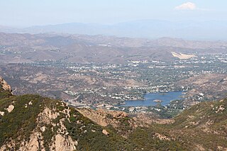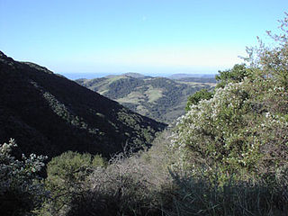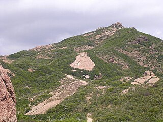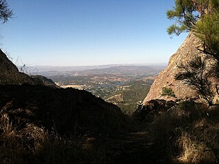
The Santa Monica Mountains is a coastal mountain range in Southern California, next to the Pacific Ocean. It is part of the Transverse Ranges. Because of its proximity to densely populated regions, it is one of the most visited natural areas in California. Santa Monica Mountains National Recreation Area is located in this mountain range.
The Peter Strauss Ranch is a regional park unit of the Santa Monica Mountains National Recreation Area - and operated by the National Park Service as Peter Strauss Ranch Park. It is located in the central Santa Monica Mountains — on Mulholland Highway near Agoura Hills, Southern California, in the Western United States. The ranch is named after the actor Peter Strauss, who was the last private owner-resident of the property. Much of the ranch was destroyed during the Woolsey Fire in November 2018.

Malibu Creek State Park is a state park of California, United States, preserving the Malibu Creek canyon in the Santa Monica Mountains. The 8,215-acre (3,324 ha) park was established in 1974. Opened to the public in 1976, the park is also a component of Santa Monica Mountains National Recreation Area.

The Conejo Valley is a region spanning both southeastern Ventura County and northwestern Los Angeles County in Southern California, United States. It is located in the northwestern part of the Greater Los Angeles Area.

Rocky Peak, located in Rocky Peak Park, is the fourth-highest point in the Santa Susana Mountains, and overlooks the San Fernando Valley and Chatsworth, the Simi Hills, and the Simi Valley in Southern California. The peak, which is 2,715 feet (828 m) in elevation, sits on the Los Angeles County–Ventura County line.

The Simi Hills are a low rocky mountain range of the Transverse Ranges in eastern Ventura County and western Los Angeles County, of southern California, United States.

Gaviota State Park is a state park of California, United States. It is located in southern Santa Barbara County, California, about 33 miles (53 km) west of the city of Santa Barbara. One of three state parks along the Gaviota Coast, it extends from the Pacific coast to the crest of the Santa Ynez Mountains, and is adjacent to Los Padres National Forest. The 2,787-acre (1,128 ha) park was established in 1953.

The Upper Las Virgenes Canyon Open Space Preserve is a large open space nature preserve owned and operated by the Santa Monica Mountains Conservancy spanning nearly 3,000 acres (1,200 ha) in the Simi Hills of western Los Angeles County and eastern Ventura County.

The Santa Monica Mountains National Recreation Area is a United States national recreation area containing many individual parks and open space preserves, located primarily in the Santa Monica Mountains of Southern California. The SMMNRA is in the greater Los Angeles region, with two thirds of the parklands in northwest Los Angeles County, and the remaining third, including a Simi Hills extension, in southeastern Ventura County.
A movie ranch is a ranch that is at least partially dedicated for use as a set in the creation and production of motion pictures and television shows. These were developed in the United States in southern California, because of the climate. The first such facilities were all within the 30-mile (48 km) studio zone, often in the foothills of the San Fernando Valley, Santa Clarita Valley, and Simi Valley in the U.S. state of California.

Boney Mountain in Ventura County, California is one of the highest peaks in the Santa Monica Mountains. The prominent mountain visible from Newbury Park, California is 2,825 feet (861 m). It is also known as Boney Peak. The mountain contains four of the highest peaks in the coastal range of the Santa Monica Mountains: Boney Peak, Sandstone Peak, Exchange Peak, and Tri Peaks. The highest summit in the Santa Monica Mountains is Sandstone Peak, situated less than a mile northeast of Boney Peak along the same ridge of volcanic rock. It is the top section of a mass of volcanic rock which solidified around 15 million years ago, and was later uplifted to its dominant position, overshadowing western Conejo Valley. The Chumash Native Americans have a long and deeply spiritual history of interaction at and near the mountain, and the peak is considered a sacred mountain to the Chumash people.
Rustic Canyon is a residential neighborhood and canyon in eastern Pacific Palisades, on the west side of Los Angeles, California. It is along Rustic Creek, in the Santa Monica Mountains.

Founded in 1915, the Los Angeles Area Council (LAAC) (#033) served most of the City of Los Angeles as well as several other cities in the greater Los Angeles area. It was one of five Boy Scouts of America councils in Los Angeles County, California. Since its founding in 1915, the Los Angeles Area Council has brought its purpose and values to millions of youth. The Council served 54,567 youth in the Greater Los Angeles Area in 2008 alone.

Hidden Valley is a valley in the Santa Monica Mountains, in southeastern Ventura County, Southern California. The unincorporated community in the valley is an equestrian ranch community with single family houses on 20-acre or more (8.1 ha) parcels of land. Residents rely on wells as the Hidden Valley Municipal Water District does not provide drinking water.

Santa Susana Pass State Historic Park is a California State Park of approximately 680 acres (2.8 km2) located on the boundary between Ventura and Los Angeles counties, between the communities of Chatsworth and Simi Valley. Geologically, the park is located where the Simi Hills meet the Santa Susana Mountains. Here in the western part of the Transverse Ranges, the land is dominated by high, narrow ridges and deep canyons covered with an abundant variety of plant life. The park offers panoramic views of the rugged natural landscape as a striking contrast to the developed communities nearby. The park is also rich in archaeological, historical, and cultural significance.

Malibou Lake is a small reservoir surrounded by a residential development in the Santa Monica Mountains near Agoura Hills, California. Adjacent to Malibu Creek State Park and within the Santa Monica Mountains National Recreation Area, it is situated between Malibu Beach and the Conejo Valley. It was created in 1922 after the Malibu Lake Club Dam was built at the confluence of two creeks. The lake, and community of 250 residents are private.

Sandstone Peak, also known as Mount Allen, is a mountain in Ventura County, California, and the highest summit in the Santa Monica Mountains with an elevation of 3,114 feet (949 m). Located near the western edge of the Santa Monica Mountains National Recreation Area, the summit provides panoramic views of Malibu, The Pacific Ocean, Santa Monica, the Conejo Valley, and four of the Channel Islands. The peak separates the drier inland valley from the coast facing side with higher humidity. The Sandstone Peak Trail, which leads to the top, connects to a vast trail system in the area, including the Backbone Trail. The mountain is highly popular with climbers, hikers, campers, and photographers.

God's Seat is a popular vista and rock formation in Malibu, California, United States, about two miles east of Circle X Ranch in the Santa Monica Mountains National Recreation Area. God's Seat's name derives from its natural throne-like shape at the top of a thousand-foot cliff. It is well-known locally for its scenic views of Lake Sherwood, Sandstone Peak, the Conejo Valley and the Pacific Ocean.

Circle X Ranch is a park unit located in the Triunfo Pass within the southwestern Santa Monica Mountains National Recreation Area, in Ventura County, California. It is located in the western Santa Monica Mountains.

Stunt Ranch Santa Monica Mountains Reserve, also known as UCLA Stunt Ranch, is a 121-hectare (310-acre) University of California Natural Reserve System reserve and biological field station located in Los Angeles County. The reserve protects habitat surrounded by the Santa Monica Mountains National Recreation Area. The address is 1201 Stunt Road, Calabasas, California.


