The River Thames, known alternatively in parts as the River Isis, is a river that flows through southern England including London. At 215 miles (346 km), it is the longest river entirely in England and the second-longest in the United Kingdom, after the River Severn.

The Thames and Severn Canal is a canal in Gloucestershire in the south-west of England, which was completed in 1789. It was conceived as part of a cargo route from Bristol and the Midlands to London, linking England's two largest rivers for better trade. The route climbs the steep Cotswold escarpment through the Golden Valley, tunnels underneath the summit of the Cotswold Edge, and emerges near the source of the Thames.

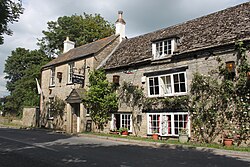
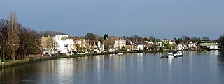
Lechlade is a town at the southern edge of the Cotswolds in Gloucestershire, England, 55 miles (89 km) south of Birmingham and 68 miles (109 km) west of London. It is the highest point at which the River Thames is navigable, although there is a right of navigation that continues south-west into Cricklade, in the neighbouring county of Wiltshire. The town is named after the River Leach that joins the Thames near the Trout Inn and St. John's Bridge.

Kelmscott is a village and civil parish on the River Thames in West Oxfordshire, about 2 miles (3 km) east of Lechlade in neighbouring Gloucestershire. Since 2001 it has absorbed Little Faringdon, which had been a separate civil parish. The 2011 Census recorded the merged parish's population as 198.

The River Leach is a river tributary to the River Thames, in England which runs mostly in Gloucestershire. It is approximately 18 miles (29 km) long, springing from the limestone uplands of the Cotswolds. In parts of its course it becomes a seasonal bourn, only running above ground when there is sufficient rainfall. Despite its small size it gives its name to two towns and a pair of villages.

Bibury is a village and civil parish in Gloucestershire, England. It is on the River Coln, a Thames tributary that rises in the same (Cotswold) District. The village centre is 6+1⁄2 miles northeast of Cirencester. Arlington Row is a nationally notable architectural conservation area depicted on the inside cover of some British passports. It is a major destination for tourists visiting the traditional rural villages, tea houses and many historic buildings of the Cotswold District; it is one of six places in the country featured in Mini-Europe, Brussels.

The River Frome, once also known as the Stroudwater, is a small river in Gloucestershire, England. It is to be distinguished from another River Frome in Gloucestershire, the Bristol Frome, and the nearby River Frome, Herefordshire. The river is approximately 25 miles (40 km) long.

Radcot Bridge is a crossing of the Thames in England, south of Radcot, Oxfordshire, and north of Faringdon, Oxfordshire which is in the district of that county that was in Berkshire. It carries the A4095 road across the reach above Radcot Lock. In many analyses it is a series of three bridges – before the northern one is reached, mainly to the east, is the smaller island hosting the Swan Inn. On the main north bank are slight earthworks forming a large square in which further remains have been found of Matilda's Castle and some Roman artefacts.

The Thames Path is a National Trail following the River Thames from one of its sources near Kemble in Gloucestershire to the Woolwich foot tunnel, south east London. It is about 185 miles (298 km) long. A path was first proposed in 1948 but it only opened in 1996.
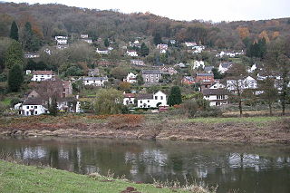
Llandogo is a small village in Monmouthshire, south Wales, between Monmouth and Chepstow in the lower reaches of the Wye Valley AONB, two miles north of Tintern. It is set on a steep hillside overlooking the River Wye and across into the Forest of Dean in Gloucestershire, England. The 2011 census population was 547.
Strand-on-the-Green is one of Chiswick's four medieval villages, and a "particularly picturesque" riverside area in West London. It is a conservation area, with many "imposing" listed buildings beside the River Thames; a local landmark, the Kew Railway Bridge that crosses the River Thames and the Strand, is itself Grade II listed. Oliver's Island is just offshore.

St John's Lock, below the town of Lechlade, Gloucestershire, is the furthest upstream lock on the River Thames in England. The name of the lock derives from a priory that was established nearby in 1250, but which no longer exists. The lock was built of stone in 1790 by the Thames Navigation Commission.

Halfpenny Bridge is a bridge across the River Thames, at Lechlade, Gloucestershire, England. The bridge and its toll house are a Grade II listed building. It marks the start of the navigable Thames, although if the waters are high, the Thames can continue to be travelled by small and unpowered craft as far as Cricklade, over 10 miles (16 km) South-west.

St John's Bridge is a two-section road bridge across the channel of the upper Thames near Lechlade, England, then across the lock cut to the south, the highest lock on the Thames. It is a Grade II listed building.

Inglesham is a small village and civil parish in the Borough of Swindon, Wiltshire, England, notable for the Grade-I listed St John the Baptist Church. The village is just off the A361 road about 1 mile (1.6 km) south-west of Lechlade in Gloucestershire. Most of the population lives in the hamlet of Upper Inglesham, which is on the main road about 1.3 miles (2 km) south of the village.

The River Lyde or Lyde River is a small river in the English county of Hampshire. It rises near Mapledurwell, where the water is used in watercress beds before entering the main channel. It flows in a generally northerly direction, and used to supply power to watermills along its route. Near Sherfield on Loddon it joins the River Loddon, which is a tributary of the River Thames.

The round houses on the Thames and Severn Canal are five former lengthsmen's cottages built along the canal between Chalford and Lechlade in Gloucestershire. Constructed in the 1790s when the canal was built, all but one of the round houses are Grade II listed and have been restored as private dwellings. The buildings have been described as "peculiar" and "a distinctive feature of the Thames and Severn Canal's architecture".
Lechlade Priory was a house of Augustinian Canons Regular in Lechlade, Gloucestershire, England.