
The European route E 22 is one of the longest European routes. It has a length of about 5,320 km (3,310 mi). Many of the E-roads have been extended into Asia since the year 2000; the E 22 was extended on 24 June 2002.
The Washington Hospital is a major hospital and healthcare provider in Washington County, Pennsylvania. It is located in the City of Washington at 155 Wilson Avenue.

Nitrofurans are a class of drugs typically used as antibiotics or antimicrobials. The defining structural component is a furan ring with a nitro group.

Kii-Ogura Station is a train station in Wakayama, Wakayama Prefecture, Japan.
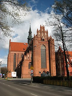
The Roman Catholic Diocese of Pelplin is a diocese located in the city of Pelplin in the Ecclesiastical province of Gdańsk in Poland.
Valentia is a small community founded in 1807, located in the city of Kawartha Lakes, just south of the town of Lindsay on County Road 18 northeast of Lake Scugog. During its bicentennial celebrations in August 2007, it held its first Valentia Heritage Rodeo.
Dubasiewskie Kolonie is a village in the administrative district of Gmina Suchowola, within Sokółka County, Podlaskie Voivodeship, in north-eastern Poland.
Przejma Mała is a village in the administrative district of Gmina Szypliszki, within Suwałki County, Podlaskie Voivodeship, in north-eastern Poland, close to the border with Lithuania.
Black Stone is the highest peak of the Jablanica massif located both in Albania and the Republic of Macedonia. Black Stone reaches a height of 2,257 m (7,405 ft), being not many metres higher than other peaks of the Jablanica.
Zapały is a village in the administrative district of Gmina Banie Mazurskie, within Gołdap County, Warmian-Masurian Voivodeship, in northern Poland, close to the border with the Kaliningrad Oblast of Russia.

Montejícar is a municipality in the province of Granada, Spain. As of 2010, it has a population of 2464 inhabitants.

Moreton Hall is a Grade II* listed building in Bury St Edmunds, a market town in the county of Suffolk, England. It was designed by the Scottish architect Robert Adam and built in 1773 as a country house for John Symonds (1729–1807), a clergyman and Professor of Modern History at Cambridge University. The building was originally known as "St. Edmund's Hill". It was later called "The Mount" and from 1890 "Moreton Hall".
Kosmos 2464 is one of a set of three Russian military satellites launched in 2010 as part of the GLONASS satellite navigation system. It was launched with Kosmos 2465 and Kosmos 2466.
Kosmos 2465 is one of a set of three Russian military satellites launched in 2010 as part of the GLONASS satellite navigation system. It was launched with Kosmos 2464 and Kosmos 2466.
Kosmos 2466 is one of a set of three Russian military satellites launched in 2010 as part of the GLONASS satellite navigation system. It was launched with Kosmos 2465 and Kosmos 2464.
Klinckowströmfjorden is the eastern branch of Raudfjorden at Spitsbergen, Svalbard, on the divide between Albert I Land and Haakon VII Land. It is named after Swedish zoologist Axel Klinckowström. The glacier Raudfjordbreen debouches into the fjord. The peninsula Buchananhalvøya separates Klinckowströmfjorden from the western fjord branch Ayerfjorden. The mountain Ben Nevis is located southeast of the fjord.
Kosmos 2413 is one of a set of three Russian military satellites launched in 2004 as part of the GLONASS satellite navigation system. It was launched with Kosmos 2411 and Kosmos 2412. NORAD apparently call this satellite Kosmos 2411, and instead call Kosmos 2411 Kosmos 2413.

Braeburn Park is a 22.3 hectare nature reserve in Crayford in the London Borough of Bexley. It is managed by the London Wildlife Trust, and includes Wansunt Pit, a 1.9 hectare geological Site of Special Scientific Interest.
Badger Township is a township in Vernon County, in the U.S. state of Missouri.
ISO 5426 is character set developed by ISO. It was first published in 1983.


