The Arctic Archipelago, also known as the Canadian Arctic Archipelago, is a group of islands north of the Canadian mainland.

The Okavango River is a river in southwest Africa. It is the fourth-longest river system in southern Africa, running southeastward for 1,600 km (990 mi). It begins in Angola, where it is known by the Portuguese name Rio Cubango. Further south, it forms part of the border between Angola and Namibia, and then flows into Botswana, draining into the Moremi Game Reserve.

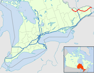
King's Highway 417, commonly referred to as Highway 417 and the Queensway through Ottawa, is a 400-series highway in the Canadian province of Ontario. It connects Montreal with Ottawa, and is the backbone of the transportation system in the National Capital Region. Within Ottawa, it forms part of the Queensway west from Highway 7 to Ottawa Regional Road 174. Highway 417 extends from the Quebec border to Arnprior, where it continues westward as Highway 17. Aside from the urban section through Ottawa, Highway 417 passes through farmland that dominates much of the fertile Ottawa Valley.

Apac is a town in Apac District, Northern Uganda. It is the 'chief town' of the district and the district headquarters are located there. The district is named after the town.

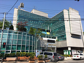
Galhyeon-dong is a dong, neighbourhood of Eunpyeong-gu in Seoul, South Korea.

Tybory Uszyńskie is a village in the administrative district of Gmina Kulesze Kościelne, within Wysokie Mazowieckie County, Podlaskie Voivodeship, in north-eastern Poland. It lies approximately 10 kilometres (6 mi) north-west of Wysokie Mazowieckie and 53 km (33 mi) west of the regional capital Białystok.

Wypychów is a village in the administrative district of Gmina Zgierz, within Zgierz County, Łódź Voivodeship, in central Poland. It lies approximately 15 kilometres (9 mi) north of Zgierz and 23 km (14 mi) north of the regional capital Łódź.

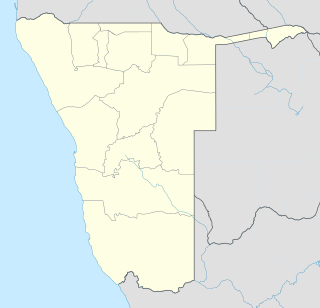
Kalahari Constituency is an electoral constituency in Omaheke Region, Namibia. It has 9,234 inhabitants, the constituency office has been inaugurated in 2009 and is located at the Ben-Hur settlement. The constituency forms part of the border between Namibia and Botswana.
The Pinch River, a perennial river of the Snowy River catchment, is located in the Snowy Mountains region of New South Wales, Australia.
Otamanzi Constituency is an electoral constituency in the Omusati Region of Namibia. Its district capital is the settlement of Otamanzi, it further contains the settlements of Onandjo, Kelimwe, Etilyasa, Onanyala, Onkani, Iiyekeya, Epato, Amarika, Etsikilo, and Onkaankaa,Okeendapa

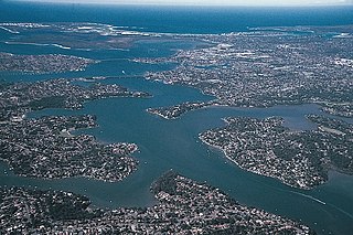
Oatley Bay is a bay located in the Georges River Council, surrounded by the suburbs of Oatley, Hurstville Grove and Connells Point. The bay is part of the Georges River waterway. It is popular for boating, fishing, picnicking and bush walking, and is surrounded by waterfront properties. It also has the largest number of plants and animals in the Municipality of Kogarah protected in its reserves/parks, which include: Poulton Park, Redin Place Reserve, Oatley Point Reserve, Oatley Pleasure Grounds and Moore Reserve.
Dolna Krushitsa is a village in Petrich Municipality, in Blagoevgrad Province, Bulgaria.
Üüvere is a village in Saaremaa Parish, Saare County in western Estonia.

Nobby Nunatak is a nunatak, 270 m, standing 1 nautical mile (1.9 km) south of Lake Boeckella and 1 nautical mile (1.9 km) east of Mount Flora, at the northeast end of Antarctic Peninsula.

Gamsberg Nature Reserve is a protected reserve of Namibia, located west of Rehoboth. Within the reserve we find the flat-topped Gamsberg mountain. With its 2347 m above sea level it is said to be the third highest mountain in Namibia.
Naukluft Mountain Zebra Park is a protected reserve of Namibia. It is located south of Gamsberg Nature Reserve, northwest of Hardap Game Reserve and north of Namib-Naukluft National Park.

Maryland Route 983 was the unsigned designation for a pair of state highways in the U.S. state of Maryland. The highways formed parts of the old alignment of MD 216 on either side of Interstate 95 (I-95) in North Laurel in southeastern Howard County, Maryland. MD 983 had a length of 1.02 miles (1.64 km) and ran on the east side of I-95. MD 983A spanned 0.71 miles (1.14 km) on the west side of I-95. MD 216 through North Laurel was built in the early 1920s. The segments of MD 983 were designated when MD 216 was relocated east of I-95 in the early 1960s and west of I-95 in the late 1970s. In 2017, both MD 983 and MD 983A were removed from the state highway system and transferred to county maintenance.

Epukiro is a cluster of small settlements in the remote eastern part of the Omaheke Region of Namibia, situated about 120 kilometres (75 mi) northeast of the regional capital Gobabis. The centre of the populated area is the Catholic mission station. Epukiro had about 3,200 inhabitants in 1997, predominantly ethnic Tswana.

Mount Etjo Airport is an airport serving Mount Etjo Safari Lodge and the Okonjati Game Reserve in Namibia.
Samba Lucala is a town and commune of Angola, located in the province of Cuanza Norte.


