| Tsarkva | |
|---|---|
| Village | |
| Country | |
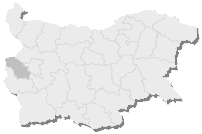
| Province | Dobrich Province |
| Municipality | Balchik |
| Time zone | EET (UTC+2) |
| • Summer (DST) | EEST (UTC+3) |
Tsarkva is a village in Balchik Municipality, Dobrich Province, northeastern Bulgaria. [1]

Balchik Municipality is a municipality (obshtina) in Dobrich Province, Northeastern Bulgaria, located on the Northern Bulgarian Black Sea Coast in Southern Dobruja geographical region. It is named after its administrative centre - the town of Balchik.

Dobrich Province is a province in northeastern Bulgaria, part of Southern Dobruja geographical region. It is bounded on east by the Black Sea, on south by Varna Province, on west by Yambol & Sliven provinces, on north by Shumen & Varna provinces. It is divided into 8 municipalities. At the 2011 census, it had a population of 186,016.

Bulgaria, officially the Republic of Bulgaria, is a country in Southeast Europe. It is bordered by Romania to the north, Serbia and North Macedonia to the west, Greece and Turkey to the south, and the Black Sea to the east. The capital and largest city is Sofia; other major cities are Plovdiv, Varna and Burgas. With a territory of 110,994 square kilometres (42,855 sq mi), Bulgaria is Europe's 16th-largest country.