Tshopo River

Last updated
Tshopo River
Cascades of the Tshopo river.jpg
Cascades of the Tshopo river, January 2015
Democratic Republic of the Congo relief location map.jpg
Red pog.svg
Location
CountryDemocratic Republic of the Congo
Physical characteristics
Mouth Congo River
  coordinates
0°33′47″N25°07′01″E / 0.563030°N 25.117032°E / 0.563030; 25.117032 Coordinates: 0°33′47″N25°07′01″E / 0.563030°N 25.117032°E / 0.563030; 25.117032
Basin size17,200 square kilometres (6,600 sq mi)
Discharge 
  minimum100 cubic metres per second (3,500 cu ft/s)
  maximum700 cubic metres per second (25,000 cu ft/s)

The Tshopo River is a river in the Democratic Republic of the Congo. It flows through the north of the city of Kisangani and joins the Lindi River just before that river enters the Congo River. It gives its name to the province of Tshopo.

Contents

Basin

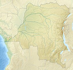
The Tshopo basin has an area of about 17,200 square kilometres (6,600 sq mi), mostly covered by Guinean-Congolian rainforests. It is elongated, and almost entirely north of the equator. The river flows from east to west and enters the Congo River 13 kilometres (8.1 mi) downstream from Kisangani where it joins the Lindi River. [1] The great falls near the river mouth vary in height from 11.2 to 13.8 metres (37 to 45 ft) depending on the height of the Congo River. About 120 metres (390 ft) further upstream the small falls are 3.2 metres (10 ft) high over a section of rapids. [2]

The location in the continental interior by the equator with two rainy seasons and two dry seasons, and the vegetation covering the basin, result in a fairly constant flow. There are low waters in February–April and in June–August, and high waters in April–May and particularly in October–December. Average annual flow is about 300–450 cubic metres per second (11,000–16,000 cu ft/s). [1] At the great falls just above the river mouth the flow is 100–700 cubic metres per second (3,500–24,700 cu ft/s), with a velocity of 5–6 metres per second (16–20 ft/s). [2] The water is pH 6.6–6.8, and has a temperature of 26–28 °C (79–82 °F) in January and June 1987. [2]

Ecology

The Lindi and Tshopo rivers form one of the three major right-bank river systems in the Cuvette Centrale , or central Congo Basin, the others being the Itimbiri River and Aruwimi River. [3] According to a 2015 report, 184 species of fish had been found in the Lindi/Tshopo basin. The family of the elephant fish, Mormyridae , was richest in species. [4] The river has clear water, compared to the turbid water of the Congo, making it habitable to plant species such as Inversodicraea . [5]

Schistosomiasis is a chronic parasitic disease transmitted by a freshwater mollusc. A 2018 study of people living in a camp on the banks of the Tshopo river 28 kilometres (17 mi) from Kisangani on the old Buta road found 54.5% positive for Schistosoma haematobium and 7.3% positive for Schistosoma mansoni . This compared to 2.4% and 4.8% positive rates for people in a nearby village. [6]

Hydroelectric plant

A hydroelectric power plant was built at the Tshopo River Falls to the north of Kisangani in the 1950s, causing the local extinction of Inversodicraea congolana at one of the two sites in the world where it was found. [5] It was a run-of-the-river plant, so did not require a large reservoir. [7] The river passes through the hydroelectric dam and then over a waterfall. [8] In 2013 Belgium's Minister for Cooperation and Development Jean-Pascal Labille  [ fr ] and the Orientale Province governor Jean Bamanisa reopened the Tshopo hydroelectric facility after it had been closed for rehabilitation. [9]

A truss bridge was built over the fall in 1968, providing a route for farmers from the northeast to access the city. It fell into disrepair, and in 2014 was replaced by a 163 metres (535 ft) steel panel bridge with a single lane that could carry vehicles up to 41 tons. It had two external pedestrian walkways. [8]

Citations

  1. 1 2 Léonard 1993, p. 286.
  2. 1 2 3 Cheek et al. 2017, p. 130.
  3. Decru et al. 2017, p. 226.
  4. Decru 2015.
  5. 1 2 Cheek et al. 2017, p. 129.
  6. Mongita Esol’e et al. 2020.
  7. Cheek et al. 2017, p. 131.
  8. 1 2 Barnes 2015.
  9. Daly 2013.

Sources

Commons-logo.svg Media related to Tshopo River at Wikimedia Commons

Related Research Articles

<span class="mw-page-title-main">Congo River</span> River in central Africa

The Congo River, formerly also known as the Zaire River, is the second-longest river in Africa, shorter only than the Nile, as well as the third largest river in the world by discharge volume, following the Amazon and the Ganges rivers. It is also the world's deepest recorded river, with measured depths of around 219.5 m (720 ft). The Congo-Lualaba-Chambeshi River system has an overall length of 4,700 km (2,920 mi), which makes it the world's ninth-longest river. The Chambeshi is a tributary of the Lualaba River, and Lualaba is the name of the Congo River upstream of Boyoma Falls, extending for 1,800 km (1,120 mi).

<span class="mw-page-title-main">Lualaba River</span> River in Democratic Republic of the Congo

The Lualaba River flows entirely within the eastern part of Democratic Republic of the Congo. It provides the greatest streamflow to the Congo River, while the source of the Congo is recognized as the Chambeshi. The Lualaba is 1,800 kilometres (1,100 mi) long. Its headwaters are in the country's far southeastern corner near Musofi and Lubumbashi in Katanga Province, next to the Zambian Copperbelt.

<span class="mw-page-title-main">Kisangani</span> City in the northeastern DR Congo

Kisangani is the capital of Tshopo province in the Democratic Republic of the Congo. It is the fifth most populous urban area in the country, with an estimated population of 1,312,000 in 2021, and the largest of the cities that lie in the tropical woodlands of the Congo.

<span class="mw-page-title-main">Ruzizi River</span> River in Central Africa

The Ruzizi is a river, 117 kilometres (73 mi) long, that flows from Lake Kivu to Lake Tanganyika in Central Africa, descending from about 1,500 metres (4,900 ft) to about 770 metres (2,530 ft) above sea level over its length. The steepest gradients occur over the first 40 kilometres (25 mi), where hydroelectric dams have been built. Further downstream, the Ruzizi Plain, the floor of the Western Rift Valley, has gentle hills, and the river flows into Lake Tanganyika through a delta, with one or two small channels splitting off from the main channel.

<i>Marcusenius</i> Genus of ray-finned fishes

Marcusenius is a genus of elephantfishes native to Africa. Its members are highly diverse in size, with the smallest species reaching less than 15 cm (6 in) and the largest more than 1 m (3.3 ft).

<span class="mw-page-title-main">Topoke people</span>

The Topoke people are an ethnic group that live in the Isangi Territory south of the Congo River, downstream from Kisangani in Tshopo District of the Democratic Republic of the Congo. They speak the Poke language, in the Soko–Kele languages group of Bantu languages.

<span class="mw-page-title-main">Félou Falls</span> Waterfall in Kayes Region, Mali

The Félou Falls are located on the Sénégal River 15 kilometres (9.3 mi) upstream of Kayes in western Mali. The river tumbles 13 metres (43 ft) down an irregular series of rocky steps. The waterfalls mark the furthest point from the mouth of the river that can be reached by boat. In 2009 work started on the construction of the Félou Hydroelectric Plant, a 62.3 megawatts (83,500 hp) run-of-the-river hydroelectric plant at the falls replacing a small 600 kW plant dating from the 1920s.

<span class="mw-page-title-main">Kahuzi-Biéga National Park</span>

The Kahuzi-Biega National Park is a protected area near Bukavu town in eastern Democratic Republic of the Congo. It is situated near the western bank of Lake Kivu and the Rwandan border. Established in 1970 by the Belgian photographer and conservationist Adrien Deschryver, the park is named after two dormant volcanoes, Mount Kahuzi and Mount Biega, which are within its limits. With an area of 6,000 square kilometres (2,300 sq mi), Kahuzi-Biega is one of the biggest national parks in the country. Set in both mountainous and lowland terrain, it is one of the last refuges of the rare species of Eastern lowland gorilla, an endangered category under the IUCN Red List. The park is a UNESCO World Heritage Site, inscribed in 1980 for its unique biodiversity of rainforest habitat and its eastern lowland gorillas. In 1997, it was listed on the List of World Heritage in Danger because of the political instability of the region, an influx of refugees, and increasing wildlife exploitation.

<span class="mw-page-title-main">Bas-Uele District</span> District in Orientale, Democratic Republic of the Congo

Bas-Uele District was a district of the Belgian Congo and the Democratic Republic of the Congo. It was formed from part of Uele District in 1912. Later it was merged back into Uele District, then split out again. There were various boundary changes. It roughly corresponded in area to the present Bas-Uélé province.

The following is a timeline of the history of the city of Kisangani, Democratic Republic of the Congo.

Aruwimi District was a district of the Congo Free State and Belgian Congo. It went through various changes in extent before being absorbed into other districts.

<span class="mw-page-title-main">Stanleyville District</span> District in Orientale, Democratic Republic of the Congo

Stanleyville District was a district of the Belgian Congo and Democratic Republic of the Congo. It went through various changes in extent. Between 1933 and 1963 it had roughly the same extent as the current Tshopo province.

Uele District was a district of the Congo Free State and the Belgian Congo. It roughly corresponded to the current provinces of Bas-Uélé and Haut-Uélé.

Stanley Falls District was a district of the Congo Free State. It covered most of the eastern part of the colony along the Congo River south from Stanleyville.

<span class="mw-page-title-main">Districts of the Congo Free State</span>

The Districts of the Congo Free State were the primary administrative divisions of the Congo Free State from 1885 to 1908. There were various boundary changes in the period before the Congo Free State was annexed by Belgium to become the Belgian Congo.

The Itimbiri River is a right tributary of the Congo River, which it joins above Bumba. At one time it was important as a navigable waterway for transporting good from the northeast of the country down to the Congo.

The Nzoro River is a river in the Democratic Republic of the Congo. It is a right tributary of the Kibali River. It is used to supply hydroelectric power to the Kibali Gold Mine.

<span class="mw-page-title-main">Léon Roget</span>

Léon Roget was a Belgian soldier and colonial administrator who was active in the Congo Free State. He was the first commander of the Force Publique, the armed force used to police the colony.

<span class="mw-page-title-main">Willem Frans Van Kerckhoven</span>

Willem Frans Van Kerckhoven, or Guillaume François van Kerckhoven was a Belgian soldier, explorer, colonial administrator who was active in the service of the International Association of the Congo and the subsequent Congo Free State. He is known for his extended expedition through the Uele River basin and onward towards the Nile, which was responsible for the deaths of over 1,800 people and established a Belgian presence in the region. He died in an accident before reaching the Nile.