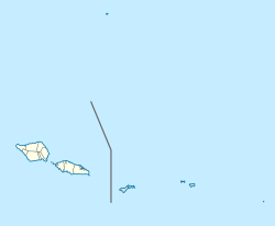
Samoa is made up of eleven itūmālō. These are the traditional eleven districts that were established well before European arrival. Each district has its own constitutional foundation (faavae) based on the traditional order of title precedence found in each district's faalupega.

Lalomanu is a village on the east coast of Upolu island in Samoa.The village is part of the electoral constituency Aleipata Itupa i Luga which is within the larger political district of Atua. It has a population of 712.
Siumu is a village on the central south coast of Upolu island in Samoa. The population is 1183. There is also a sub-village Siumu Uta which has a population of 304.

Leulumoega Tuai is a village situated on the northwest coast Upolu island in Samoa. The village is part of the A'ana Alofi 3 Electoral Constituency which forms part of the larger A'ana political district.
Nofoali'i is a village on the Samoan island of Upolu. It is located on the northwestern coast of the island between Fasito'o Uta and Leulumoega. It is the sixth village from Faleolo International Airport. The village is part of A'ano Alofi 3 Electoral Constituency, which forms part of the larger A'ana political district.
Faleasi'u is one of the largest village settlements on the island of Upolu in Samoa. It is located on the northwestern coast of the island and has a population of 4177.
Letogo is a village on the central north coast of Upolu island in Samoa. Letogo is situated east of the capital Apia.
Pesega is a village on the island of Upolu in Samoa. It is located on western outskirts of Apia, the country's capita. Pesega is part of Faleata West Electoral Constituency which forms part of the larger political district of Tuamasaga.
Fagaliʻi or Fagaliʻi-uta is a village on the island of Upolu in the Samoa archipelago approximately 5 kilometres south-east of Apia. It is in the electoral constituency of Vaimauga East which forms part of the larger political district of Tuamasaga.
Matatufu is a small village on south east end of Upolu island in Samoa. The village is part of Lotofaga Electoral Constituency which is within the larger political district of Atua.
Tino i Iva, is a village at the east end of Savai'i island in Samoa. The village is part of the electoral constituency Fa'asaleleaga 2 which is within the larger political district (Itumalo) of Fa'asaleleaga.
Lano is a village on the north east coast of Savai'i island in Samoa. The village is part of the electoral constituency Fa'asaleleaga 5 which is within the larger political district (Itumalo) of Fa'asaleleaga. The population is 695.
Fogapoa is a village on the north east coast of Savai'i island in Samoa. The village is part of the electoral constituency Fa'asaleleaga 3 which is within the larger political district (Itumalo) of Fa'asaleleaga.
Le'auva'a is a village on the island of Upolu in Samoa. The population is 3274.
Luatuanu'u is a village situated on the east side of Upolu island in Samoa. The village is part of Anoamaa West Electoral Constituency which is within the larger political district of Atua.
Asaga is a village on the north east coast of Savai'i island in Samoa, situated between the villages of Lano to the south and Pu'apu'a to the north. The village is part of the electoral constituency Fa'asaleleaga 5 which is within the larger political district (Itumalo) of Fa'asaleleaga.

Fatausi is a village on the island of Savai'i in Samoa. It is situated on the east coast of the island in the district of Fa'asaleleaga and the electoral district of Fa'asaleleaga 3. The population is 205.
Faleatiu is a village on the island of Upolu in Samoa. The village is on the north-west coast of the island and forms part of A'ano Alofi 4 Electoral Constituency which forms part of the larger A'ana political district.
Matafaa is a village on the island of Upolu in Samoa. The village is on the south coast of the island and is part of the Lefaga ma Faleaseela Electoral Constituency which forms part of the larger A'ana political district.