Milden is a village in the Canadian province of Saskatchewan within the Rural Municipality of Milden No. 286 and Census Division No. 12. The village is located at the junction of Highway 15 and Highway 655 approximately 20 km west of Outlook on Highway 15.
Semans is a village in the Canadian province of Saskatchewan within the Rural Municipality of Mount Hope No. 279 and Census Division No. 10. The village is located approximately 125 km north of the City of Regina and 195 km southeast of the City of Saskatoon.

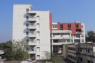
Nilphamari Sadar is an upazila of Nilphamari District in the Division of Rangpur, Bangladesh. Nilphamari Sadar thana was established in 1870. It was under Daroani thana before 1870. It gradually turned into an Upazilla in 1984.

Elbow is a village in the Canadian province of Saskatchewan within the Rural Municipality of Loreburn No. 254 and Census Division No. 11. Elbow was founded in 1909, near what is now Lake Diefenbaker. It is 8 kilometres (5.0 mi) north-west of Mistusinne, 10 kilometres (6.2 mi) north-west of Douglas Provincial Park, and 16 kilometres (9.9 mi) south-east of Loreburn. The village got its name from its position on the elbow of the South Saskatchewan River.
Hubbard is a village in the Canadian province of Saskatchewan within the Rural Municipality of Ituna Bon Accord No. 246 and Census Division No. 10.
Kelliher is a village in the Canadian province of Saskatchewan within the Rural Municipality of Kellross No. 247 and Census Division No. 10. The village is located about 140 km north of the City of Regina.
Lancer is a special service area in the Canadian province of Saskatchewan within the Rural Municipality of Miry Creek No. 229 and Census Division No. 8. It held village status between 1913 and 2022.
Leross or is a village in the Canadian province of Saskatchewan within the Rural Municipality of Kellross No. 247 and Census Division No. 10.
MacNutt is a village in the Canadian province of Saskatchewan within the Rural Municipality of Churchbridge No. 211 and Census Division No. 5. The former District of Landestreu was renamed in 1909 to honour Thomas MacNutt, the area Member of the Legislative Assembly at the time. The village was settled between the late 1880s and the 1910s by immigrants of predominantly German origin.
Stenen is a village in the Canadian province of Saskatchewan within the Rural Municipality of Clayton No. 333 and Census Division No. 9.
Margo is a village in the Canadian province of Saskatchewan within the Rural Municipality of Sasman No. 336 and Census Division No. 10.
Plunkett is a special service area in the Canadian province of Saskatchewan within the Rural Municipality of Viscount No. 341 and Census Division No. 11. It held village status between 1921 and 2022.

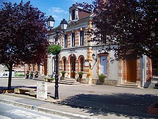
Trépail is a commune in the Marne department in north-eastern France. It had a population of 436 in 2019. Its inhabitants are referred to as Trépaillots and Trépaillotes in French.
Quinton is a village in the Canadian province of Saskatchewan within the Rural Municipality of Mount Hope No. 279 and Census Division No. 10. The village is located on Highway 15 between the Town of Raymore and the Village of Punnichy. It is near the administrative office of the Kawacatoose First Nations.

Tessier is a village in the Canadian province of Saskatchewan within the Rural Municipality of Harris No. 316 and Census Division No. 12. The village is located approximately 60 km southwest of the City of Saskatoon on Highway 7.
Uparhali is a village in Kamrup rural district, situated in south bank of river Brahmaputra.
Tukrapara is a village in Kamrup rural district, situated in the south bank of the river Brahmaputra.
Topatali is a village in Kamrup Metropolitan district, situated in south bank of river Brahmaputra.

Paintemau is a village in Rahi block of Rae Bareli district, Uttar Pradesh, India. It is located 6 km from Rae Bareli, the district headquarters. As of 2011, its population comprises 617 people, in 112 households. The village has one primary school and no medical facilities and it does not host a weekly haat or a permanent market. It belongs to the nyaya panchayat of Rustampur.


