Serghaya or Sirghaya is a small town located in the Damascus countryside in south west Syria. According to the Syria Central Bureau of Statistics (CBS), Serghaya had a population of 7,501 in the 2004 census. Its inhabitants are predominantly Sunni Muslims.

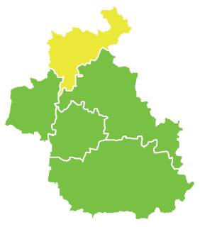
Kafr Laha is a town in the Homs Governorate north of Homs in northern Syria. In 2004 it had a population of 20,041 according to the Central Bureau of Statistics of Syria. Its inhabitants are predominantly Sunni Muslims. It is the largest town in the Houla region. Nearby localities include Tallaf to the northeast, Tell Dahab to the north, Aqrab to the northwest, Qarmas and Maryamin to the west, al-Taybah al-Gharbiyah to the southwest and Taldou to the southeast.

Al-Qabu is a town in central Syria, administratively part of the Homs Governorate, northwest of Homs. Nearby localities include al-Shinyah to the north, Taldou and Kafr Laha to the northeast, Sharqliyya to the east, al-Mahfurah to the south, Rabah to the southwest and Fahel to the west. According to the Syria Central Bureau of Statistics (CBS), al-Qabu had a population of 4,870 in the 2004 census. The inhabitants are predominantly Alawites.

Fahil is a town in central Syria, administratively part of the Homs Governorate, northwest of Homs. Nearby localities include Taldou and Kafr Laha to the northeast and al-Qabu to the west. According to the Central Bureau of Statistics (CBS), Fahil had a population of 5,775 in the 2004 census. Its inhabitants are predominantly Alawites and Greek Orthodox Christians.

Qarmas is a village in northern Syria, administratively part of the Hama Governorate, located west of Hama. Nearby localities include Aqrab to the north, Tell Dahab to the east, Kafr Laha to the southeast, al-Taybah al-Gharbiyah to the south, Maryamin to the southwest, Awj and Kafr Kamrah to the west and Baarin to the northwest. According to the Syria Central Bureau of Statistics, Mahrusah had a population of 5,331 in the 2004 census. Its inhabitants are predominantly Alawites.

Flitah or Meshrefah is a Syrian village in the An-Nabek District of the Rif Dimashq Governorate. According to the Syria Central Bureau of Statistics (CBS), Flitah had a population of 6,475 in the 2004 census. Its inhabitants are predominantly Sunni Muslims.

Kafr Laha, Hama is a Syrian village located in Wadi al-Uyun Nahiyah in Masyaf District, Hama. According to the Syria Central Bureau of Statistics (CBS), Kafr Laha, Hama had a population of 379 in the 2004 census.
Shallakh is a Syrian village located in Taftanaz Nahiyah in Idlib District, Idlib. According to the Syria Central Bureau of Statistics (CBS), Shallakh had a population of 1917 in the 2004 census.
Abu Sharji is a Syrian village located in Sinjar Nahiyah in Maarrat al-Nu'man District, Idlib. According to the Syria Central Bureau of Statistics (CBS), Abu Sharji had a population of 507 in the 2004 census.
Basqala is a Syrian village located in Kafr Nabl Nahiyah in Maarrat al-Nu'man District, Idlib. According to the Syria Central Bureau of Statistics (CBS), Basqala had a population of 2673 in the 2004 census.
Ftireh is a Syrian village located in Kafr Nabl Nahiyah in Maarrat al-Nu'man District, Idlib. According to the Syria Central Bureau of Statistics (CBS), Ftireh had a population of 2715 in the 2004 census.
Aqrabat, Idlib is a Syrian village located in Al-Dana Nahiyah in Harem District, Idlib. According to the Syria Central Bureau of Statistics (CBS), Aqrabat, Idlib had a population of 388 in the 2004 census.
Kafr Hind is a Syrian village located in Salqin Nahiyah in Harem District, Idlib. According to the Syria Central Bureau of Statistics (CBS), Kafr Hind had a population of 1073 in the 2004 census.
Al-Tlul is a Syrian village located in Salqin Nahiyah in Harem District, Idlib. According to the Syria Central Bureau of Statistics (CBS), Al-Tlul had a population of 1703 in the 2004 census.
Htan is a Syrian village located in Qurqania Nahiyah in Harem District, Idlib. According to the Syria Central Bureau of Statistics (CBS), Htan had a population of 928 in the 2004 census.
Radwa is a Syrian village located in Qurqania Nahiyah in Harem District, Idlib. According to the Syria Central Bureau of Statistics (CBS), Radwa had a population of 567 in the 2004 census.
Biret Armanaz is a Syrian village located in Armanaz Nahiyah in Harem District, Idlib. According to the Syria Central Bureau of Statistics (CBS), Biret Armanaz had a population of 320 in the 2004 census.
Armala, Idlib is a Syrian village located in Bidama Nahiyah in Jisr al-Shughur District, Idlib. According to the Syria Central Bureau of Statistics (CBS), Armala, Idlib had a population of 911 in the 2004 census.
Baksariya is a Syrian village located in Bidama Nahiyah in Jisr al-Shughur District, Idlib. According to the Syria Central Bureau of Statistics (CBS), Baksariya had a population of 732 in the 2004 census.
Maraand is a Syrian village located in Bidama Nahiyah in Jisr al-Shughur District, Idlib. According to the Syria Central Bureau of Statistics (CBS), Maraand had a population of 734 in the 2004 census.


