Turtle Creek (New Jersey)

Last updated

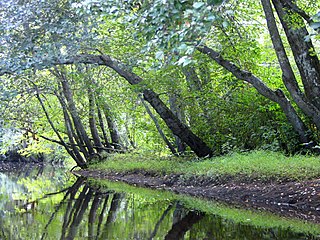
Turtle Creek is a 1.9-mile-long (3.1 km) [1] tributary of the Mullica River in southern New Jersey in the United States. [2]

Tributary stream or river that flows into a main stem river or lake

A tributary or affluent is a stream or river that flows into a larger stream or main stem river or a lake. A tributary does not flow directly into a sea or ocean. Tributaries and the main stem river drain the surrounding drainage basin of its surface water and groundwater, leading the water out into an ocean.

Mullica River river in the United States of America

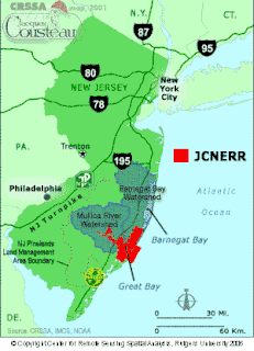
The Mullica River is a 50.6-mile-long (81.4 km) river in southern New Jersey in the United States. The Mullica was once known as the Little Egg Harbor River.

New Jersey State of the United States of America

New Jersey is a state in the Mid-Atlantic region of the Northeastern United States. It is a peninsula, bordered on the north and east by the state of New York, particularly along the extent of the length of New York City on its western edge; on the east, southeast, and south by the Atlantic Ocean; on the west by the Delaware River and Pennsylvania; and on the southwest by the Delaware Bay and Delaware. New Jersey is the fourth-smallest state by area but the 11th-most populous, with 9 million residents as of 2017, and the most densely populated of the 50 U.S. states; its biggest city is Newark. New Jersey lies completely within the combined statistical areas of New York City and Philadelphia and was the second-wealthiest U.S. state by median household income as of 2017.

From source to outlet, it is entirely surrounded by the tidal marshes of the Swan Bay Wildlife Management Area. The former upper reaches of the stream, reaching some distance north into the Wharton State Forest, have been diverted and given their own channel, reaching the Mullica to the west of the remaining stream.

Wharton State Forest

Wharton State Forest is the largest state forest in the U.S. state of New Jersey. It is the largest single tract of land in the state park system of New Jersey, encompassing approximately 122,880 acres (497.3 km2) of the Pinelands northeast of Hammonton. It is protected acreage is divided between Burlington, Camden, and Atlantic counties. The entire forest is located within Atlantic coastal pine barrens ecoregion as well as the New Jersey Pinelands National Reserve. The forest is located in the forested watershed of the Mullica River, which drains the central Pinelands region into the Great Bay. The forest is under the jurisdiction of the New Jersey Division of Parks and Forestry.

See also

Related Research Articles

Toms River freshwater river and estuary in Ocean County, New Jersey in the United States

The Toms River is a 41.7-mile-long (67.1 km) freshwater river and estuary in Ocean County, New Jersey in the United States.

The Wading River is a tributary of the Mullica River, approximately 10.1 miles (16.3 km) long, in southern New Jersey in the United States. The river drains a rural forested area of the Pinelands, one of the most pristine areas along the coast of the northeastern United States.

The Bass River is a 4.7-mile-long (7.6 km) tributary of the Mullica River in southeastern New Jersey in the United States.

The Affair at Little Egg Harbor took place on October 15, 1778, in southern New Jersey, United States, during the American Revolution. The Loyalists killed nearly 50 Patriot men, bayonetting them as they slept. The massacre took place about one week after the Battle of Chestnut Neck, a British raid aimed at suppressing privateers who used the area as a base to harass and seize British ships and their cargoes.

Raccoon Creek is a 22.6-mile-long (36.4 km) tributary of the Delaware River in southern New Jersey in the United States.

Landing Creek is an 11.2-mile-long (18.0 km) tributary of the Mullica River in southern New Jersey in the United States. The creek originates near Egg Harbor City and joins the Mullica River just below Lower Bank near Hog Islands. It is joined along its route by Union Creek, Indian Cabin Creek, Elliot's Creek, and Rubin's Run, respectively.

Nescochague Creek is a 6.4-mile-long (10.3 km) tributary of the Mullica River in southern New Jersey in the United States. The creek starts just northwest of Hammonton, arcs along the southern boundary of Wharton State Forest, and joins the Mullica River just above County Route 542.

Batsto River river in the United States of America

The Batsto River is a 22.9-mile-long (36.9 km) tributary of the Mullica River in the southern New Jersey Pine Barrens in the United States. The river also drains 49.42 square miles of land.

Cedar Creek is an 18.9-mile-long (30.4 km) tributary of Barnegat Bay in Ocean County in the southern New Jersey Pine Barrens in the United States.

The West Branch Wading River is a 22.7-mile-long (36.5 km) tributary of the Wading River in Burlington County in the southern New Jersey Pine Barrens in the United States.

Oswego River (New Jersey) river in New Jersey, United States

The Oswego River is a 23.7-mile-long (38.1 km) tributary of the Wading River in the southern New Jersey Pine Barrens in the United States.

Westecunk Creek is an 11.1-mile-long (17.9 km) tributary of Little Egg Harbor in southeastern New Jersey in the United States.

Sluice Creek is a 5.3-mile-long (8.5 km) tributary of Dennis Creek in Cape May County, New Jersey in the United States.

Big Graveling Creek is a 2.9-mile-long (4.7 km) tributary of the Mullica River in southern New Jersey in the United States.

Ballanger Creek is a 4.7-mile-long (7.6 km) tributary of the Mullica River in southern New Jersey in the United States. The name is derived from "Belangee," a family of French Huguenots who were early settlers in the area.

Jacques Cousteau National Estuarine Research Reserve

The Jacques Cousteau National Estuarine Research Reserve, located in southeastern New Jersey, encompasses over 110,000 acres (450 km²) of terrestrial, wetland and aquatic habitats within the Mullica River-Great Bay Ecosystem.

Great Bay is located in southern New Jersey's Atlantic Coastal Plain in Ocean and Atlantic Counties, about ten miles (16 km) north of Atlantic City and 87 mi (140 km) south of New York City. The Mullica River flows into the bay, and together they form the Mullica River - Great Bay estuary habitat. The bay is connected to the Atlantic Ocean via the Little Egg Inlet. Great Bay is considered one of the least-disturbed marine wetlands habitats in the northeastern United States.

New Jersey Route 167 highway in New Jersey

Route 167 is a short, 0.77-mile-long (1.24 km) unsigned state highway in Atlantic and Burlington counties in New Jersey. The route is one of the few discontinuous state highways in New Jersey, split by wetlands, the Garden State Parkway and the Mullica River. Although the alignment is registered by the New Jersey Department of Transportation as 2.76 miles (4.44 km) highway, the amount of roadway is considerably shorter. The route begins at an intersection with U.S. Route 9 (US 9) in Port Republic, where it continues along Old New York Road to an end of roadway at the Parkway embankment. Across the Mullica River, Route 167 continues at a gate for wetlands, heading northward to an intersection with US 9 in Bass River Township.

The Sweetwater Casino, located in Mullica Township, New Jersey on the Mullica River and established in 1928, was known for its riverside deck, catering, event hosting, local nightlife, as well as being a gathering place for families to spend meals for generations. Never a real casino however, the Sweetwater was established by a local family as a restaurant in days before distance travel was common.

References

  1. U.S. Geological Survey. National Hydrography Dataset high-resolution flowline data. The National Map, accessed April 1, 2011
  2. Gertler, Edward. Garden State Canoeing, Seneca Press, 2002. ISBN   0-9605908-8-9

Coordinates: 39°41′58″N74°11′06″W / 39.699337°N 74.184998°W / 39.699337; -74.184998

Geographic coordinate system Coordinate system

A geographic coordinate system is a coordinate system that enables every location on Earth to be specified by a set of numbers, letters or symbols. The coordinates are often chosen such that one of the numbers represents a vertical position and two or three of the numbers represent a horizontal position; alternatively, a geographic position may be expressed in a combined three-dimensional Cartesian vector. A common choice of coordinates is latitude, longitude and elevation. To specify a location on a plane requires a map projection.