Holalkere is a town and taluk headquarters located near Chitradurga in the Indian state of Karnataka.
Bantwal is a suburb of Mangalore in Dakshina Kannada district, Karnataka, India, and the headquarters of Bantwal taluk. It is located 25 km (16 mi) East of Mangalore city center. BC Road-Kaikamba of Bantwal is one of the fastest developing areas in Dakshina Kannada district of Karnataka.
Arsikere is a city and taluka in the Hassan district in the state of Karnataka, India. It is the second largest city in Hassan district, demographically. Arsikere city municipal council consists of 35 wards. This region is known for its coconut production and is also called Kalpataru Nadu. Arsikere Junction is a major railway junction in the South Western Railway which links Mangalore and Mysore to North Karnataka and a central place for tourists who visit nearby places that do not have rail access, such as Belur, Halebidu and Shravanabelagola, Harnahalli, and Kodimata.

Kaduru, also known as Kadur, is a town in the district and a taluk in Chikmagalur district, in Karnataka. It is located at 13.553345°N 76.011260°E in the rain shadow region of western ghats in the Malenadu region. Most of the taluk is dry, unlike much of the district. Kadur is known for areca nut and also coconut production.

Kollegala is the Major taluk in the Chamarajanagara District of Karnataka State in the south of India. Kollegala is well known for its silk industry which attracts traders from all over the state.

Holenarasipura is a town and taluk in Hassan district of Karnataka. The town is situated on the banks of the Hemavati, one of the tributaries of the Kaveri.
Honnāli is a town and a taluk headquarter in Davanagere district in the Indian state of Karnataka. Its name is derived from honnarali, which means "Blossom of gold".
Kunigal is a town in Tumakuru district in the Indian state of Karnataka. It is the headquarters of Kunigal taluk. As of 2011 census, the town has a population of 34155.

Madukkarai is a suburb of Coimbatore city in the Indian state of Tamil Nadu. It is the gateway to Coimbatore city from Kerala State and is located around 12 km from the Kerala border. The Coimbatore International Airport is about 27 km from here. It is the administrative centre for Madukkarai taluk.

Malavalli is a town and a taluka in Mandya district in the Indian state of Karnataka. Malavalli town in history is quoted dates back to 27 March 1799 - Fourth Anglo Mysore War. Battle of Malavalli was fought between Tippu Sultan's Mysore Army against the British East India Company led by Arthur Wellesley. The men from the town fought fiercely and laid down their lives.
Minjur is a suburb located in the northern outskirts of Chennai, India. It is located in Thiruvallur district in the Indian state of Tamil Nadu. Minjur is called 'Vada Kanchi' meaning North Kanchipuram. The locality has two famous temples for Shiva and Vishnu, similar to Kanchipuram. The neighbourhood is served by Minjur railway station of the Chennai Suburban Railway Network.

Nagamangala is a PuraSabhe and a taluk in Mandya district, in the Indian state of Karnataka.

Pandavapura is a Municipality Town in Mandya district in the Indian state of Karnataka.
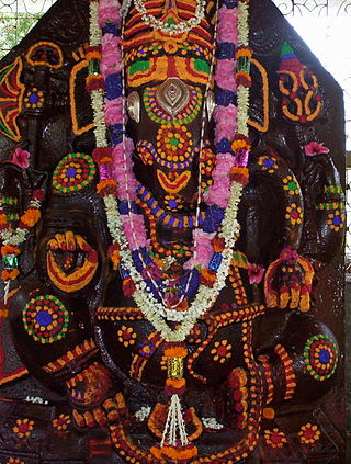
Pavagada is a town and a taluk in the Tumkur district of Karnataka, India. Historically it was part of the Mysore kingdom. Though it is geographically connected to Chitradurga district inside state of Karnataka, it comes under Tumkur district. It is 157.8 km from state capital of Bengaluru. Uttara Pinakini river flows into this Taluk. Pavagada Taluk falls on the border of Karnataka, hence a majority of the population are bilingual speaking Kannada and Telugu. The town is famous for its fort located on the hill, Kote Anjaneya temple at the foothills and also the temple of Sri Shani Mahatma.
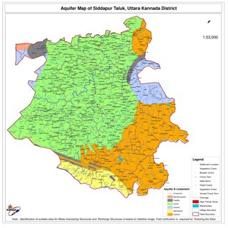
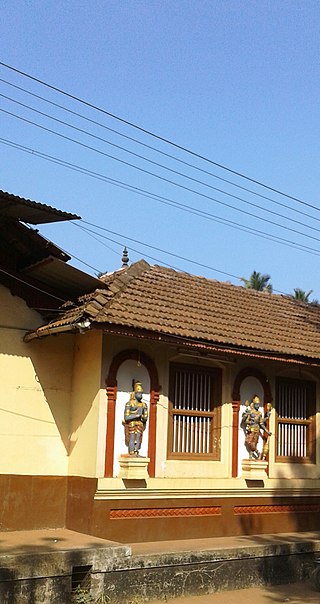
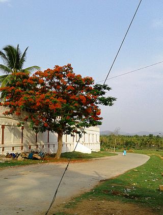
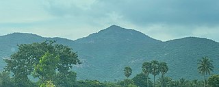
Siddapur Taluk is the destination of world famous Jog Falls. It is a part of Uttara Kannada district, Karnataka, India and is located in the midst of forest areas of Western Ghats and it is also a part of Malenadu. The taluk is full of greenery, hills and arecanut gardens developed in the valleys’. The taluk headquarters is Siddapur. Sirsi is the nearest city,
Tarikere is a town, a taluk and is one of the two Subdivisional headquarter in the Chikmagalur district of Karnataka state, India. It is popularly known as gateway of Malnad because the Malnad area starts from here. The town's name is derived from the number of water tanks which surround it.
Kanathur is a village in Turvekere taluk of Tumkur district, in the Indian state of Karnataka.
Kuruburu is a village in Chintamani Taluk in the Chikballapur district in the state of Karnataka, India.
Poovaipalayam, also called "Sithakkaattur" is a village in Dindigul district, Tamil Nadu, India. It is 8 km from the nearest town, Vedasandur, and 22 km from the district headquarters, Dindigul. The villagers are primarily farmers who grow drumsticks, onion, chili peppers, gooseberry, tomato, eggplants, tobacco, and lentils. The villagers belong to the Kongu Vellala Gounder community. Poovaipalayam is under Oddancatram taluk and in the same constituency.
Saligrama is a new sub-district of Mysore district, situated on the northern bank of the river Cauvery [Kaveri]. This place is esteemed as sacred by the Shri Vaishnavas on account of its having been the residence of Sri Ramanujacharya. It is the headquarters of Saligrama Taluk. It was established as a new taluk carving out of K.R.Nagar taluk with effect from 31.12.2020 and become ninth taluk of Mysore district of Karnataka, India.


