Santacruz or Santa Cruz is a suburb of Mumbai. The Santacruz railway station on the Mumbai Suburban Railway, the domestic terminal (T1) of the Chhatrapati Shivaji Maharaj International Airport, and one campus of the University of Mumbai, are all located in Santacruz (East).

Coonoor, is a taluk and a municipal town of the Nilgiris district in the Indian state of Tamil Nadu. As of 2011, the town had a population of 45,494. The town sits at the south-east corner of the Nilgiri plateau, and at the head of the Coonoor Ghat, the principal pass connecting the Nilgiris to the plains. It is 363 miles by rail from Chennai and 12 miles from Ooty. The town is built within the picturesque Jackatalla valley (Jagathala), surrounded by wooded hills.

Tumakuru district is an administrative district in the state of Karnataka in India. It is the third largest district in Karnataka by land area with an area of 10,598 km2, and fourth largest by Population. It is a one-and-a-half-hour drive from Bengaluru, the state capital. The district is known for the production of coconuts and is also called as 'Kalpataru Nadu'. It is the only discontiguous district in Karnataka.
Alandur is a zone of Chennai corporation, and an urban node in Chennai district in Guindy division in the state of Tamil Nadu, India. It is surrounded by Guindy in the north and east, Adambakkam in the south, Pazhavanthangal in the south-west and Parangimalai in the north-west. As of 2011, Alandur had a population of 164,430. The town agglomeration of Alandur will have an estimated population of 300,000 by 2030. Alandur neighbours the St. Thomas Mount Cantontment, the Officers Training Academy of the Indian army and the nearby towns of Guindy and Adambakkam. M. G. Ramachandran, a former chief minister of Tamil Nadu started his political career by winning his first legislative election from Alandur in 1967. Alandur also holds famous landmarks of Chennai namely Nehru Statue and Kathipara Junction.

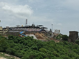
Tiruttani is a historic temple town situated in the Tiruvallur district and serves as a suburb of Chennai within the Chennai Metropolitan Area in the southern Indian state of Tamil Nadu. The town is famous for the Tiruttani Murugan Temple, an ancient Hindu temple dedicated to Kartikeya, also known as Murugan, the Hindu god of war. This temple is one of the Arupadaiveedu, a group of six significant abodes of Murugan. Tiruttani was officially incorporated into the Chennai Metropolitan Area in October 2022, signifying its growing importance and influence within the region..
Chhota Gobindpur is a census town in the Golmuri-cum-Jugsalai CD block in the Dhalbhum subdivision of the Purbi Singhbhum district in the state of Jharkhand, India.
Gomoh (better known as Netaji Subhash Chandra Bose Junction Gomoh) is a census town in Topchanchi CD Block Dhanbad Sadar subdivision of Dhanbad district in the Indian state of Jharkhand. It has a major railway junction, which was renamed Netaji Subhas Chandra Bose Gomoh railway station on 23 January 2009, that is situated on the Grand Chord Line under the Dhanbad division of the East Central Railway. Gomoh is the meeting point for trains coming from Howrah, Ranchi/Bokaro and Puri/Bhubaneswar.
Kharkhari is a census town in Baghmara CD block in Dhanbad Sadar subdivision of Dhanbad district in the Indian state of Jharkhand.
Musabani, also spelt as Mosabani or Mushabani, is a census town in the Musabani CD block in the Ghatshila subdivision of the East Singhbhum district in the Indian state of Jharkhand.
Nirsa is a census town in Nirsa CD block in the Dhanbad Sadar subdivision of Dhanbad district in the Indian state of Jharkhand.
Partur is a town with municipal council in Jalna district in the Indian state of Maharashtra.
Pondar Kanali is a census town in Dhanbad CD block in Dhanbad Sadar subdivision of Dhanbad district in the Indian state of Jharkhand.

Rishra is a city and a municipality in Srirampore subdivision of Hooghly district in the Indian state of West Bengal. It is a part of the area covered by Kolkata Metropolitan Development Authority (KMDA).

Turuvekere is a panchayat town and Taluk in Tumakuru district in the Indian state of Karnataka.
Tati is a census town in the Namkum CD block in the Ranchi Sadar subdivision of Ranchi district in the Indian state of Jharkhand.

Stone Mills is a lower-tier township north of Greater Napanee in Lennox and Addington County, Ontario, Canada. According to the 2016 census, the township has a population of 7,702.

The economy of the state of Maharashtra is the largest in India. Maharashtra is India's second most industrialised state contributing 20% of national industrial output. Almost 46% of the GSDP is contributed by industry. Maharashtra has software parks in many cities around the state, and is the second largest exporter of software with annual exports over ₹ 80,000 crores.
Kanathur is a village in Turvekere taluk of Tumkur district, in the Indian state of Karnataka.
Chandwara is a community development block that forms an administrative division in the Koderma subdivision of the Koderma district, Jharkhand state, India.
Taldi is a census town and a gram panchayat in the Canning I CD block in the Canning subdivision of the South 24 Parganas district in the Indian state of West Bengal.


