Hamilton Park, also known as Brewster Park and Howard Avenue Grounds, was a sports venue in New Haven, Connecticut, located at the intersection of Whalley Avenue and West Park Avenue.

Fredrikstad fortress was a fortification in Fredrikstad, Norway. It was the base of the Østfold Regiment, with defence related responsibilities for the east side of Oslofjord.

The A194 road is a road in Tyne and Wear, England. It runs northeast from its start at junction 65 of the A1(M) near Washington, and the first 3 miles (4.8 km) are motorway standard, designated the A194(M). There are intermediate junctions with the A182 and the A195 before the motorway section ends at the A184 junction. The junctions were unnumbered until 2013 when they were designated J1 to J3.
Quatre is one of the Grenadines islands which lie between the Caribbean islands of Saint Vincent and Grenada. It is part of the nation of Saint Vincent and the Grenadines.

Bagrami is a town situated in the eastern fringes of Kabul at 34.4911°N 69.2756°E and 1797 m altitude, part of city District 12. The population is 31,680. Downtown Kabul can be reached in 30 minutes, so it's becoming a suburb. The Bagrami Industrial Park is one of the major projects for the economy of the region. In 2010 the town also harboured a shanty town of mud-built huts from refugees escaping the violence of the Taliban insurgency in the southern provinces of Afghanistan.

Visitation Park is a neighborhood of St. Louis, Missouri. The neighborhood is defined by Maple Avenue on the North, Delmar Boulevard on the South, Union Boulevard on the East, and Belt Avenue on the West. Visitation Park is a small neighborhood nestled southeast of the West End neighborhood, just north of DeBaliviere Place.
Middleton Hall is a restored 17th-century country house at Stoney Middleton, Derbyshire. It is a Grade II listed building.
Machary is a village in the administrative district of Gmina Strzelce Krajeńskie, within Strzelce-Drezdenko County, Lubusz Voivodeship, in western Poland.
Burtnieki Parish is an administrative territorial entity of the Valmiera District, Latvia.
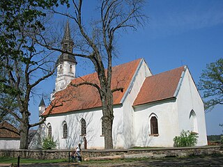
Křešín is a village and municipality in Příbram District in the Central Bohemian Region of the Czech Republic.
Tehuitzingo Municipality is a municipality in Puebla in south-eastern Mexico.
Svartdalskollen is a mountain of Oppland, in southern Norway.

The Sanriku Coast is a coastal region on the Pacific Ocean, extending from southern Aomori prefecture, through Iwate prefecture and northern Miyagi prefecture in northeastern Honshū, which is Japan's main island. The name comes from the historical region of Sanriku, referring to the former provinces of Rikuō, Rikuchū and Rikuzen.
Gradište is a village in Serbia in the municipality Merošina in Nisava district. According to the census of 2002, there were 596 people. In the near Gradiste, is the archeological site Kulina.
The Fat Cat is a pub at 49 West End Street, Norwich, Norfolk, England.
Kalka is one of the 90 assembly seats of Haryana. Kalka is a part of Panchkula district.
Marshall Township is an inactive township in Platte County, in the U.S. state of Missouri.
Khaguria high School is a boy's high school located in Dighali, Lakshmipur, Bangladesh. It is one of the oldest schools in the country. The school was established in 1988 Lakshmipur Sadar Upazila, Bangladesh. It was established in 1886 by the summit of local advocates and authorised by The school is under the Board of Intermediate and Secondary Education, Comilla.
Sungei Tampines is a river in Tampines, Singapore. It is named for a type of tree that reportedly grew in the area, Streblus elongatus, commonly known as "tempinis".

Atgharia is a village and a gram panchayat in Kalna I CD block in Kalna subdivision of Purba Bardhaman district in the Indian state of West Bengal.


