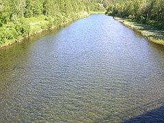
The Torne, also known as the Tornio, is a river in northern Sweden and Finland. For approximately half of its length it defines the border between these two countries. It rises at Lake Torne near the border with Norway and flows generally southeast for a distance of 522 kilometres (324 mi) into the Gulf of Bothnia. It is the largest river in Norrbotten both by length and by watershed area.
The Dunderland Valley is a valley in the municipality of Rana in Nordland county, Norway. It reaches from just below the eastern Saltfjellet plateau about 8 miles (13 km) south of the Arctic circle. The mountain Bolna is situated in the uppermost boundary of the valley which then proceeds to the southwest all the way down to the Ranfjorden. Some of the minor side valleys include Plurdalen, Røvassdalen, Bjøllådalen, Grønfjelldalen and Virvassdalen. The valley also includes several villages such as Krokstrand, Bjøllånes, Storvoll, Dunderland, Eiterå, Nevernes, Storforshei, Nevermoen and Røssvoll.

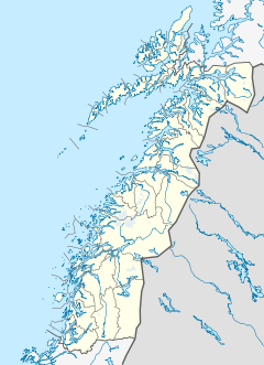
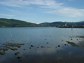
The Ranfjorden is a fjord in the Helgeland district of Nordland county, Norway. The largest part of the fjord is in the municipality of Rana, but the fjord also passes through the municipalities of Hemnes, Vefsn, Leirfjord, Nesna, and Dønna. The river Ranelva meets the Ranfjord in at the town of Mo i Rana at the innermost part of the fjord. It then flows to the west for about 68 kilometres (42 mi) to where it meets the sea along the border of Dønna and Nesna municipalities.
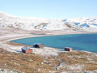
Bogvatnet (Norwegian) or Tjoamodisjávrre (Lule Sami) is a lake in the municipality of Rana in Nordland county, Norway. The lake is located inside the Saltfjellet–Svartisen National Park, about 40 kilometres (25 mi) north of the town of Mo i Rana. The glacial lake is also the headwaters of the Blakkåga river, a tributary to the main river Ranelva.
Nordre Bjøllåvatnet (Norwegian) or Bajep Ruovdajávrre (Lule Sami) is a lake that lies in the municipality of Saltdal in Nordland county, Norway. The 9.93-square-kilometre (3.83 sq mi) lake is located inside Saltfjellet–Svartisen National Park, about 1 kilometre (0.62 mi) east of the border with the municipality of Beiarn and north of the border with the municipality of Rana. The lake flows out through the river Bjøllåga and ultimately into the river Ranelva.

Raudvatnet is a lake in the municipality of Rana in Nordland county, Norway. The European route E12 highway passes along the northern and eastern shores of the lake between the town of Mo i Rana and the border with Sweden. A Red cross hut (Rauvasshytta) is located east of the lake Raudvatnet. Water flows into the lake Raudvatnet primarily from the nearby lake Tverrvatnet to the south. From Raudvatnet, the water flows into the river Tverråga, a tributary to the main river Ranelva.

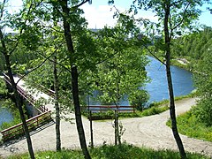
Ranelva is a 130-kilometre (81 mi) long river in the municipality of Rana in Nordland county, Norway. It is one of the longest rivers in Nordland county. The catchment area of the river is 3,790 square kilometres (1,460 sq mi). Before the power stations of Reinforsen (1925) and Langvatnet (1964) were built, the catchment area was 3,843 square kilometres (1,484 sq mi).
Langvassåga is a river that flows out of the lake Langvatnet in the municipality of Rana in Nordland county, Norway. It flows in a southeastern direction and almost immediately, it is joined by the river Røvassåga. It then continues a short distance southwards before joining the main river Ranelva, just south of the village of Røssvoll. The Langvassåga catchment area covers about 1,114 square kilometres (430 sq mi). The river passes by the Mo i Rana Airport, Røssvoll.

Plura is a river in the municipality of Rana in Nordland county, Norway. The river begins at the lake Kallvatnet, flows through the Plurdalen valley, and ends up as a tributary to the river Ranelva, about 10 kilometres (6.2 mi) north of the town of Mo i Rana. The river is rich with salmon, trout, and Arctic char. The name comes from the Norwegian verb "prula" which means "boiling" or "seething".

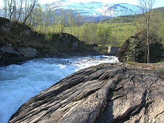
Grønfjellåga is a river in the municipality of Rana in Nordland county, Norway. The 17-kilometre (11 mi) long river's source is the lakes Kallvatnet and Kopparvatnet. It then flows through the Grønfjelldalen valley while absorbing several smaller rivers, before it flows out as a tributary to the river Ranelva at the Dunderforsen waterfall.
Messingåga (Norwegian) or Siejphjohke (Southern Sami) is a 8-kilometre (5.0 mi) long river which flows northwards, ending up as a tributary to the river Ranelva at Hjartåsen in the small village of Storvoll in the Dunderland Valley in the municipality of Rana in Nordland county, Norway. The river should not be confused with the nearby stream, also named Messingåga, which flows into the river Ranelva from the east, just north of the village of Dunderland.

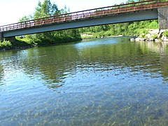
Selfors is a village in the municipality of Rana in Nordland county, Norway. Selfors sits on the northern shore of the river Ranelva and it is a northeastern suburb of the town of Mo i Rana. The European route E06 highway passes through the village. Selfors has been inhabited since the Iron age.

Virvasselva or Virvassåga (Norwegian) or Viresjåhkå (Lule Sami) is a river in the municipality of Rana in Nordland county, Norway. The river flows out of the eastern part of the lake Virvatnet. The stream Boneselva meets Virvasselva about 1 kilometre (0.62 mi) east of the lake Virvatnet. This is a large, continuous, very rich and untouched wetland area with tarns, rivers, marshes, and very tight vegetation. Virvasselva has a good population of Arctic char.

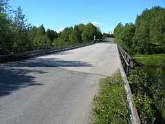
The Illhøllia Tunnel is a 1,262-metre (4,140 ft) long tunnel on European route E06 in the Dunderland Valley in the municipality of Rana in Nordland county, Norway. The tunnel was opened in 2002. The tunnel is located in an area with very steep mountains along the Ranelva river. Before the opening of the tunnel, European route E06 had to be continuously repaired because the road was about to collapse into the river due to erosion from the small brooks flowing down the mountains and going beneath the road.

Eiteråga or Eiterå is a village in the Dunderland Valley in the municipality of Rana in Nordland county, Norway. The village is located along the Ranelva river about 7 kilometres (4.3 mi) east of the village of Storforshei and about 10 kilometres (6.2 mi) south of the village of Dunderland. The European route E6 highway passes through the village. "Stjernen Art and Silver Gallery" is a local shop that produces pieces of jewelry from silver and precious stones.
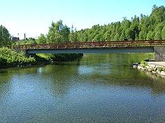
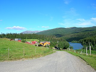
Skonseng is a village in the municipality of Rana in Nordland county, Norway. The village is located about 10 kilometres (6.2 mi) northeast of the town of Mo i Rana in an agricultural area with a population of about 1000. The village is located along the south side of the river Ranelva where three valleys meet each other: the Dunderland Valley, Plurdal, and Rødvassdal. The village of Røssvoll lies on the north side of the river, just across from Skonseng. The Nordland Line passes through the village.

Tverrvatnet or Tvervatnet [tvær'vatne] is a lake in the municipality of Rana in Nordland county, Norway. The European route E12 highway passes along the northern and eastern shores of the lake between the town of Mo i Rana and the border with Sweden. Tverrvatnet gets its name from the fact that it is located "across", in a north-south direction, while most lakes in Rana are located in an east-west direction.
Røssvoll is a village in the municipality of Rana in Nordland county, Norway. The village is located about 10 kilometres (6.2 mi) north-east of the town of Mo i Rana. The village is located along the north side of the river Ranelva. The European route E06 highway passes through the village, passing right by Røssvoll Church in the centre of the village. Mo i Rana Airport, Røssvoll is also located here.