Ranelva

Last updated
Ranelva
Illhollia seen from South.JPG
Norway Nordland location map.svg
Red pog.svg
Location of the river
Relief Map of Norway.png
Red pog.svg
Ranelva (Norway)
Location
Country Norway
County Nordland
Municipalities Rana Municipality
Physical characteristics
Source Saltfjellet
 - location Rana, Norway
 - coordinates 66°29′32″N15°14′15″E / 66.49222°N 15.23750°E / 66.49222; 15.23750
 - elevation540 metres (1,770 ft)
Mouth Ranfjorden
 - location
Mo i Rana, Norway
 - coordinates
66°20′9″N14°09′49″E / 66.33583°N 14.16361°E / 66.33583; 14.16361 Coordinates: 66°20′9″N14°09′49″E / 66.33583°N 14.16361°E / 66.33583; 14.16361
 - elevation
0 metres (0 ft)
Length130 km (81 mi)
Basin size3,790 km2 (1,460 sq mi)

Ranelva is a 130-kilometre (81 mi) long river in the municipality of Rana in Nordland county, Norway. It is one of the longest rivers in Nordland county. [1] The catchment area of the river is 3,790 square kilometres (1,460 sq mi). Before the power stations of Reinforsen (1925) and Langvatnet (1964) were built, the catchment area was 3,843 square kilometres (1,484 sq mi). [2] [3]

Rana, Norway Municipality in Nordland, Norway

Rana is a municipality in Nordland county, Norway. It is part of the Helgeland traditional region. The administrative centre of the municipality is the town of Mo i Rana, which houses the National Library of Norway. Other population centers in Rana include Alterneset, Båsmoen, Dunderland, Eiteråga, Flostrand, Hauknes, Mæla, Myklebustad, Nevernes, Røssvoll, Selfors, Skonseng, Storforshei, Utskarpen, and Ytteren.

Nordland County (fylke) of Norway

Nordland is a county in Norway in the Northern Norway region, bordering Troms in the north, Trøndelag in the south, Norrbotten County in Sweden to the east, Västerbotten County to the southeast, and the Atlantic Ocean to the west. The county was formerly known as Nordlandene amt. The county administration is in Bodø. The remote Arctic island of Jan Mayen has been administered from Nordland since 1995.

Norway constitutional monarchy in Northern Europe

Norway, officially the Kingdom of Norway, is a Nordic country in Northern Europe whose territory comprises the western and northernmost portion of the Scandinavian Peninsula; the remote island of Jan Mayen and the archipelago of Svalbard are also part of the Kingdom of Norway. The Antarctic Peter I Island and the sub-Antarctic Bouvet Island are dependent territories and thus not considered part of the kingdom. Norway also lays claim to a section of Antarctica known as Queen Maud Land.

Contents

Path

The river begins on the Saltfjellet plateau, near the border between Norway and Sweden, at the confluence of the little rivers Randalselva (Southern Sami : Goabdesjåhkå) and Gubbeltåga (Lule Sami : Gubbeltædno). The river then flows mainly in a western-southwestern direction. [4] On its way southwestwards, the river is joined by the river Virvasselva from south. The part of the Ranelva river between its beginning and its joining with Virvasselva is called Ruovadajåhkå in Lule Sami language.

Saltfjellet mountain range in Nordland, Norway

Saltfjellet is a mountain area in Nordland county, Norway that separates the two regions of Helgeland and Salten. It is also a cultural border between the Southern and Central parts of Sápmi.

Sweden constitutional monarchy in Northern Europe

Sweden, officially the Kingdom of Sweden, is a Scandinavian Nordic country in Northern Europe. It borders Norway to the west and north and Finland to the east, and is connected to Denmark in the southwest by a bridge-tunnel across the Öresund, a strait at the Swedish-Danish border. At 450,295 square kilometres (173,860 sq mi), Sweden is the largest country in Northern Europe, the third-largest country in the European Union and the fifth largest country in Europe by area. Sweden has a total population of 10.2 million of which 2.5 million have a foreign background. It has a low population density of 22 inhabitants per square kilometre (57/sq mi). The highest concentration is in the southern half of the country.

Confluence Meeting of two or more bodies of flowing water

In geography, a confluence occurs where two or more flowing bodies of water join together to form a single channel. A confluence can occur in several configurations: at the point where a tributary joins a larger river ; or where two streams meet to become the source of a river of a new name ; or where two separated channels of a river rejoin at the downstream end.

Near Storvollen, the rivers Bjøllåga, Tespa, and Stormdalsåga all join Ranelva from the north and the river Messingåga joins from the south. It continues in a southwestern direction through the Dunderland Valley. The rivers Grønfjellåga and Plura join the Ranelva in this valley.

Bjøllåga river in Nordland, Norway

Bjøllåga or Bjellåga (Norwegian) or Biellok or Biellok-jåhkå (Lule Sami) is a river in Nordland county, Norway. It flows from the lake Nordre Bjøllåvatnet in Saltdal Municipality, through the valley of Bjøllådalen in the Saltfjellet mountains, within the Saltfjellet–Svartisen National Park, and joins with the river Ranelva in Rana Municipality.

Tespa is a North American collegiate esports organization headquartered in the offices of Blizzard Entertainment in Irvine, California. Founded in 2012 as a collegiate gaming club at the University of Texas, Austin, Tespa expanded nationally in 2013 as an event support network for college gaming organizations. In 2014, the company announced an official partnership with Blizzard Entertainment, hosting online leagues for Hearthstone, League of Legends, StarCraft II, Heroes of the Storm, and Overwatch.

Messingåga river in Rana, Norway

Messingåga (Norwegian) or Siejphjohke (Southern Sami) is a 8-kilometre (5.0 mi) long river which flows northwards, ending up as a tributary to the river Ranelva at Hjartåsen in the small village of Storvoll in the Dunderland Valley in the municipality of Rana in Nordland county, Norway. The river should not be confused with the nearby stream, also named Messingåga, which flows into the river Ranelva from the east, just north of the village of Dunderland.

Southwest of the small village Røssvoll, Ranelva meets the river Langvassåga which empties the lake Langvatnet. Further down, at Selfors, the river Revelelva (the name of the lowest parts of the river Tverråga) joins the Ranelva. The river Ranelva empties into the Ranfjorden just south of Ytteren in Mo i Rana.

Røssvoll Village in Northern Norway, Norway

Røssvoll is a village in the municipality of Rana in Nordland county, Norway. The village is located about 10 kilometres (6.2 mi) north-east of the town of Mo i Rana. The village is located along the north side of the river Ranelva. The European route E06 highway passes through the village, passing right by Røssvoll Church in the centre of the village. Mo i Rana Airport, Røssvoll is also located here.

Langvassåga river in Rana, Norway

Langvassåga is a river that flows out of the lake Langvatnet in the municipality of Rana in Nordland county, Norway. It flows in a southeastern direction and almost immediately, it is joined by the river Røvassåga. It then continues a short distance southwards before joining the main river Ranelva, just south of the village of Røssvoll. The Langvassåga catchment area covers about 1,114 square kilometres (430 sq mi). The river passes by the Mo i Rana Airport, Røssvoll.

Langvatnet (Rana) lake in Rana, Norway

Langvatnet is a lake in the municipality of Rana in Nordland county, Norway. The 26.38-square-kilometre (10.19 sq mi) lake lies just northwest of the town of Mo i Rana. The lake flows out into the river Langvassåga just north of Mo i Rana Airport, Røssvoll. The lake used as a reservoir for the Langvatn hydroelectric power plant in the village of Ytteren, just down the hill from the lake.

The river receives water from Storakersvatnet via Rana Hydroelectric Power Station.

Storakersvatnet lake in Rana, Nordland, Norway

Storakersvatnet or Akersvatnet is a lake in the municipality of Rana in Nordland county, Norway. The lake lies about 15 kilometres (9.3 mi) south of the town of Mo i Rana and less than 900 metres (3,000 ft) from the border with Sweden. The original lake was only 15.9 square kilometres (6.1 sq mi), but a dam was built at the northern end so that it can serve as a reservoir for the Rana power station. This dam has caused the lake to enlarge to an area of 42.3 square kilometres (16.3 sq mi).

Rana Hydroelectric Power Station building in Rana, Northern Norway

The Rana Power Station is a hydroelectric power station located in Rana, Nordland, Norway. It operates at an installed capacity of 500 MW, with an average annual production of about 2,100 GWh. The station is owned by Statkraft. In terms of annual production in Norway the station is second only to Svartisen Hydroelectric Power Station.

Fishing

Ranelva is a popular river for fishing. It is very rich with salmon and trout. One of the largest salmon tunnels in Norway (385 metres or 1,263 feet long) is located at the Reinforsen waterfall, and was built in 1956.

Fishing Activity of trying to catch fish

Fishing is the activity of trying to catch fish. Fish are normally caught in the wild. Techniques for catching fish include hand gathering, spearing, netting, angling and trapping. “Fishing” may include catching aquatic animals other than fish, such as molluscs, cephalopods, crustaceans, and echinoderms. The term is not normally applied to catching farmed fish, or to aquatic mammals, such as whales where the term whaling is more appropriate. In addition to being caught to be eaten, fish are caught as recreational pastimes. Fishing tournaments are held, and caught fish are sometimes kept as preserved or living trophies. When bioblitzes occur, fish are typically caught, identified, and then released.

Salmon Family of fish related to trout

Salmon is the common name for several species of ray-finned fish in the family Salmonidae. Other fish in the same family include trout, char, grayling and whitefish. Salmon are native to tributaries of the North Atlantic and Pacific Ocean. Many species of salmon have been introduced into non-native environments such as the Great Lakes of North America and Patagonia in South America. Salmon are intensively farmed in many parts of the world.

Trout Number of species of freshwater fish

Trout is the common name for a number of species of freshwater fish belonging to the genera Oncorhynchus, Salmo and Salvelinus, all of the subfamily Salmoninae of the family Salmonidae. The word trout is also used as part of the name of some non-salmonid fish such as Cynoscion nebulosus, the spotted seatrout or speckled trout.

Ranelva was cleansed with rotenone in 1996, 2004, and 2005 beneath the Sjøforsen waterfall, in order to remove the salmon parasite Gyrodactylus salaris, which was registered there for the first time in 1975. [5]

Storvoll

Illhøllia

Reinforsen ("Reindeer waterfall")

Selfors

Fossetangen

See also

Related Research Articles

Ranfjord fjord in Nordland, Norway

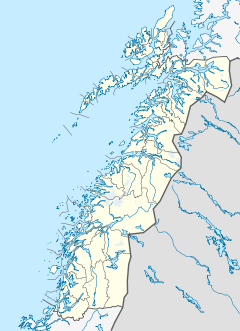
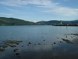
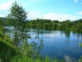
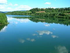
The Ranfjorden is a fjord in the Helgeland district of Nordland county, Norway. The largest part of the fjord is in the municipality of Rana, but the fjord also passes through the municipalities of Hemnes, Vefsn, Leirfjord, Nesna, and Dønna. The river Ranelva meets the Ranfjord in at the town of Mo i Rana at the innermost part of the fjord. It then flows to the west for about 68 kilometres (42 mi) to where it meets the sea along the border of Dønna and Nesna municipalities.

Bogvatnet lake in Rana, Norway

Bogvatnet (Norwegian) or Tjoamodisjávrre (Lule Sami) is a lake in the municipality of Rana in Nordland county, Norway. The lake is located inside the Saltfjellet–Svartisen National Park, about 40 kilometres (25 mi) north of the town of Mo i Rana. The glacial lake is also the headwaters of the Blakkåga river, a tributary to the main river Ranelva.

Kjelvatnet (Fauske) lake in Fauske, Norway

Kjelvatnet (Norwegian) or Giebbnejávrre or Giebnejávri (Lule Sami) is a lake in Fauske Municipality in Nordland county, Norway. The 3.85-square-kilometre (1.49 sq mi) lake lies about 7 kilometres (4.3 mi) south of the village of Sulitjelma near the border with Junkerdal National Park. Water flows into the lake from the large lake Balvatnet and it flows out of the lake to the north along the Balmi River to the lake Langvatnet.

Langvatnet (Sørfold) lake in Sørfold, Norway

Langvatnet (Norwegian) or Guhkesjávrre (Lule Sami) is a lake that lies in the municipality of Sørfold in Nordland county, Norway. The 13.97-square-kilometre (5.39 sq mi) lake is located about 30 kilometres (19 mi) northeast of the village of Straumen, just north of Rago National Park and the border with Sweden.

Langvatnet (Tysfjord) lake on the Norway-Sweden border

Langvatnet (Norwegian) or Tjoaddnejávrre  (Lule Sami) is a lake that lies on the border between Norway and Sweden. Almost all of the lake is located in Tysfjord Municipality in Nordland county, Norway with a very small part of the lake in Jokkmokk Municipality in Norrbotten County, Sweden. The 5.46-square-kilometre (2.11 sq mi) lake is located about 20 kilometres (12 mi) southeast of the village of Kjøpsvik in Tysfjord.

Nordre Bjøllåvatnet lake in Saltdal, Norway

Nordre Bjøllåvatnet (Norwegian) or Bajep Ruovdajávrre (Lule Sami) is a lake that lies in the municipality of Saltdal in Nordland county, Norway. The 9.93-square-kilometre (3.83 sq mi) lake is located inside Saltfjellet–Svartisen National Park, about 1 kilometre (0.62 mi) east of the border with the municipality of Beiarn and north of the border with the municipality of Rana. The lake flows out through the river Bjøllåga and ultimately into the river Ranelva.

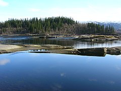
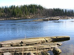
Revelelva is the native name of the lowest part of the river Tverråga, which has its outlet in Ranelva in Rana municipality in Nordland county, Norway. The river change its name at the bridge connecting European route E6 with Gruben. Before this bridge it is called Tverråga. Passing this bridge, it is called Revelelva.

Tverråga river in Rana, Norway

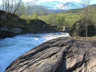
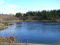
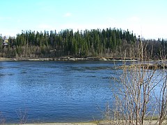
Tverråga is a river in the municipality of Rana in Nordland county, Norway. The river flows from lake Tverrvatnet north until it joins the river Ranelva. The river absorbs seven other rivers during its course, the last one by Hamaren near the village of Gruben.

Selfors Village in Northern Norway, Norway

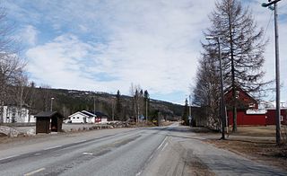
Selfors is a village in the municipality of Rana in Nordland county, Norway. Selfors sits on the northern shore of the river Ranelva and it is a northeastern suburb of the town of Mo i Rana. The European route E06 highway passes through the village. Selfors has been inhabited since the Iron age.

Virvasselva river in Rana, Norway

Virvasselva or Virvassåga (Norwegian) or Viresjåhkå (Lule Sami) is a river in the municipality of Rana in Nordland county, Norway. The river flows out of the eastern part of the lake Virvatnet. The stream Boneselva meets Virvasselva about 1 kilometre (0.62 mi) east of the lake Virvatnet. This is a large, continuous, very rich and untouched wetland area with tarns, rivers, marshes, and very tight vegetation. Virvasselva has a good population of Arctic char.

Bolna, Rana mountain in Rana, Norway

Bolna (Norwegian) or Bållná (Lule Sami) is a mountain in the Saltfjellet mountain range in the municipality of Rana in Nordland county, Norway. The mountain peak reaches 1,460 metres (4,790 ft) above sea level, and is located just north of the Arctic Circle inside Saltfjellet–Svartisen National Park. The mountain peak is located less than 2 kilometres (1.2 mi) west of the municipal border with Saltdal and about 15 kilometres (9.3 mi) west of the border with Sweden.

Ytteren Village in Northern Norway, Norway

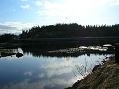
Ytteren is a village in the municipality of Rana in Nordland county, Norway. Ytteren and the neighboring village of Båsmoen are northern suburbs of the town of Mo i Rana. They are both located on the northern edge of the mouth of the Ranelva river at the Ranfjorden. Norwegian County Road 12 runs through the village. The large lake Langvatnet lies about 2 kilometres (1.2 mi) north of the village.

Gubbeltåga river in Rana, Norway

Gubbeltåga (Norwegian) or Gubbeltædno (Lule Sami) is a river in the municipality of Rana in Nordland county, Norway, which flows in a southern and southwestern direction. The 15-kilometre (9.3 mi) long river begins at the drainage divide on the Saltfjellet plateau in the north. On its direction mainly southwards, it meets and becomes a part of Randalselva, which has its beginning in the Norwegian-Swedish border regions. At Elvmøthei in the Dunderland Valley, Randalselva then meets Virvasselva and thus forms the beginning of Ranelva.

Balmi River river in Fauske, Norway

The Balmi River is a river in the municipality of Fauske in Nordland county, Norway. It flows about 6.5 km (4.0 mi) from one lake and empties into another: from Kjelvatnet at an elevation of 510 meters (1,670 ft) north to Langvatnet at an elevation of 127 meters (417 ft). The river has a drainage basin of 439 square kilometers (169 sq mi). The river is located a short distance south of the village of Sulitjelma and about 35 kilometres (22 mi) southeast of the Fauske.

Daja Hydroelectric Power Station building in Sulitjelma, Northern Norway

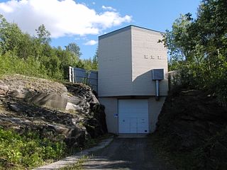
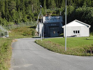
The Daja Hydroelectric Power Station is a hydroelectric power station in the municipality of Fauske in Nordland county, Norway. It is located about 2.3 kilometers (1.4 mi) east-southeast of Jakobsbakken.

Sundsfjord Hydroelectric Power Station building in Gildeskål, Northern Norway

The Sundsfjord Hydroelectric Power Station is a hydroelectric power station in the municipality of Gildeskål in Nordland county, Norway. Part of the plant's catchment area also lies in the municipality of Beiarn.

Langvann Hydroelectric Power Station building in Gildeskål, Northern Norway

The Langvann Hydroelectric Power Station is a hydroelectric power station in the municipality of Gildeskål in Nordland county, Norway. It is sometimes referred to as the Langvatn kraftverk, which should not be confused with the Langvatn Hydroelectric Power Station in Rana.

References

  1. "Ranelva". Archived from the original on 2012-03-10. Retrieved 4 Aug 2010.
  2. Petterson, Lars-Evan (January 2004). Flomsonekartprosjektet Flomberegning for Ranelva (156.Z) (PDF) (in Norwegian). Norges vassdrags- og energidirektorat. ISSN   1501-2840.
  3. Store norske leksikon. "Rana – elv" (in Norwegian). Retrieved 2011-12-19.
  4. "Ranelva River" . Retrieved 4 Aug 2010.
  5. Bevaringsgruppa, Rana. Ranaelva. Plan for fiskebevaringsarbeid og dødfiskoppsamling i forbindelse med rotenonbehandlingen 2003-04 (in Norwegian).