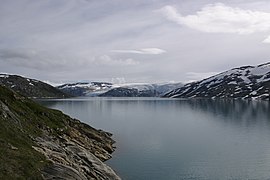
Nordland is one of the three northernmost counties in Norway in the Northern Norway region, bordering Troms in the north, Trøndelag in the south, Norrbotten County in Sweden to the east, Västerbotten County to the south-east, and the Atlantic Ocean to the west. The county was formerly known as Nordlandene amt. The county administration is in the town of Bodø. The remote Arctic island of Jan Mayen has been administered from Nordland since 1995. In the southern part of the county is Vega, listed on the UNESCO World Heritage Site list.

Meløy is a municipality in Nordland county, Norway. It is part of the Salten traditional region. The administrative centre of the municipality is the village of Ørnes. Other villages include Eidbukt, Neverdal, Glomfjord, Halsa, Reipå, Støtt, and Ågskardet.

Saltdal is a municipality in Nordland county, Norway. It is part of the traditional district of Salten. The administrative centre of the municipality is the village of Rognan. Other villages in Saltdal include Røkland, Lønsdal, Langset, and Saksenvika.

(Norwegian) or Fuossko (Lule Sami) is a municipality located in Nordland county, Norway. It is part of the traditional district of Salten. The administrative centre of the municipality is the town of Fauske. Some of the villages in Fauske include Nystad, Venset, Straumsnes, Sjønstå, Valnesfjord, Finneid, and Sulitjelma.
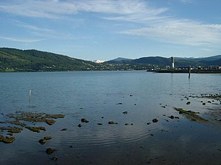
Rana (Norwegian) or Raane (Southern Sami) is a municipality in Nordland county, Norway. It is part of the Helgeland traditional region. The administrative centre of the municipality is the town of Mo i Rana, which houses the National Library of Norway. Other population centers in Rana include Båsmoen, Dunderland, Eiteråga, Flostrand, Hauknes, Myklebustad, Nevernes, Røssvoll, Selfors, Sjonbotn, Skonseng, Storforsheia, Utskarpen, and Ytteren.
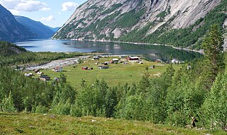
Northern Norway is a geographical region of Norway, consisting of the three northernmost counties Nordland, Troms and Finnmark, in total about 35% of the Norwegian mainland. Some of the largest towns in Northern Norway are Mo i Rana, Bodø, Narvik, Harstad, Tromsø and Alta. Northern Norway is often described as the land of the midnight sun and the land of the northern lights. Farther north, halfway to the North Pole, is the Arctic archipelago of Svalbard, traditionally not regarded as part of Northern Norway.

Helgeland is the most southerly district in Northern Norway. Generally speaking, Helgeland refers to the part of Nordland county that is located south of the Arctic Circle. It is bordered in the north by the Saltfjellet mountains and Svartisen glacier, which form a natural border with the Salten district. In the south, Helgeland borders Trøndelag county.
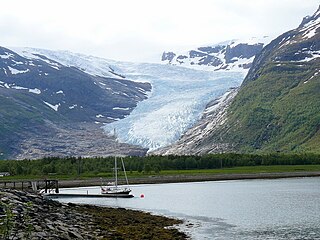
Svartisen is a collective term for two glaciers located in Nordland county in northern Norway. It is part of Saltfjellet-Svartisen National Park, located in the Saltfjell mountain range. The glaciers are located in the municipalities of Beiarn, Meløy, Rana, and Rødøy. Svartisen consists of two separate glaciers that are separated by the 1-kilometre (0.62 mi) long Vesterdalen valley. The two glaciers are:

Saltfjellet–Svartisen National Park is a national park in Nordland county in Norway. It is located within the municipalities of Beiarn, Meløy, Rana, Rødøy, Saltdal, and Bodø. The European route E6 highway and the Nordland Line railway both follow the southern and eastern borders around the park. The park's eastern border is the Norway-Sweden border and a portion of this border is shared with the Vindelfjällen Nature Reserve which lies in Sweden.
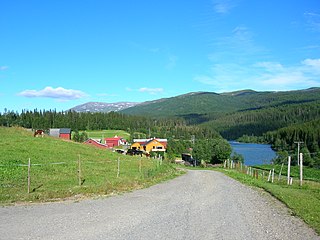
The Dunderland Valley is a valley in Rana Municipality in Nordland county, Norway. It reaches from just below the eastern Saltfjellet plateau about 8 miles (13 km) south of the Arctic Circle. The mountain Bolna is situated in the uppermost boundary of the valley which then proceeds to the southwest all the way down to the Ranfjorden. Some of the minor side valleys include Plurdalen, Røvassdalen, Bjøllådalen, Grønfjelldalen and Virvassdalen. The valley also includes several villages such as Krokstrand, Bjøllånes, Storvoll, Dunderland, Eiterå, Nevernes, Storforshei, Nevermoen and Røssvoll.
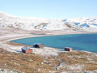
Nordre Bjøllåvatnet (Norwegian) or Bajep Ruovdajávrre (Lule Sami) is a lake that lies in Saltdal Municipality in Nordland county, Norway. The 9.93-square-kilometre (3.83 sq mi) lake is located inside Saltfjellet–Svartisen National Park, about 1 kilometre (0.62 mi) east of the border with Beiarn Municipality and north of the border with Rana Municipality. The lake flows out through the river Bjøllåga and ultimately into the river Ranelva.
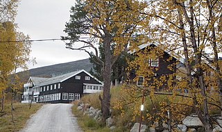
Lønsdal (Norwegian) or Luonosvágge (Lule Sami) is a village in Saltdal Municipality in Nordland county, Norway. The village is located in the Lønsdal valley, along the Lønselva river. The European route E06 highway and the Nordland Line railway both pass through the village. The village also has a train station on the Nordland Line, about halfway between Dunderland Station and Røkland Station.

Bolna (Norwegian) or Bållná (Lule Sami) is a mountain in the Saltfjellet mountain range in Rana Municipality in Nordland county, Norway. The mountain peak reaches 1,460 metres (4,790 ft) above sea level, and is located just north of the Arctic Circle inside Saltfjellet–Svartisen National Park. The mountain peak is located less than 2 kilometres (1.2 mi) west of the border with Saltdal Municipality and about 15 kilometres (9.3 mi) west of the border with Sweden.
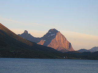
Tjongsfjorden is a fjord in Rødøy Municipality in Nordland county, Norway. The 17-kilometre (11 mi) long fjord begins just west of the Svartisen glacier; it flows west and flows into the Rødøyfjorden, which is just east of the island of Rødøya. The mountain, Blokktinden, lies on the southern shore. The village, Tjong and Vågaholmen, lie along the northern shore. Norwegian County Road 17, running across Nordland and Trøndelag counties, runs along the inner part of the fjord.

Melfjorden is a fjord in Rødøy Municipality in Nordland county, Norway. It is located on the Arctic Circle. The 33-kilometre (21 mi) long fjord goes from the village of Melfjordbotn in the east to its mouth in the Rødøyfjorden near the island of Rangsundøya. There are two fjord arms that branch off the main fjord: Nordfjorden flows to the north into the Saltfjellet–Svartisen National Park and Sørfjorden to the south past the villages of Sørfjorden and Kilboghavn.
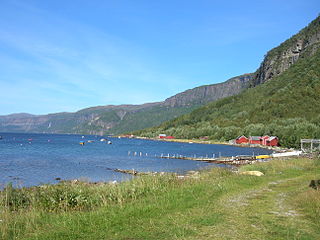
Melfjordbotn or Melfjorden is a village in Rødøy Municipality in Nordland county, Norway. The village is located at the eastern end of the Melfjorden, southwest of the Svartisen glacier. The Saltfjellet–Svartisen National Park lies about 7 kilometres (4.3 mi) north of the village.
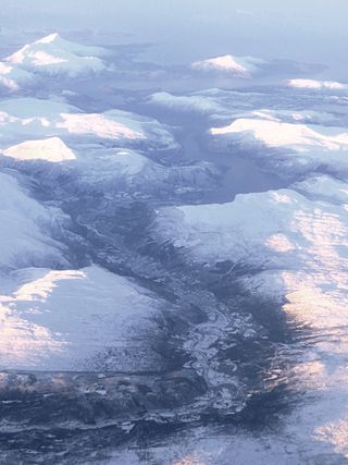
The Beiar River is a river in Beiarn Municipality in Nordland, Norway. The river begins at the Svartisen glacier high in the mountains near the municipal borders of Beiarn Municipality, Meløy Municipality, and Rana Municipality inside the Saltfjellet-Svartisen National Park. The river then flows north and then west through the Beiar Valley to the head of Beiar Fjord. It has a length of about 54 kilometers (34 mi) and a drainage area of 1,052 square kilometers (406 sq mi), and is among the largest rivers in Nordland county.

Bjøllådalen (Norwegian) or Biellokvágge (Lule Sami) is a valley in Rana Municipality in Nordland county, Norway. It is a side valley of the Dunderland Valley, and is located in the Saltfjellet mountains, within the Saltfjellet–Svartisen National Park. The river Bjøllåga flows through the valley. The old road across Saltfjellet passed through Bjøllådalen.

Bjøllåga (Norwegian) or Biellok (Lule Sami) is a river in Nordland county, Norway. It flows from the lake Nordre Bjøllåvatnet in Saltdal Municipality, through the valley of Bjøllådalen in the Saltfjellet mountains, within the Saltfjellet–Svartisen National Park, and joins with the river Ranelva in Rana Municipality.


