Twilight's Last Gleaming Cross Country Challenge | |
---|---|
Date | Last Saturday in October |
Location | Ventura, California |
Event type | Cross Country |
Distance | 4 Miles |
Established | 1986 |
Course records | 23:04.19 (M; 2013, Jacques Sallberg); 26:28.75 (F; 1997, Sylvia Mosqueda) |
Official site | www.trackinfo.org/twilight.html |
Twilight's Last Gleaming Cross Country Challenge is a four mile, annual cross country style running race. It is held on the same course, in and around Arroyo Verde Park, annually on the last Saturday in October, starting at 5 p.m. The race was the last race of the Southern California USATF Cross Country Grand Prix series before the final. [1] The 2015 event will be on October 24.
The race was started in 1986 by television director and eccentric track and field enthusiast Andrew Hecker. He devised this event on encouragement from another local, eccentric race director Brian Pritchard, who at the time the Long Distance Running Chairman for Southern California TAC (The Athletics Congress), the predecessor of the modern day USATF. Seeing Hecker's enthusiasm for helping at local events he asked, "So Andrew, when are you going to put on a race?" This race became the answer.
The original intent with the name and schedule of the race was to coincide with the last day of Daylight saving time. When the U.S. Government decided to change the weekend of the time change, it was decided to keep the race on the same, final Saturday in October, schedule. When there is a large wildfire in the Ventura County area, the park where the race is held has been procured as a secluded housing area for the firefighters, canceling all other events in the park. There have been a few occasions over the years when the race has had to be rescheduled into the month of November. The weather on those occasions has been less pleasant, though the race is announced as "Rain or Shine."
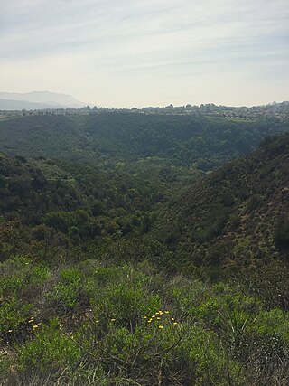
Arroyo Verde Park, off Foothill Road at the end of Day Road, is one of the most distinctive parks in the Ventura, California Park System. It is nestled in a canyon of oak-thickets, with steep hills covered by chaparral on both sides. The steep hills are part of the distinctive and challenging course, which boasts over 1200 feet of elevation gain (and loss) over its four miles. The hills are notable. The first is the Skyline hill, a residential city street adjacent to the park, rising almost 400 feet in just over half a mile. The next one is referred to as "The Finger," as in the obscene gesture, which ultimately winds down to the base of the steepest hill on the course, called "The Wall" which achieves almost a 20 percent grade. The 2 mile, halfway point is on "The Wall." After reaching the peak of that hill, the next mile generally winds down through sandy trails (with hidden boulders under the sand) to the floor of the canyon, where it passes through sections of pavement, wood chips, grass and more dirt trails. The final mile is perhaps the easiest part of the course, but after the previous three miles, even the gentle climb on the park's lower trail is a challenge. Just for insult, the final 50 yards is a steep climb up a grass hill.Course map
See the satellite view of the course area.
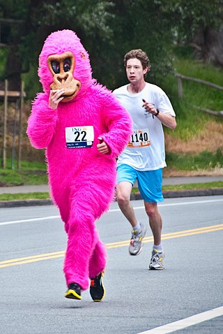
If the course is not different enough, the (dis-)organization of the race deliberately tries to do things differently. The race is held in the evening, rather than the morning. The 4 p.m. start time allows for even the slowest competitors to find their way back to the finish before sunset. The age division are uniquely broken into 6 year age groups, with records carefully kept based on these age groups since the race started. And while the entry fees are kept to a minimum, race management deliberately requests all entrants use day of race registration. A $5 penalty for EARLY registration is charged . . . nobody has ever been interested in paying for such a privilege. While many running races make T-shirt sales an important part of their marketing, flyers for this race advertise T-shirts are available for $30, which somehow has had a severely detrimental effect on their sales. The awards have traditionally been personalized mugs and commemorative tiles with the race logo. The tiles have become so treasured, perhaps a badge of honor, that some competitors have put them on display by installing them in their kitchen or bathroom wall.
Santee is a city in San Diego County, California, United States. The population was 60,037 at the 2020 census. It is a part of the East County region. The city is bisected by the San Diego River, a linear greenbelt that includes parks, trails and more than 1,100 acres (450 ha) of natural habitat.
Oak Park is an unincorporated community in southeastern Ventura County, California, United States. When developed in the Simi Hills in the late 1960s, a single road provided the only access to the community from Agoura Hills, California, in neighboring Los Angeles County. As of the 2010 census, Oak Park had a population of 14,266, down from 14,625 at the 2000 census. For statistical purposes, the United States Census Bureau has defined Oak Park as a census-designated place (CDP). The census definition of the area may not precisely correspond to local understanding of the area with the same name.
Cross country running is a sport in which teams and individuals run a race on open-air courses over natural terrain such as dirt or grass. The course, typically 3–12 kilometres (1.9–7.5 mi) long, may include surfaces of grass and earth, pass through woodlands and open country, and include hills, flat ground and sometimes gravel road and minor obstacles. It is both an individual and a team sport; runners are judged on individual times and teams by a points-scoring method. Both men and women of all ages compete in cross country, which usually takes place during autumn and winter, and can include weather conditions of rain, sleet, snow or hail, and a wide range of temperatures.
The Cotswold Way is a 102-mile (164 km) long-distance footpath, running along the Cotswold Edge escarpment of the Cotswold Hills in England. It was officially inaugurated as a National Trail on 24 May 2007 and several new rights of way have been created.
An ultramarathon is a footrace longer than the traditional marathon distance of 42.195 kilometres. The sport of running ultramarathons is called ultra running or ultra distance running.
The Wildflower Triathlon was a triathlon held at Lake San Antonio in Central California from 1983 to 2019, the first winner being Dean "The Machine" Harper. It was held the first weekend in May each year.
The Simi Hills are a low rocky mountain range of the Transverse Ranges in eastern Ventura County and western Los Angeles County, of southern California, United States.
The Arroyo Seco, meaning "dry stream" in Spanish, is a 24.9-mile-long (40.1 km) seasonal river, canyon, watershed, and cultural area in Los Angeles County, California. The area was explored by Gaspar de Portolà who named the stream Arroyo Seco as this canyon had the least water of any he had seen. During this exploration he met the Chief Hahamog-na (Hahamonga) of the Tongva Indians.
The Angeles Crest 100-Mile Endurance Run, or AC100, is an ultramarathon 100 miles long that takes place annually along trails through California's Angeles National Forest.
The Peachtree Road Race is a series of two American 10-kilometer runs held annually in Atlanta. After being held on Independence Day from 1970 to 2019, the race was cancelled temporarily due to the COVID-19 pandemic after originally being set for Thanksgiving. It is the world's largest 10k race, a title it has held since the late 1970s. The race has become a citywide tradition in which over 70,000 amateur and professional runners try to register for one of the limited 60,000 spots. The event also includes a wheelchair race, which precedes the footrace. In recent years, the race also has a special division for soldiers stationed in the Middle East. The race attracts some of the world's elite 10K runners and has served as both the United States' men's and women's 10K championship.
The USA Cross Country Championships is the annual national championships for cross country running in the United States. The championships is generally held in mid-February and it serves as a way of designating the country's national champion, as well as acting as the selection race for the IAAF World Cross Country Championships.
Bay to Breakers is an annual footrace in San Francisco, California typically on the third Sunday of May. The phrase "Bay to Breakers" reflects the fact that the race starts at the northeast end of the downtown area a few blocks from The Embarcadero and runs west through the city to finish at the Great Highway. The complete course is 7.46 miles (12 km) long.
The Bell-Jeff Invitational is an eponymous, annual cross country event hosted by Bellarmine-Jefferson High School in Griffith Park since 1973. Starting early in the morning on the last Saturday in September, the series of races over the course of the day play host to over a hundred different high school cross country teams from across the CIF Southern Section and other sections of the state.
Wildwood Regional Park is a suburban regional park in the western Simi Hills and Conejo Valley, in Ventura County, California. It is located in western Thousand Oaks, northern Newbury Park, and southern Moorpark.
Arroyo Conejo carries part of the longest creek in the Conejo Valley which sprawls past the cities of Thousand Oaks and Camarillo, and the communities of Newbury Park, Casa Conejo and Santa Rosa Valley. Arroyo Conejo is the primary drainage for the City of Thousand Oaks. Its watershed covers 57 square miles (150 km2) of which 43 square miles (110 km2) are in the Conejo Valley and 14 square miles (36 km2) in the Santa Rosa Valley.
Hill Canyon is a deep canyon in the western Simi Hills and within northern Newbury Park and Thousand Oaks, in Ventura County, southern California.
The Conejo Canyons Open Space consists of 1,628 acres (659 ha) of open-space areas in northernmost Newbury Park, Ventura County, California. It consists of deeply eroded canyons, numerous ridgelines and plateaus in the northwestern portion of the Conejo Valley. The area consists of diverse natural features such as deep canyons with perennial streams, prominent ridgelines, volcanic mountains, and a variety of natural habitats. While some of the flora includes chaparral, riparian habitats, oak woodlands and coastal sage, fauna includes mountain lions, coyotes, mule deer, and bobcats.
Arroyo Conejo Open Space is a 302-acre (122 ha) open space reserve in the western Simi Hills in northern Newbury Park, Ventura County, California. Most of it is part of the 250-acre (100 ha) Arroyo Conejo Nature Preserve.
Ventu Park Open Space is a 141-acre open space area in Newbury Park, California. Its primary features are the Rosewood Trail leading to Angel Vista, a 1,603 ft peak in the Santa Monica Mountains. Parking for the Rosewood Trail is located at the Stagecoach Inn Park, across Lynn Road from the primary trailhead. The Rosewood Trail begins with oak woodland and crosses a creek at the canyon floor, before climbing up towards the steep Angel Vista Point. There are 360-degree panoramic views of the Conejo Valley, the Oxnard Plain, the California Channel Islands, Pacific Ocean, Point Mugu, Hidden Valley, as well as the Santa Monica-, Santa Susana- and Topa Topa Mountains.
Arroyo Verde Park is a park located in a dried-up river valley in Ventura, California. The entry gate is located at the intersection between Ventura's Foothill and Day Roads. The park is 132 acres in area., The park is open from 7:00 A.M. to 6:00 P.M. Arroyo Verde Park is a popular spot for barbecues and children's birthday parties, particularly in the summer. Several hiking trails run near and outside the park, including a notoriously steep path known as "The Wall". However, the most notable trail in the park is the 3.5-mile-long Arroyo Verde Park Trail.
During the Thomas Fire of 2017–2018, multiple structures, including the park's nature center and a playground were destroyed. A new playground, dubbed the "inclusive play area", was later built.