
The Shropshire Union Canal, nicknamed the "Shroppie", is a navigable canal in England. The Llangollen and Montgomery canals are the modern names of branches of the Shropshire Union (SU) system and lie partially in Wales.

Horseshoe Bend, Shirehampton is an 11 acre biological Site of Special Scientific Interest in Bristol, England, on the north bank of a lower, tidal stretch of the River Avon, 1.9 miles downstream from the Avon Gorge, and just east of Shirehampton. It was notified as an SSSI in 1999.

The Irwell Valley in North West England extends from the Forest of Rossendale through the cities of Salford and Manchester. The River Irwell runs through the valley, along with the River Croal.

Turners Hill SSSI is a 0.2-hectare (0.49-acre) geological Site of Special Scientific Interest in Turners Hill in West Sussex. It is a Geological Conservation Review site.

The Elenydd is an upland area of Mid Wales, extending across parts of northern and eastern Ceredigion and Powys between Aberystwyth and Rhayader. Elenydd is also a name given to the medieval commote of Cwmwd Deuddwr which covered approximately the same area.

Frays Farm Meadows is a 28.2-hectare (70-acre) biological Site of Special Scientific Interest near Denham in the London Borough of Hillingdon. It was notified as an SSSI in 1981, and has been managed by the London Wildlife Trust on behalf of Hillingdon Council since 1999. It is part of the Colne Valley Regional Park.
Denham Lock Wood is a 6.3-hectare (16-acre) biological Site of Special Scientific Interest (SSSI) next to the Grand Union Canal, and near Denham in the London Borough of Hillingdon. It was notified in 1986 and is managed by the London Wildlife Trust on behalf of Hillingdon Council. It lies within the Colne Valley Regional Park.

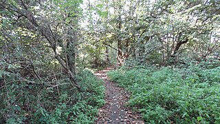
Mid Colne Valley is a 132 hectare biological Site of Special Scientific Interest in Harefield in the London Borough of Hillingdon and Denham in South Buckinghamshire. Its main importance lies in its extensive diversity of birdlife in lakes in former gravel pits.

Blo' Norton and Thelnetham Fens are a 21.3-hectare (53-acre) biological Site of Special Scientific Interest (SSSI) on the Norfolk/Suffolk border. Blo' Norton Fen is in the parish of Blo' Norton in Norfolk and Thelnetham Fen is in Thelnetham parish in Suffolk. It is a Nature Conservation Review site, Grade 2, and part of the Waveney and Little Ouse Valley Fens Special Area of Conservation, Thelnetham Fen is managed by the Suffolk Wildlife Trust and Blo' Norton Fen by the Little Ouse Headwaters Project (LOHP).
Oakenhill Railway Cutting is a 0.81-hectare (2.0-acre) geological Site of Special Scientific Interest in Gloucestershire, notified in 1985.
Puddlebrook Quarry is a 0.7-hectare (1.7-acre) geological Site of Special Scientific Interest in Gloucestershire, near Drybrook notified in 1986. The site is listed in the 'Forest of Dean Local Plan Review' as a Key Wildlife Site (KWS).
Old River Bed, Shrewsbury is a Site of Special Scientific Interest located two miles north of Shrewsbury town centre, to the east of the A528 in Shropshire, England. It is currently owned and managed by Shrewsbury Town Council.

Cranford St John SSSI is a 2.8-hectare (6.9-acre) geological Site of Special Scientific Interest in Cranford St John, east of Kettering in Northamptonshire. It is a Geological Conservation Review site.

Grantham Canal SSSI is a 9.5-hectare (23-acre) biological Site of Special Scientific Interest which runs along a stretch of the Grantham Canal and its banks between Redmile and Harby in Leicestershire.

The Black Country UNESCO Global Geopark is a geopark in the Black Country, a part of the West Midlands region of England. Having previously been an ‘aspiring Geopark’, it was awarded UNESCO Global Geopark status on 10 July 2020.
Tyrley was a small settlement in Staffordshire, England, now lost, and a former civil parish. It was located immediately south of Market Drayton. The name means "clearing by the River Tern" It was mentioned in the Domesday Book of 1086, when it belonged to William Pandolf, and was the site of a castle later. Tyrley (Tirley) Castle was located alongside the present day A529. "The castle built after the conquest by the Pantulfs" is believed to date back to 1066 and later rebuilt in stone in the thirteenth-century. The castle was succeeded by a newly built Manor house in the 1280s which fell into disrepair, with an eighteenth-century farmhouse built upon the site which remains to this day.