The QG engine is a 1.3 L (1,295 cc), 1.5 L (1,497 cc), 1.6 L (1,597 cc) and 1.8 L (1,769 cc) straight-4 piston engine from Nissan. It is a lean-burn aluminum DOHC 4-valve design with variable valve timing and optional NEO Di direct injection.

The Nissan SR engine is a 1.6 L (1,596 cc), 1.8 L (1,838 cc) or 2.0 L (1,998 cc) straight-4, four-stroke gasoline internal combustion engine manufactured by Nissan Motors. It features an aluminum head and block with steel sleeves and features a DOHC 4-valve design, with variable valve timing on select models. The engine was used in many small to medium Nissan vehicles including high-performance turbocharged variants. It was designed by Nissan as a replacement for the earlier CA series of engines. Power output shown is JIS Net PS or ECE Net kilowatts unless otherwise indicated.
Mrauk-U Township is a township of Mrauk-U District in the Rakhine State of Myanmar. The principal town is Mrauk-U.
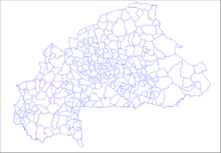
Sangou is a town in the Zabré Department of Boulgou Province in south-eastern Burkina Faso. As of 2005, the town has a population of 2,954.

Mołoczki is a village in the administrative district of Gmina Boćki, within Bielsk County, Podlaskie Voivodeship, in north-eastern Poland. It lies approximately 13 kilometres (8 mi) south-east of Boćki, 19 km (12 mi) south of Bielsk Podlaski, and 58 km (36 mi) south of the regional capital Białystok.
Sangrave is a town and commune in the Brakna Region of southern Mauritania.
Santa Rosa is a corregimiento in Bugaba District, Chiriquí Province, Panama. It has a land area of 48 square kilometres (19 sq mi) and had a population of 1,510 as of 2010, giving it a population density of 31.4 inhabitants per square kilometre (81/sq mi). Its population as of 1990 was 1,337; its population as of 2000 was 1,407.
Cochea is a corregimiento in David District, Chiriquí Province, Panama. It has a land area of 58.8 square kilometres (22.7 sq mi) and had a population of 2,447 as of 2010, giving it a population density of 41.6 inhabitants per square kilometre (108/sq mi). Its population as of 1990 was 1,790; its population as of 2000 was 2,004.
Puerto Lindo o Garrote is a corregimiento in Portobelo District, Colón Province, Panama with a population of 869 as of 2010. Its population as of 1990 was 591; its population as of 2000 was 721.
El Calabacito is a corregimiento in Los Pozos District, Herrera Province, Panama with a population of 617 as of 2010. Its population as of 1990 was 703; its population as of 2000 was 692.
La Arena is a corregimiento in Los Pozos District, Herrera Province, Panama with a population of 559 as of 2010. Its population as of 1990 was 509; its population as of 2000 was 533.
Los Castillos is a corregimiento in Parita District, Herrera Province, Panama with a population of 745 as of 2010. Its population as of 1990 was 646; its population as of 2000 was 647.
Bajo Corral is a corregimiento in Las Tablas District, Los Santos Province, Panama with a population of 483 as of 2010. Its population as of 1990 was 601; its population as of 2000 was 546.
Oria Arriba is a corregimiento in Pedasí District, Los Santos Province, Panama with a population of 297 as of 2010. It was created by Law 58 of July 29, 1998, owing to the Declaration of Unconstitutionality of Law 1 of 1982. Its population as of 2000 was 281.
Purio is a corregimiento in Pedasí District, Los Santos Province, Panama with a population of 494 as of 2010. Its population as of 1990 was 555; its population as of 2000 was 547.
Bejuco is a corregimiento in Chame District, Panamá Oeste Province, Panama with a population of 5,548 as of 2010. Its population as of 1990 was 3,643; its population as of 2000 was 4,509.
Otoque Occidente is a corregimiento in Taboga District, Panamá Province, Panama with a population of 262 as of 2010. Its population as of 1990 was 401; its population as of 2000 was 295.
Otoque Oriente is a corregimiento in Taboga District, Panamá Province, Panama with a population of 126 as of 2010. Its population as of 1990 was 210; its population as of 2000 was 199.
Puerto Vidal is a corregimiento in Las Palmas District, Veraguas Province, Panama with a population of 1,671 as of 2010. Its population as of 1990 was 1,671; its population as of 2000 was 1,665.
Mrauk-U District is a newly created district in Rakhine State, Burma (Myanmar); which was formerly part of Sittwe District. Its administrative center is the city of Mrauk-U.


