Related Research Articles

The Upper Peninsulaof Michigan—also known as Upper Michigan or colloquially the U.P. or Yoop—is the northern and more elevated of the two major landmasses that make up the U.S. state of Michigan; it is separated from the Lower Peninsula by the Straits of Mackinac. It is bounded primarily by Lake Superior to the north, separated from the Canadian province of Ontario at the east end by the St. Marys River, and flanked by Lake Huron and Lake Michigan along much of its south. Although the peninsula extends as a geographic feature into the state of Wisconsin, the state boundary follows the Montreal and Menominee rivers and a line connecting them.

Delta County is a county in the Upper Peninsula in the U.S. state of Michigan. As of the 2020 census, the population was 36,903. The county seat is Escanaba. The county was surveyed in 1843 and organized in 1861. Its name originates from the Greek letter delta (Δ), which refers to the triangular shape of the original county which included segments of Menominee, Dickinson, Iron, and Marquette counties. Recreation and forest products are major industries, and crops include hay, corn, small grains, potatoes, and strawberries.

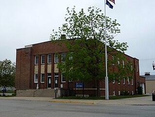
Escanaba, commonly shortened to Esky, is a port city and the county seat of Delta County in the U.S. state of Michigan, located on Little Bay de Noc in the state's Upper Peninsula. The population was 12,450 at the 2020 census, making it the third-largest city in the Upper Peninsula after Marquette and Sault Ste. Marie.
Gladstone is a city in Delta County in the Upper Peninsula of the U.S. state of Michigan. First settled in 1877, Gladstone's original name was Minnewasca. The population was 5,257 according to the 2020 census, The U.S. Highways 2 and 41 run concurrently through the city, connecting it to various other communities in the Upper Peninsula of Michigan. The city of Escanaba lies roughly 14km (9mi) to the south.
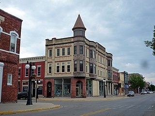
Menominee is a city and the county seat of Menominee County, Michigan in the Upper Peninsula. The population was 8,488 at the 2020 census. It is the county seat of Menominee County. Menominee is the fourth-largest city in the Upper Peninsula, behind Marquette, Sault Ste. Marie, and Escanaba. Menominee Township is located to the north of the city, but is politically autonomous.
A Pure Michigan Byway is the designation for a segment of the State Trunkline Highway System in the US state of Michigan that is a "scenic, recreational, or historic route that is representative of Michigan's natural and cultural heritage." The designation was created with the name Michigan Heritage Route by the state legislature on June 22, 1993, and since then six historic, seven recreational and seven scenic byways have been designated by the Michigan Department of Transportation (MDOT), and another two have been proposed. These byways have been designated in both the Upper and Lower peninsulas of the state. The current name was adopted on December 30, 2014, and it references the Pure Michigan tourism marketing campaign.

M-28 is an east–west state trunkline highway that traverses nearly all of the Upper Peninsula of the U.S. state of Michigan, from Wakefield to near Sault Ste. Marie in Bruce Township. Along with US Highway 2 (US 2), M-28 forms a pair of primary highways linking the Upper Peninsula from end to end, providing a major access route for traffic from Michigan and Canada along the southern shore of Lake Superior. M-28 is the longest state trunkline in Michigan numbered with the "M-" prefix at 290.373 miles (467.310 km). The entire highway is listed on the National Highway System, while three sections of M-28 are part of the Lake Superior Circle Tour. M-28 also carries two memorial highway designations along its route.
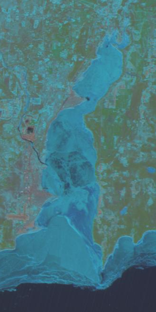
Little Bay de Noc is a bay in the Upper Peninsula of the U.S. state of Michigan. The bay opens into Lake Michigan's Green Bay.

M-15 is a north–south state trunkline highway in the US state of Michigan. The southern terminus is a junction with US Highway 24 (US 24) just south of Clarkston on the northwestern edge of the Detroit metropolitan area. The trunkline is a recreational route running north and northwest to the Tri-Cities area. The northern terminus is the junction with M-25 on the east side of Bay City. The total length is about 73+2⁄3 miles (118.6 km) between the two regions.

M-186 is a state trunkline highway in the US state of Michigan. Entirely within Fife Lake Township, in southeastern Grand Traverse County, the highway serves as a short connector between M-113 near Kingsley and US Highway 131 (US 131) at the village of Fife Lake. The current incarnation of M-186 is the second usage of the designation, as it was originally used for a highway in Delta County in the 1930s.

M-38 is an east–west state trunkline highway in the Upper Peninsula (UP) of the U.S. state of Michigan. Its west end starts in Ontonagon and runs east to Baraga, some 42.225 miles (67.955 km) apart. The highway crosses streams and rivers in forest lands and provides access to a casino. The east end is located by the Keweenaw Bay of Lake Superior in the Keweenaw Bay Indian Community.
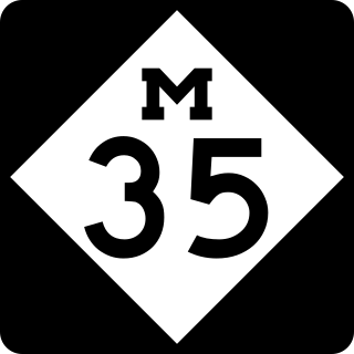
M-35 is a state trunkline highway in the Upper Peninsula (UP) of the US state of Michigan. It runs for 128 miles (206 km) in a general north–south direction and connects the cities of Menominee, Escanaba, and Negaunee. The southern section of M-35 in Menominee and Delta counties carries two additional designations; M-35 forms a segment of the Lake Michigan Circle Tour, and it is the UP Hidden Coast Recreational Heritage Trail, which is a part of what is now called the Pure Michigan Byways Program. Along the southern section, the highway is the closest trunkline to the Green Bay, a section of Lake Michigan. The northern section of the highway turns inland through sylvan areas of the UP, connecting rural portions of Delta and Marquette counties.

Business US Highway 41 was a state trunkline highway that served as a business loop off US 41 and M-28 in Marquette, Michigan, along Washington and Front streets. The streets serve the downtown area of Marquette and are bordered by several commercial properties and businesses. Those two streets originate with the early founding of the city in the middle of the 19th century. Jurisdiction over them was transferred to the city as part of a highway swap that resulted in the decommissioning of the trunkline in 2005. It was also previously co-designated Bus. M-28, mirroring the Bus. US 41/Bus. M-28 designation previously used along Bus. M-28 in Ishpeming and Negaunee. Washington and Front streets had been a part of the state highway system since the 1910s, and a part of the United States Numbered Highway System since 1926. The business loop designation dates back to the 1960s and was removed in 2005.
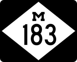
M-183 is a north–south state trunkline highway in the Upper Peninsula of the US state of Michigan. It serves Fayette State Park as an access route from US Highway 2 (US 2). The highway runs through rural farmlands of the Garden Peninsula and next to Big Bay de Noc, a bay of Lake Michigan. The community at Fayette dates back to the 1860s. It has been a state park since the late 1950s, and the connecting road has been a state highway since the 1980s.
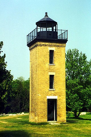
The Peninsula Point Light is a lighthouse located at the southern tip of the Stonington Peninsula in Bay de Noc township in Delta County, Michigan. United States Coast Guard historical documents have over the years listed the name of the site as both Peninsula Point and Point Peninsula.
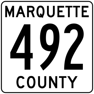
County Road 492 is a primary county road in Marquette County, Michigan. The road serves as an alternate route between Negaunee and Marquette. Several historic sites line the roadway as it runs south and parallel to the main highway, U.S. Highway 41 (US 41) and M-28, through the Marquette Iron Range in Michigan's Upper Peninsula. The path of the road runs near tracks of the Lake Superior and Ishpeming Railroad (LS&I). The locally created Iron Ore Heritage Trail will follow CR 492 through Eagle Mills and Morgan Meadows upon completion. The western terminus of the county road is on US 41/M-28 in Negaunee and the eastern end is in Marquette next to Lake Superior.
US Highway 41 (US 41) is a part of the United States Numbered Highway System that runs from Miami, Florida, to the Upper Peninsula of the US state of Michigan. In Michigan, it is a state trunkline highway that enters the state via the Interstate Bridge between Marinette, Wisconsin, and Menominee, Michigan. The 278.769 miles (448.635 km) of US 41 that lie within Michigan serve as a major conduit. Most of the highway is listed on the National Highway System. Various sections are rural two-lane highway, urbanized four-lane divided expressway and the Copper Country Trail National Scenic Byway. The northernmost community along the highway is Copper Harbor at the tip of the Keweenaw Peninsula. The trunkline ends at a cul-de-sac east of Fort Wilkins State Park after serving the Central Upper Peninsula and Copper Country regions of Michigan.

US Highway 2 (US 2) is a component of the United States Numbered Highway System that connects Everett, Washington, to the Upper Peninsula (UP) of the US state of Michigan, with a separate segment that runs from Rouses Point, New York, to Houlton, Maine. In Michigan, the highway runs through the UP in two segments as a part of the state trunkline highway system, entering the state at Ironwood and ending at St. Ignace; in between, US 2 briefly traverses the state of Wisconsin. As one of the major transportation arteries in the UP, US 2 is a major conduit for traffic through the state and neighboring northern Midwest states. Two sections of the roadway are included as part of the Great Lakes Circle Tours, and other segments are listed as state-designated Pure Michigan Byways. There are several memorial highway designations and historic bridges along US 2 that date to the 1910s and 1920s. The highway runs through rural sections of the UP, passing through two national and two state forests in the process.

The Great Lakes Circle Tour is a designated scenic road system connecting all of the Great Lakes and the St. Lawrence River. It consists of routes for circumnavigating the lakes, either individually or collectively. It was designated by the Great Lakes Commission in 1988.

County Road 186 is a primary county road in Delta County, Michigan, that runs along Brampton 27.5 Road from M-35 in Brampton to US Highway 2/US Highway 41 (US 2/US 41) at Rapid River. The roadway was previously a state highway called M-186 from 1932 until July 1939, when it was transferred by the Michigan State Highway Department (MSHD) to the control of the Delta County Road Commission (DCRC). The commission initially refused to accept jurisdiction of the roadway for nearly seven months, resulting in an orphan road that was not being maintained by any agency until the legal dispute was settled.
References
- ↑ UP Hidden Coast Recreation Heritage Route Planning Committee (September 2013). "Chapter 1: Introduction". UP Hidden Coast Recreation Heritage Route Management Plan. Escanaba, MI: Central Upper Peninsula Planning and Development Regional Commission. p. 2.
If an internal link led you here, you may wish to change the link to point directly to the intended article.