USGS Historical Topographic Maps for the Juneau Icefield area
The Juneau Icefield is a geological icefield located just north and east of Juneau, Alaska and continues north to the Skagway, Alaska area. Current research of Climate Change in the field of Glaciology relies upon comparison of historical glacier mass-balance to current conditions. The United States Geological Survey (USGS) historical topographic maps, some more than 65 years old, are useful to a glaciologist in determining glacier change.
Contents
- USGS Historical Topographic Maps for the Juneau Icefield area
- See also
- References
- Sources
- Mapping Systems
These maps were provided by the United States Geological Survey (USGS) [1] and archived to Wikimedia Commons. They are scanned (by the USGS) images of the original paper maps that were published from 1948 to 1997. The information contained in the table below was transcribed from the paper map images displayed in the Image Array.
| Quadrangle | Date | Field | Topographic | Remarks | ||||||
|---|---|---|---|---|---|---|---|---|---|---|
| Area | Map | Published [a] | Revised [b] | Aerial Photo [c] | Annotated | Checked | Scale | Contour | Download [d] | Notes |
| Atlin | A-7 | 1960 | 1948 | 1960 | No | 1:63360 | 100 | [HM 1] | Mount London, Mount Service, Mount Poletica | |
| Atlin | A-8 | 1960 | 1948/1961 | 1960 | No | 1:63360 | 100 | [HM 2] | Mount Pullen, Meade Glacier | |
| Atlin | B-8 | 1960 | 1948 | 1960 | No | 1:63360 | 100 | [HM 3] | Snowtop Mountain | |
| Juneau | B-1 | 1997 | 1996 | 1997 | No | 1:63360 | 100 | [HM 4] | Norris Glacier, Taku Glacier terminus | |
| Juneau | B-2 | 1949 | Sept, 1942 | No | 1:63360 | 100 | [HM 5] | Mendenhall Glacier | ||
| Juneau | B-3 | 1949 | Sept, 1942 | No | 1:62500 | 100 | [HM 6] | Auke Bay, Alaska | ||
| Juneau | C-1 | 1960 | 1971 | 1947 | 1960 | No | 1:63360 | 100 | [HM 7] | Matthes Glacier, Demorest Glacier |
| Juneau | C-2 | 1960 | 1948 | No | 1:63360 | 100 | [HM 8] | Taku Glacier, Mendenhall Glacier, Herbert Glacier | ||
| Juneau | C-3 | 1975 | 1996 | 1947 | No | 1:63360 | 100 | [HM 9] | Eagle Glacier | |
| Juneau | D-1 | 1960 | 1975 | 1948/61 | No | 1:63360 | 100 | [HM 10] | ||
| Juneau | D-2 | 1997 | 1996 | No | 1:63360 | 100 | [HM 11] | Bucher Glacier, Gilkey (lower) | ||
| Juneau | D-3 | 1953 | 1948 | No | 1:63360 | 100 | [HM 12] | |||
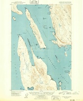
| Juneau | D-4 | 1951 | July, 1948 | No | 1:63360 | 100 | [HM 13] | Mid Lynn Canal | ||
| Skagway | A-1 | 1951 | August, 1948 | No | 1:63360 | 100 | [HM 14] | |||
| Skagway | B-1 | 1951 | July, 1948 | No | 1:63360 | 100 | [HM 15] | |||
| Taku River | B-5 | 1951 | 1948 | No | 1:63360 | 100 | [HM 16] | Wright Glacier | ||
| Taku River | B-6 | 1948 | 1951 | No | 1:63360 | 100 | [HM 17] | South of Taku River | ||
| Taku River | C-5 | 1960 | 1948 | No | 1:63360 | 100 | [HM 18] | Wright Glacier | ||
| Taku River | C-6 | 1960 | 1995 | 1947 | No | 1:63360 | 100 | [HM 19] | Twin Glaciers | |
Notes
- ↑ This was the year that the map was originally published
- ↑ This was the year that the map was last revised
- ↑ This was the year that the aerial photographs were taken that the topology is based upon
- ↑ Map download location was determined at: http://historicalmaps.arcgis.com/usgs/
- USGS Historical Topographic Maps (1:63360) for the Juneau Icefield area
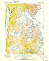 Skagway B-1 (1951)
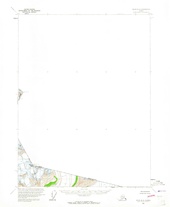 Atlin B-8 (1960)
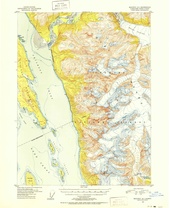 Skagway A-1 (1951))
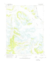 Atlin A-8 (1960)
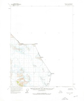 Atlin A-7 (1960)
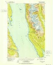 Juneau D-4 (1951))
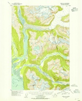 Juneau D-3 (1953)
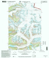 Juneau D-2 (1997)
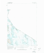 Juneau D-1 (1960)
 Juneau C-4
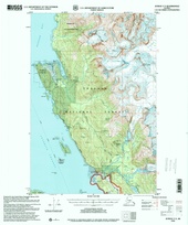 Juneau C-3 (1996R)
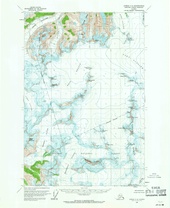 Juneau C-2 (1960)
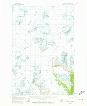 Juneau C-1 (1971R)
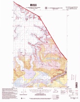 Taku River C-6 (1995)
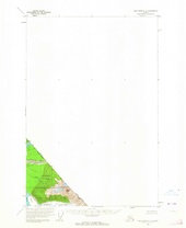 Taku River C-5 (1960)
- Juneau B-4
 Juneau B-3 (1949)
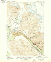 Juneau B-2 (1949)
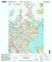 Juneau B-1 (1997)
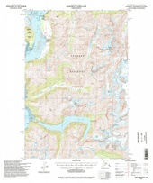 Taku River B-6 (1994)
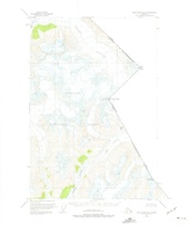 Taku River B-5 (1951)


