Related Research Articles

The Western Province is one of the nine provinces of Sri Lanka, the first level administrative division of the country. The provinces have existed since the 19th century but did not have any legal status until 1987 when the 13th Amendment to the Constitution of Sri Lanka established provincial councils. Western Province is the most densely populated province in the country and is home to the legislative capital Sri Jayawardenepura Kotte as well as to Colombo, the nation's administrative and business center.

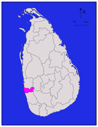
Colombo District is one of the 25 districts of Sri Lanka, the second level administrative division of the country. The district is administered by a District Secretariat headed by a District Secretary appointed by the central government of Sri Lanka. The capital of the district is the city of Colombo. The district of Colombo was officially recorded in 2016 as having the highest income on average, per household.

Nawalapitiya is a town in Kandy District, Sri Lanka. It is governed by an Urban Council. It is 38 km (24 mi) away from Kandy and 112 km (70 mi) from Colombo, at a height of 589 m (1,932 ft) above sea level. It is located on the banks of the Mahaweli Ganga. The area was developed during the colonisation of the island by the British, as one of the colony's centres of Coffee Production.

Vavuniya District is one of the 25 districts of Sri Lanka, the second level administrative division of the country. The district is administered by a District Secretariat headed by a District Secretary appointed by the central government of Sri Lanka. The capital of the district is the city of Vavuniya.
Chilaw is a city in Puttalam District, North Western Province, Sri Lanka. It is governed by an urban council, whereas the outskirts are governed by a pradeshiya sabha of the same name. The town is located 80 kilometers away from Colombo via Negombo.
Aladeniya is a village in Sri Lanka. It is located within Kandy District, Central Province. It is located approximately 12 km (7.5 mi) north-west of Kandy on the main road to Kurunegala.
Alagalla Kondagama is a village in Sri Lanka. It is located 6.4 km (4 mi) northwest of Kadugannawa, within Kandy District, Central Province.
Alagoda is a village in Sri Lanka. It is located near Palipana, on the road to Alawatugoda, within Kandy District, Central Province.
Alanduwaka is a village in Sri Lanka. It is located within Kandy District, Central Province.
Alutgama is a village within Kandy District, Central Province, Sri Lanka. It is located about four miles north of Kandy, east of the road to Matale. It is subdivided into Bopegammedda, Digahawatura, Hatiyaldeniya, Kurundeniya, Mahakumburagammedda, and Wakumburawatta.
Ankendagolla is a village in Sri Lanka. It is located within Central Province.
Dehianga is a village in Sri Lanka. It is located within Kandy District, Central Province, northwest of Dehigama, about 8.6 km (5.3 mi) from Kandy.
Hapupe is a village in Sri Lanka. It is located within Central Province.
Uda Talawinna Megodagammedda, also known as Udatalawinna, is a village in Sri Lanka. It is located within Central Province. The majority of the population is Sinhala.
Suduhumpola, or Huduhumpola, is a village in Sri Lanka. It lies 1.5 miles from Kandy on the foothills of the Hanthana Mountain Range, within Kandy District, Central Province.
Palle Makuruppe is a village in Sri Lanka. It is located within Central Province.
Polmalagama is a village in Central Province, Sri Lanka, situated about 8.3 kilometres (5.2 mi) southwest of the town of Gampola by road. The principal landmark of note is the Polmalagama Bodhiya temple.
Ratninda is a village in Sri Lanka. It is located within Central Province.
Agarawala Grama Niladhari Division is a Grama Niladhari Division of the Devinuwara Divisional Secretariat of Matara District of Southern Province, Sri Lanka. It has Grama Niladhari Division Code 448C.
References
- ↑ "Census of Population and Housing 2012 - Population by GN division and sex 2012". Sri Lanka Census of Population and Housing, 2011. p. 94. Retrieved 19 November 2023.
- ↑ Campbell, Lawrie Archibald (1898). A gazetteer of the Central Province of Ceylon (excluding Walapane). Vol. II. Colombo: G. J. A. Skeen. p. 524. Retrieved 19 November 2023.
- ↑ "Know the Etymology: 232 - Uda-peruwa, Palle-peruwa". tamilnet.com. 2 December 2012. Retrieved 2023-11-20.